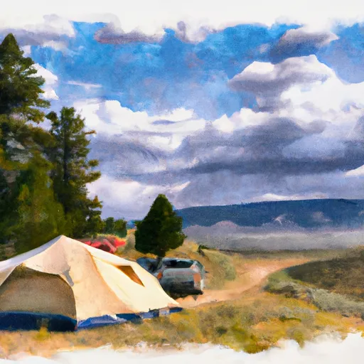
Middle Lamar Stock Campground
Community Reviews
Been here? Share the conditions.
Reviews, ratings & photos are added in the free Snoflo iOS app — rate a spot, tag the conditions, and your visit is verified by location. Add or manage your reviews from the app.
Middle Lamar Stock
Reservations are not accepted at Middle Lamar Stock camping area, as it operates on a first-come, first-served basis. It is recommended to arrive early to secure a spot, especially during peak camping seasons. The best time to visit this camping area is during the summer months when the weather is mild and conducive to outdoor activities. However, it is advisable to check the local weather forecast and road conditions before embarking on a trip.
While camping at Middle Lamar Stock, campers can enjoy the surrounding natural beauty and engage in various recreational activities such as hiking, fishing, and wildlife viewing. The area is known for its abundant wildlife, including elk, deer, and bighorn sheep, so visitors should exercise caution and be respectful of the wildlife habitat. Additionally, it is important to practice Leave No Trace principles and properly dispose of trash to preserve the natural environment. Overall, Middle Lamar Stock camping area provides a tranquil and scenic camping experience in the beautiful state of Montana.
What's on-site at Middle Lamar Stock
Key facilities Snoflo tracks for this campground. Confirm with the operator before booking -- amenities can change seasonally.
Plan your trip down to the hour
Same weather feed Snoflo's iOS app uses -- updated continuously from NOAA / yr.no.
Next 5 days, hour by hour
Temperature line with weather symbols on top, snow + rain accumulation as columns, humidity as a dotted line.
5-day forecast table
Every 3 hours, broken out across temperature, snow, rain, humidity, and wind. Each cell is colour-coded relative to the column min/max so trends jump out at a glance.
| Time | Condition | Temp (°F) | Snow (in) | Rain (in) | Humidity (%) | Wind (mps) | Wind dir |
|---|---|---|---|---|---|---|---|
| Loading detailed forecast… | |||||||
15-day temperature & precipitation
Daily temperatures, snow, and rain projected over the next two weeks. Hover any point for the full breakdown.
Other campgrounds in the area
Snoflo-tracked campsites within driving distance of Middle Lamar Stock, with reservations status.
| Campground | Reservations | Toilets | View |
|---|---|---|---|
| Middle Lamar | ✓ | ✗ | → |
| Appaloosa Meadows | ✓ | ✗ | → |
| 3l9 | ✗ | ✗ | → |
| Lower Miller Creek | ✓ | ✗ | → |
| 3u1 | ✗ | ✗ | → |
Nearby streamflow
USGS streamgauges within reach of Middle Lamar Stock -- pulled live from the National Water Information System.
| Streamgauge | Discharge | View |
|---|---|---|
| Soda Butte Cr At Park Bndry At Silver Gate | 54 cfs | → |
| Lamar River Nr Tower Falls Ranger Station Ynp | 423 cfs | → |
| Yellowstone River At Yellowstone Lk Outlet Ynp | 2,470 cfs | → |
| Tantalus Creek At Norris Junction | 3 cfs | → |
| Boiling River At Mammoth | 22 cfs | → |
| Gardner River Near Mammoth Ynp | 167 cfs | → |
Nearby snow depths
NRCS SNOTEL stations within reach of Middle Lamar Stock -- relevant when planning a shoulder-season or alpine trip.
| SNOTEL station | Snowpack | 24h Snowfall | View |
|---|---|---|---|
| Nohrsc Parker Peak Snotel | 0.0 in | 0.0 in | → |
| Parker Peak | 0.0 in | 0.0 in | → |
| Nohrsc Evening Star Snotel | 0.0 in | 0.0 in | → |
| Evening Star | 0.0 in | 0.0 in | → |
| Nohrsc Northeast Entrance | 0.0 in | 0.0 in | → |
| Northeast Entrance | 0.0 in | 0.0 in | → |
Plan a longer trip
The closest parks, lakes, boat launches, and paddle runs so a camping night can grow into a full weekend.
Parks
Fishing spots
Points of interest
- The Mushpots
- Lamar Buffalo Ranch
- Inkpot Spring
- Mount Washburn Northeast View Webcam
- Mount Washburn South View Webcam
- Devil's Den
Paddle runs
- The Confluence With Soda Butte Creek To The Confluence With The Yellowstone River
- The Headwaters To The Confluence With Soda Butte Creek
- Begins Above Slough Creek Campground, Located On A Secondary Spur Road To The Park's Main Road To The Confluence With Lamar River
- Northeast Yellowstone National Park Boundary, Near Cooke City To The Confluence With Lamar River
- Begins 1/4 Mile Upstream From Northeast Entrance Road Bridge In The Area Of Tower Falls/ Roosevelt To Ends 1/4 Mile Downstream From Northeast Entrance Road Bridge In The Area Of Tower Falls/ Roosevelt
- Begins 1/4 Mile Downstream From Northeast Entrance Road Bridge In The Area Of Tower Falls/ Roosevelt To Northern Park Boundary
Camping essentials & Leave No Trace
- Pack it in, pack it out
- Take all trash, food scraps, and gear back with you to keep campsites clean and protect wildlife.
- Respect wildlife
- Observe animals from a distance, store food securely, and never feed wildlife to maintain natural behavior and safety.
- Know before you go
- Check weather, fire restrictions, trail conditions, and permit requirements to ensure a safe and well-planned trip.
- Minimize campfire impact
- Use established fire rings, keep fires small, fully extinguish them, or opt for a camp stove when fires are restricted.
- Leave what you find
- Preserve natural and cultural features by avoiding removal of plants, rocks, artifacts, or other elements of the environment.
Set push alerts in the Snoflo app
Save Middle Lamar Stock as a favorite, set a custom threshold (precipitation, snowpack, freezing temperatures), and the iOS app will push the moment conditions cross.
About Middle Lamar Stock
Can I make reservations at Middle Lamar Stock?
Yes -- this campground accepts reservations. Snoflo recommends booking early for peak season; check the operator (Recreation.gov / state park system / private operator) for the booking window and cancellation policy.
How fresh is the weather data on this page?
The hourly forecast updates throughout the day from the NOAA / yr.no public feeds. Streamflow data is pulled live from USGS streamgauges and snowpack from the NRCS SNOTEL network.
What's the best time of year to visit?
Use the 15-day temperature & precipitation outlook on this page to plan -- pick a window with comfortable temperatures and low precipitation. For longer trips, the 5-day hourly meteogram shows snow + rain accumulation hour-by-hour.
How do I get to Middle Lamar Stock?
Tap Directions in the hero above to open driving directions in Google Maps, or Open in map to center the Snoflo interactive map on the campground.
Can I get alerts when conditions change?
Yes -- alerts are managed through the Snoflo iOS app. Favorite this campground, set a threshold (temperature, snowpack, precipitation), and you'll get a push the moment it crosses.
Other campgrounds near here
Snoflo-tracked campgrounds within driving distance of Middle Lamar Stock.