Coyote Creek State Park Campground
Community Reviews
Been here? Share the conditions.
Reviews, ratings & photos are added in the free Snoflo iOS app — rate a spot, tag the conditions, and your visit is verified by location. Add or manage your reviews from the app.
Coyote Creek State Park
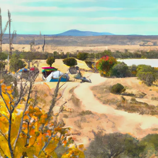
The best time of year to enjoy Coyote Creek State Park is during the spring and fall seasons, as the weather is mild and pleasant. Summers tend to be hot, so it is advisable to plan activities during the early mornings or evenings to avoid the heat. The park is nestled in a picturesque setting, surrounded by dense forests and a peaceful creek, making it a perfect spot for hiking, fishing, and wildlife watching. It is worth noting that the area is known for its black bears, so campers should take precautions by properly storing food and keeping a clean campsite to prevent any encounters.
In conclusion, Coyote Creek State Park offers a delightful camping experience with its amenities, advance reservation system, and beautiful natural surroundings. It is an ideal destination for nature lovers seeking tranquility and outdoor adventures.
What's on-site at Coyote Creek State Park
Key facilities Snoflo tracks for this campground. Confirm with the operator before booking -- amenities can change seasonally.
Plan your trip down to the hour
Same weather feed Snoflo's iOS app uses -- updated continuously from NOAA / yr.no.
Next 5 days, hour by hour
Temperature line with weather symbols on top, snow + rain accumulation as columns, humidity as a dotted line.
5-day forecast table
Every 3 hours, broken out across temperature, snow, rain, humidity, and wind. Each cell is colour-coded relative to the column min/max so trends jump out at a glance.
| Time | Condition | Temp (°F) | Snow (in) | Rain (in) | Humidity (%) | Wind (mps) | Wind dir |
|---|---|---|---|---|---|---|---|
| Loading detailed forecast… | |||||||
15-day temperature & precipitation
Daily temperatures, snow, and rain projected over the next two weeks. Hover any point for the full breakdown.
Other campgrounds in the area
Snoflo-tracked campsites within driving distance of Coyote Creek State Park, with reservations status.
| Campground | Reservations | Toilets | View |
|---|---|---|---|
| Upper La Junta Campground | ✗ | ✗ | → |
| Upper La Junta | ✗ | ✓ | → |
| Rio Chiquito | ✗ | ✗ | → |
| Lovato Camp | ✗ | ✗ | → |
| La Grulla Cow Camp | ✗ | ✗ | → |
Nearby streamflow
USGS streamgauges within reach of Coyote Creek State Park -- pulled live from the National Water Information System.
| Streamgauge | Discharge | View |
|---|---|---|
| Mora River At La Cueva | 4 cfs | → |
| Coyote Creek Near Golondrinas | 1 cfs | → |
| Rayado Creek Near Cimarron | 2 cfs | → |
| Rio Pueblo Nr Penasco | 2 cfs | → |
| Mora River Near Golondrinas | · | → |
| Rio Grande Del Rancho Near Talpa | 0 cfs | → |
Nearby snow depths
NRCS SNOTEL stations within reach of Coyote Creek State Park -- relevant when planning a shoulder-season or alpine trip.
| SNOTEL station | Snowpack | 24h Snowfall | View |
|---|---|---|---|
| Nohrsc Palo Snotel | 0.0 in | 0.0 in | → |
| Palo | 0.0 in | 0.0 in | → |
| Tres Ritos | 1.0 in | 0.0 in | → |
| Nohrsc Tres Ritos | 2.0 in | 0.0 in | → |
| Gallegos Peak | 0.0 in | 0.0 in | → |
| Nohrsc Gallegos Peak | 0.0 in | 0.0 in | → |
Plan a longer trip
The closest parks, lakes, boat launches, and paddle runs so a camping night can grow into a full weekend.
Parks
- Coyote Creek State Park
- Ski Area
- Vietnam Veterans' Memorial State Park
- Morphy Lake State Park
- Eagle Nest Lake State Park
- Carson National Forest
Boat launches
Fishing spots
- Rito De La Olla Fishing
- Rio Fernando Fishing
- Rio Chiquito Fishing
- Trampas Lakes Fishing
- Rio Trampas Fishing
- Cowles Ponds
Camping essentials & Leave No Trace
- Pack it in, pack it out
- Take all trash, food scraps, and gear back with you to keep campsites clean and protect wildlife.
- Respect wildlife
- Observe animals from a distance, store food securely, and never feed wildlife to maintain natural behavior and safety.
- Know before you go
- Check weather, fire restrictions, trail conditions, and permit requirements to ensure a safe and well-planned trip.
- Minimize campfire impact
- Use established fire rings, keep fires small, fully extinguish them, or opt for a camp stove when fires are restricted.
- Leave what you find
- Preserve natural and cultural features by avoiding removal of plants, rocks, artifacts, or other elements of the environment.
Set push alerts in the Snoflo app
Save Coyote Creek State Park as a favorite, set a custom threshold (precipitation, snowpack, freezing temperatures), and the iOS app will push the moment conditions cross.
About Coyote Creek State Park
Can I make reservations at Coyote Creek State Park?
Yes -- this campground accepts reservations. Snoflo recommends booking early for peak season; check the operator (Recreation.gov / state park system / private operator) for the booking window and cancellation policy.
How fresh is the weather data on this page?
The hourly forecast updates throughout the day from the NOAA / yr.no public feeds. Streamflow data is pulled live from USGS streamgauges and snowpack from the NRCS SNOTEL network.
What's the best time of year to visit?
Use the 15-day temperature & precipitation outlook on this page to plan -- pick a window with comfortable temperatures and low precipitation. For longer trips, the 5-day hourly meteogram shows snow + rain accumulation hour-by-hour.
How do I get to Coyote Creek State Park?
Tap Directions in the hero above to open driving directions in Google Maps, or Open in map to center the Snoflo interactive map on the campground.
Can I get alerts when conditions change?
Yes -- alerts are managed through the Snoflo iOS app. Favorite this campground, set a threshold (temperature, snowpack, precipitation), and you'll get a push the moment it crosses.
Other campgrounds near here
Snoflo-tracked campgrounds within driving distance of Coyote Creek State Park.