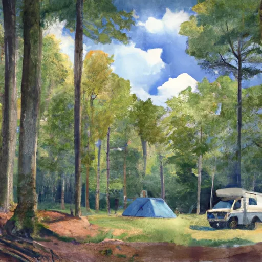
#29 Ottercreek Campground
Community Reviews
Been here? Share the conditions.
Reviews, ratings & photos are added in the free Snoflo iOS app — rate a spot, tag the conditions, and your visit is verified by location. Add or manage your reviews from the app.
#29 Ottercreek
Reservations are accepted at Ottercreek Camping Area, allowing visitors to plan their camping trip in advance. This ensures that you have a guaranteed spot, especially during peak seasons when the campground may become busy. It is recommended to make reservations well in advance to secure a spot at this popular camping area.
The best time of year to visit Ottercreek Camping Area is during the warmer months, typically from late spring to early fall, when the weather is mild and ideal for outdoor activities. During this time, campers can enjoy hiking, fishing, and wildlife watching in the surrounding area. However, it is important to note that the campground does not have any specific attractions or landmarks within its immediate vicinity.
While staying at Ottercreek Camping Area, it is advised to be cautious of potential wildlife encounters, as the campground is located in a natural setting. Proper food storage and disposal techniques are recommended to prevent attracting animals to the campsite. Additionally, it is essential to follow all safety guidelines and regulations provided by the campground management to ensure a safe and enjoyable camping experience.
What's on-site at #29 Ottercreek
Key facilities Snoflo tracks for this campground. Confirm with the operator before booking -- amenities can change seasonally.
Plan your trip down to the hour
Same weather feed Snoflo's iOS app uses -- updated continuously from NOAA / yr.no.
Next 5 days, hour by hour
Temperature line with weather symbols on top, snow + rain accumulation as columns, humidity as a dotted line.
5-day forecast table
Every 3 hours, broken out across temperature, snow, rain, humidity, and wind. Each cell is colour-coded relative to the column min/max so trends jump out at a glance.
| Time | Condition | Temp (°F) | Snow (in) | Rain (in) | Humidity (%) | Wind (mps) | Wind dir |
|---|---|---|---|---|---|---|---|
| Loading detailed forecast… | |||||||
15-day temperature & precipitation
Daily temperatures, snow, and rain projected over the next two weeks. Hover any point for the full breakdown.
Other campgrounds in the area
Snoflo-tracked campsites within driving distance of #29 Ottercreek, with reservations status.
| Campground | Reservations | Toilets | View |
|---|---|---|---|
| 29 | ✗ | ✗ | → |
| 34 | ✗ | ✗ | → |
| #34 Sugar Cove | ✗ | ✗ | → |
| Cosby - Great Smoky Mountains National Park | ✓ | ✗ | → |
| Imagination Mountain Camp-Resort | ✗ | ✗ | → |
Nearby streamflow
USGS streamgauges within reach of #29 Ottercreek -- pulled live from the National Water Information System.
| Streamgauge | Discharge | View |
|---|---|---|
| Pigeon R Bl Power Plant Nr Waterville | 236 cfs | → |
| Cataloochee Creek Near Cataloochee | 79 cfs | → |
| Pigeon River Near Hepco | 432 cfs | → |
| Pigeon River At Newport | 750 cfs | → |
| French Broad River Near Newport | 1,610 cfs | → |
| Oconaluftee River At Birdtown | 398 cfs | → |
Nearby snow depths
NRCS SNOTEL stations within reach of #29 Ottercreek -- relevant when planning a shoulder-season or alpine trip.
| SNOTEL station | Snowpack | 24h Snowfall | View |
|---|---|---|---|
| New Found Gap | 16.7 in | 0.0 in | → |
| Gatlinburg | 0.0 in | 0.0 in | → |
| Bryson City 4 | 0.0 in | 0.0 in | → |
| Brevard | 0.0 in | 0.0 in | → |
| Barnardsville 2 Se | 0.0 in | 0.0 in | → |
Plan a longer trip
The closest parks, lakes, boat launches, and paddle runs so a camping night can grow into a full weekend.
Parks
- Sevierville City Park
- Swain County Park
- Cold Mountain Game Land
- Kimberlin Heights Park
- Carter Community Park
- Bower Field
Boat launches
- Walters Powerhouse
- Moon Hill Bridge
- French Broad Boat Launch
- Indian Creek Dock
- Inspiration Point, Inc.
- Gator Point Marina
Fishing spots
Points of interest
- Willis Baxter Cabin
- Tyson Mccarter Barn
- Cosby Overlook
- Mt. Cammerer Overlook
- Allen Grove Overlook
- Greasy Cove Overlook
Paddle runs
- Natahala Powerhouse To Lake Fontana (River Mile 4)
- East Fork From Us Highway 276 To Confluence Of Dark Prong And Yellowstone Prong
- Yellowstone Prong From Headwaters To Confluence With East Fork And Yellowstone Prong
- Dark Prong From Headwaters To Confluence East Fork And Yellowstone Prong
- South Fork From Confluence With Pigeon Br To Nf Boundary
- North Fork From Bottom Of Spillway Of Hendersonville Reservoir To Confluence With South Fork
Camping essentials & Leave No Trace
- Pack it in, pack it out
- Take all trash, food scraps, and gear back with you to keep campsites clean and protect wildlife.
- Respect wildlife
- Observe animals from a distance, store food securely, and never feed wildlife to maintain natural behavior and safety.
- Know before you go
- Check weather, fire restrictions, trail conditions, and permit requirements to ensure a safe and well-planned trip.
- Minimize campfire impact
- Use established fire rings, keep fires small, fully extinguish them, or opt for a camp stove when fires are restricted.
- Leave what you find
- Preserve natural and cultural features by avoiding removal of plants, rocks, artifacts, or other elements of the environment.
Set push alerts in the Snoflo app
Save #29 Ottercreek as a favorite, set a custom threshold (precipitation, snowpack, freezing temperatures), and the iOS app will push the moment conditions cross.
About #29 Ottercreek
Can I make reservations at #29 Ottercreek?
This campground does not appear to accept reservations -- it's typically first-come, first-served. Arrive early on summer weekends.
How fresh is the weather data on this page?
The hourly forecast updates throughout the day from the NOAA / yr.no public feeds. Streamflow data is pulled live from USGS streamgauges and snowpack from the NRCS SNOTEL network.
What's the best time of year to visit?
Use the 15-day temperature & precipitation outlook on this page to plan -- pick a window with comfortable temperatures and low precipitation. For longer trips, the 5-day hourly meteogram shows snow + rain accumulation hour-by-hour.
How do I get to #29 Ottercreek?
Tap Directions in the hero above to open driving directions in Google Maps, or Open in map to center the Snoflo interactive map on the campground.
Can I get alerts when conditions change?
Yes -- alerts are managed through the Snoflo iOS app. Favorite this campground, set a threshold (temperature, snowpack, precipitation), and you'll get a push the moment it crosses.
Other campgrounds near here
Snoflo-tracked campgrounds within driving distance of #29 Ottercreek.