Creekside Mountain Camping Campground
Community Reviews
Been here? Share the conditions.
Reviews, ratings & photos are added in the free Snoflo iOS app — rate a spot, tag the conditions, and your visit is verified by location. Add or manage your reviews from the app.
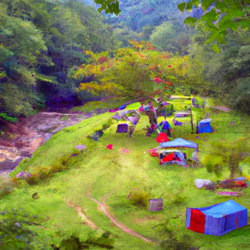
Creekside Mountain Camping
The campground offers a range of amenities, including spacious campsites, picnic tables, and fire rings for campfires. Additionally, there are clean restrooms and hot showers available for campers' convenience. For those seeking outdoor activities, Creekside Mountain Camping also provides opportunities for fishing in the nearby creek and hiking through the scenic trails.
Reservations are accepted at Creekside Mountain Camping, ensuring that campers can secure their preferred camping spot in advance. It is recommended to make a reservation, especially during peak seasons, to guarantee availability. The best time of year to visit this camping area is during the spring and fall seasons when the weather is mild and the foliage displays a stunning array of colors.
While enjoying the campground, visitors should be cautious of potential wildlife encounters, as the area is known for its diverse flora and fauna. It is advised to properly store food and dispose of waste to minimize attracting animals. Overall, Creekside Mountain Camping offers a delightful camping experience with its amenities, scenic views, and opportunities for outdoor recreation.
What's on-site at Creekside Mountain Camping
Key facilities Snoflo tracks for this campground. Confirm with the operator before booking -- amenities can change seasonally.
Plan your trip down to the hour
Same weather feed Snoflo's iOS app uses -- updated continuously from NOAA / yr.no.
Next 5 days, hour by hour
Temperature line with weather symbols on top, snow + rain accumulation as columns, humidity as a dotted line.
5-day forecast table
Every 3 hours, broken out across temperature, snow, rain, humidity, and wind. Each cell is colour-coded relative to the column min/max so trends jump out at a glance.
| Time | Condition | Temp (°F) | Snow (in) | Rain (in) | Humidity (%) | Wind (mps) | Wind dir |
|---|---|---|---|---|---|---|---|
| Loading detailed forecast… | |||||||
15-day temperature & precipitation
Daily temperatures, snow, and rain projected over the next two weeks. Hover any point for the full breakdown.
Other campgrounds in the area
Snoflo-tracked campsites within driving distance of Creekside Mountain Camping, with reservations status.
| Campground | Reservations | Toilets | View |
|---|---|---|---|
| Camp Judaea | ✗ | ✗ | → |
| Catawba Falls Campground, Llc | ✗ | ✗ | → |
| River Creek Camp Ground | ✗ | ✗ | → |
| Silver Creek Campground & Whitewater Outfitters | ✗ | ✗ | → |
| Shingle Hollow Congregational Holiness Camp Ground | ✗ | ✗ | → |
Nearby streamflow
USGS streamgauges within reach of Creekside Mountain Camping -- pulled live from the National Water Information System.
| Streamgauge | Discharge | View |
|---|---|---|
| Cove Creek Near Lake Lure | 50 cfs | → |
| French Broad River Near Fletcher | 900 cfs | → |
| Beetree Creek Near Swannanoa | 2 cfs | → |
| Swannanoa River At Biltmore | 32 cfs | → |
| North Fork Swannanoa River Near Walkertown | 11 cfs | → |
| Mills River Near Mills River | 131 cfs | → |
Nearby snow depths
NRCS SNOTEL stations within reach of Creekside Mountain Camping -- relevant when planning a shoulder-season or alpine trip.
| SNOTEL station | Snowpack | 24h Snowfall | View |
|---|---|---|---|
| Barnardsville 2 Se | 0.0 in | 0.0 in | → |
| Brevard | 0.0 in | 0.0 in | → |
| Chesnee 7 Wsw | 0.0 in | 0.0 in | → |
| Cleveland 3 S | 0.0 in | 0.0 in | → |
| Casar | 0.0 in | 0.0 in | → |
| Erwin | 0.0 in | 0.0 in | → |
Plan a longer trip
The closest parks, lakes, boat launches, and paddle runs so a camping night can grow into a full weekend.
Parks
- Florence Preserve
- Black Mountain Recreation Park
- Fletcher Community Park
- Blue Ridge Parkway Headquarters
- Lake Julian Park
- Brooklawn Park
Boat launches
- Lake Lure / Washburn Marina
- Memorial Highway 2693, Lake Lure
- Lake Lyre Boat Ramp
- Lake Adger
- Westfeldt Park
- Hooper Lane Mills River
Fishing spots
- Asheville Recreation Park Lake
- Bailey Branch
- Anderson Branch
- Big Pine Creek
- Nolichucky River
- Bear Creek Lake
Points of interest
- Canopy Ridge Farm
- Henderson Hostel
- Red House Studios And Gallery
- Blue Ridge Parkway Visitor Center
- Folk Art Center
- Western North Carolina Air Museum
Paddle runs
- Mills River From Confluence Of North/South Forks To Confluence With Foster Creek
- Nf Boundary To Confluence With North Fork
- North Fork From Bottom Of Spillway Of Hendersonville Reservoir To Confluence With South Fork
- South Fork From Confluence With Pigeon Br To Nf Boundary
- East Fork From Us Highway 276 To Confluence Of Dark Prong And Yellowstone Prong
- Dark Prong From Headwaters To Confluence East Fork And Yellowstone Prong
Camping essentials & Leave No Trace
- Pack it in, pack it out
- Take all trash, food scraps, and gear back with you to keep campsites clean and protect wildlife.
- Respect wildlife
- Observe animals from a distance, store food securely, and never feed wildlife to maintain natural behavior and safety.
- Know before you go
- Check weather, fire restrictions, trail conditions, and permit requirements to ensure a safe and well-planned trip.
- Minimize campfire impact
- Use established fire rings, keep fires small, fully extinguish them, or opt for a camp stove when fires are restricted.
- Leave what you find
- Preserve natural and cultural features by avoiding removal of plants, rocks, artifacts, or other elements of the environment.
Set push alerts in the Snoflo app
Save Creekside Mountain Camping as a favorite, set a custom threshold (precipitation, snowpack, freezing temperatures), and the iOS app will push the moment conditions cross.
About Creekside Mountain Camping
Can I make reservations at Creekside Mountain Camping?
This campground does not appear to accept reservations -- it's typically first-come, first-served. Arrive early on summer weekends.
How fresh is the weather data on this page?
The hourly forecast updates throughout the day from the NOAA / yr.no public feeds. Streamflow data is pulled live from USGS streamgauges and snowpack from the NRCS SNOTEL network.
What's the best time of year to visit?
Use the 15-day temperature & precipitation outlook on this page to plan -- pick a window with comfortable temperatures and low precipitation. For longer trips, the 5-day hourly meteogram shows snow + rain accumulation hour-by-hour.
How do I get to Creekside Mountain Camping?
Tap Directions in the hero above to open driving directions in Google Maps, or Open in map to center the Snoflo interactive map on the campground.
Can I get alerts when conditions change?
Yes -- alerts are managed through the Snoflo iOS app. Favorite this campground, set a threshold (temperature, snowpack, precipitation), and you'll get a push the moment it crosses.
Other campgrounds near here
Snoflo-tracked campgrounds within driving distance of Creekside Mountain Camping.