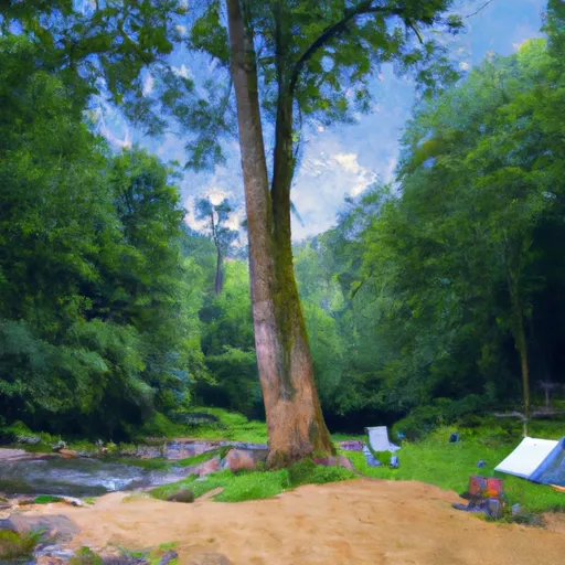
Davidson River Recreation Area Campground
Community Reviews
Been here? Share the conditions.
Reviews, ratings & photos are added in the free Snoflo iOS app — rate a spot, tag the conditions, and your visit is verified by location. Add or manage your reviews from the app.
Davidson River Recreation Area
Reservations are accepted at Davidson River Recreation Area, which is highly recommended due to the popularity of the campground. It is advised to make reservations well in advance, especially during peak seasons. The best time to visit this camping area is during spring and fall when the weather is mild, and the surrounding nature is at its most vibrant. Visitors can enjoy activities such as hiking, fishing, biking, and wildlife viewing in the picturesque forested landscape.
While camping at Davidson River Recreation Area, it is important to be aware of potential bears in the area. Campers are advised to store all food and scented items properly to prevent any unwanted encounters with wildlife. Additionally, it is essential to follow all safety guidelines and regulations provided by the campground staff to ensure a safe and memorable camping experience in the beautiful Davidson River Recreation Area.
What's on-site at Davidson River Recreation Area
Key facilities Snoflo tracks for this campground. Confirm with the operator before booking -- amenities can change seasonally.
Plan your trip down to the hour
Same weather feed Snoflo's iOS app uses -- updated continuously from NOAA / yr.no.
Next 5 days, hour by hour
Temperature line with weather symbols on top, snow + rain accumulation as columns, humidity as a dotted line.
5-day forecast table
Every 3 hours, broken out across temperature, snow, rain, humidity, and wind. Each cell is colour-coded relative to the column min/max so trends jump out at a glance.
| Time | Condition | Temp (°F) | Snow (in) | Rain (in) | Humidity (%) | Wind (mps) | Wind dir |
|---|---|---|---|---|---|---|---|
| Loading detailed forecast… | |||||||
15-day temperature & precipitation
Daily temperatures, snow, and rain projected over the next two weeks. Hover any point for the full breakdown.
Other campgrounds in the area
Snoflo-tracked campsites within driving distance of Davidson River Recreation Area, with reservations status.
| Campground | Reservations | Toilets | View |
|---|---|---|---|
| Davidson River Campground | ✗ | ✗ | → |
| Davidson River | ✓ | ✗ | → |
| White Pines Group Campground | ✓ | ✗ | → |
| Kuykendall Group Campground | ✓ | ✗ | → |
| Butter Gap Shelter | ✗ | ✗ | → |
Nearby streamflow
USGS streamgauges within reach of Davidson River Recreation Area -- pulled live from the National Water Information System.
| Streamgauge | Discharge | View |
|---|---|---|
| Davidson River Near Brevard | 40 cfs | → |
| French Broad River At Blantyre | 329 cfs | → |
| Mills River Near Mills River | 52 cfs | → |
| French Broad River At Rosman | 100 cfs | → |
| French Broad River Near Fletcher | 470 cfs | → |
| W F Pigeon R Above Lake Logan Nr Hazelwood | 28 cfs | → |
Nearby snow depths
NRCS SNOTEL stations within reach of Davidson River Recreation Area -- relevant when planning a shoulder-season or alpine trip.
| SNOTEL station | Snowpack | 24h Snowfall | View |
|---|---|---|---|
| Brevard | 0.0 in | 0.0 in | → |
| Cleveland 3 S | 0.0 in | 0.0 in | → |
| Barnardsville 2 Se | 0.0 in | 0.0 in | → |
| Dillard 0.7 Nnw | 0.0 in | 0.0 in | → |
| Bryson City 4 | 0.0 in | 0.0 in | → |
| Chesnee 7 Wsw | 0.0 in | 0.0 in | → |
Plan a longer trip
The closest parks, lakes, boat launches, and paddle runs so a camping night can grow into a full weekend.
Parks
- Wilderness Shining Rock
- Holmes Educational State Forest
- Dupont State Forest Game Land
- Wilderness Middle Prong
- Cold Mountain Game Land
- Pisgah National Forest
Boat launches
Fishing spots
- Bear Creek Lake
- Asheville Recreation Park Lake
- Bailey Branch
- Anderson Branch
- Big Pine Creek
- Presbyterian Lake
Points of interest
- Blue Moon Gallery & Frame
- M1
- Sliding Rock
- 1915 Climax Locomotive
- Cherry Cove Overlook
- Log Hollow Overlook
Paddle runs
- Dark Prong From Headwaters To Confluence East Fork And Yellowstone Prong
- South Fork From Confluence With Pigeon Br To Nf Boundary
- East Fork From Us Highway 276 To Confluence Of Dark Prong And Yellowstone Prong
- Yellowstone Prong From Headwaters To Confluence With East Fork And Yellowstone Prong
- Nf Boundary To Confluence With North Fork
- North Fork From Bottom Of Spillway Of Hendersonville Reservoir To Confluence With South Fork
Camping essentials & Leave No Trace
- Pack it in, pack it out
- Take all trash, food scraps, and gear back with you to keep campsites clean and protect wildlife.
- Respect wildlife
- Observe animals from a distance, store food securely, and never feed wildlife to maintain natural behavior and safety.
- Know before you go
- Check weather, fire restrictions, trail conditions, and permit requirements to ensure a safe and well-planned trip.
- Minimize campfire impact
- Use established fire rings, keep fires small, fully extinguish them, or opt for a camp stove when fires are restricted.
- Leave what you find
- Preserve natural and cultural features by avoiding removal of plants, rocks, artifacts, or other elements of the environment.
Set push alerts in the Snoflo app
Save Davidson River Recreation Area as a favorite, set a custom threshold (precipitation, snowpack, freezing temperatures), and the iOS app will push the moment conditions cross.
About Davidson River Recreation Area
Can I make reservations at Davidson River Recreation Area?
Yes -- this campground accepts reservations. Snoflo recommends booking early for peak season; check the operator (Recreation.gov / state park system / private operator) for the booking window and cancellation policy.
How fresh is the weather data on this page?
The hourly forecast updates throughout the day from the NOAA / yr.no public feeds. Streamflow data is pulled live from USGS streamgauges and snowpack from the NRCS SNOTEL network.
What's the best time of year to visit?
Use the 15-day temperature & precipitation outlook on this page to plan -- pick a window with comfortable temperatures and low precipitation. For longer trips, the 5-day hourly meteogram shows snow + rain accumulation hour-by-hour.
How do I get to Davidson River Recreation Area?
Tap Directions in the hero above to open driving directions in Google Maps, or Open in map to center the Snoflo interactive map on the campground.
Can I get alerts when conditions change?
Yes -- alerts are managed through the Snoflo iOS app. Favorite this campground, set a threshold (temperature, snowpack, precipitation), and you'll get a push the moment it crosses.
Other campgrounds near here
Snoflo-tracked campgrounds within driving distance of Davidson River Recreation Area.