Standing Indian Campground Campground
Community Reviews
Been here? Share the conditions.
Reviews, ratings & photos are added in the free Snoflo iOS app — rate a spot, tag the conditions, and your visit is verified by location. Add or manage your reviews from the app.
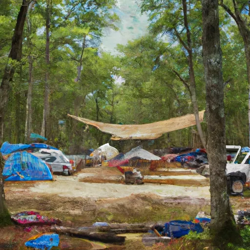
Standing Indian Campground
Reservations are accepted at Standing Indian Campground, allowing campers to secure their spot in advance. This ensures that visitors can plan their trip accordingly and have peace of mind knowing they have a reserved campsite. It is advisable to make reservations, especially during peak seasons when the campground tends to fill up quickly.
The best time to visit Standing Indian Campground is during the spring and fall months when the weather is mild and pleasant. Summers can be hot and humid, while winters can be cold, so it's best to avoid extreme temperatures. The camping area offers numerous hiking trails, including the renowned Appalachian Trail, which is a popular attraction for outdoor enthusiasts. However, visitors should be cautious of wildlife in the area, particularly bears, and take appropriate precautions to ensure their safety. Overall, Standing Indian Campground provides a well-maintained and convenient camping experience for those looking to enjoy the natural beauty of North Carolina.
What's on-site at Standing Indian Campground
Key facilities Snoflo tracks for this campground. Confirm with the operator before booking -- amenities can change seasonally.
Plan your trip down to the hour
Same weather feed Snoflo's iOS app uses -- updated continuously from NOAA / yr.no.
Next 5 days, hour by hour
Temperature line with weather symbols on top, snow + rain accumulation as columns, humidity as a dotted line.
5-day forecast table
Every 3 hours, broken out across temperature, snow, rain, humidity, and wind. Each cell is colour-coded relative to the column min/max so trends jump out at a glance.
| Time | Condition | Temp (°F) | Snow (in) | Rain (in) | Humidity (%) | Wind (mps) | Wind dir |
|---|---|---|---|---|---|---|---|
| Loading detailed forecast… | |||||||
15-day temperature & precipitation
Daily temperatures, snow, and rain projected over the next two weeks. Hover any point for the full breakdown.
Other campgrounds in the area
Snoflo-tracked campsites within driving distance of Standing Indian Campground, with reservations status.
| Campground | Reservations | Toilets | View |
|---|---|---|---|
| Standing Indian Campground Store | ✗ | ✗ | → |
| Standing Indian | ✓ | ✗ | → |
| Kimsey Creek Group Campground | ✓ | ✗ | → |
| Hurricane Creek Horse & Primitive Campground | ✗ | ✗ | → |
| Moore Creek Camp | ✗ | ✗ | → |
Nearby streamflow
USGS streamgauges within reach of Standing Indian Campground -- pulled live from the National Water Information System.
| Streamgauge | Discharge | View |
|---|---|---|
| Nantahala River Near Rainbow Springs | 171 cfs | → |
| Cartoogechaye Creek Near Franklin | 261 cfs | → |
| Little Tennessee River Near Prentiss | 157 cfs | → |
| Little Tennessee R At Franklin | 1,050 cfs | → |
| Tallulah River Near Clayton | 114 cfs | → |
| Little Tennessee River At Needmore | 555 cfs | → |
Nearby snow depths
NRCS SNOTEL stations within reach of Standing Indian Campground -- relevant when planning a shoulder-season or alpine trip.
| SNOTEL station | Snowpack | 24h Snowfall | View |
|---|---|---|---|
| Dillard 0.7 Nnw | 0.0 in | 0.0 in | → |
| Germany Valley | 0.0 in | 0.0 in | → |
| Bryson City 4 | 0.0 in | 0.0 in | → |
| Sautee 3.5 Sw | 0.0 in | 0.0 in | → |
| New Found Gap | 2.9 in | 0.0 in | → |
| Gatlinburg | 0.0 in | 0.0 in | → |
Plan a longer trip
The closest parks, lakes, boat launches, and paddle runs so a camping night can grow into a full weekend.
Parks
- Wilderness Southern Nantahala
- Nantahala National Forest
- Needmore Game Land
- Black Rock Mountain State Park
- Moccasin Creek State Park
- Wilderness Tray Mountain
Boat launches
Fishing spots
- Hickory Nut Cove Trout Farm
- Lake Burton
- Seed Lake
- Lake Rabun
- Tallulah Falls Lake
- Massey Branch Fishing Pier
Points of interest
- Wasilik Poplar
- Too-Cowee;ᎧᏫᏱ
- Fishing Hole Rock
- Waterwheel
- Stonewall Creek Vineyards Tasting Room
- Tiger Mountain Vineyards
Paddle runs
- Headwaters In Standing Indian Basin To Slackwater Of Natahala Lake
- Natahala Powerhouse To Lake Fontana (River Mile 4)
- Ga/Nc State Line To 2 Miles Downriver
- Earl's Ford To Route 76 (Section 3)
- Source Near Chattahoochee Gap To Mark Trail Wilderness Boundary
- Highway 28 To Earl's Ford (Section 2)
Camping essentials & Leave No Trace
- Pack it in, pack it out
- Take all trash, food scraps, and gear back with you to keep campsites clean and protect wildlife.
- Respect wildlife
- Observe animals from a distance, store food securely, and never feed wildlife to maintain natural behavior and safety.
- Know before you go
- Check weather, fire restrictions, trail conditions, and permit requirements to ensure a safe and well-planned trip.
- Minimize campfire impact
- Use established fire rings, keep fires small, fully extinguish them, or opt for a camp stove when fires are restricted.
- Leave what you find
- Preserve natural and cultural features by avoiding removal of plants, rocks, artifacts, or other elements of the environment.
Set push alerts in the Snoflo app
Save Standing Indian Campground as a favorite, set a custom threshold (precipitation, snowpack, freezing temperatures), and the iOS app will push the moment conditions cross.
About Standing Indian Campground
Can I make reservations at Standing Indian Campground?
Yes -- this campground accepts reservations. Snoflo recommends booking early for peak season; check the operator (Recreation.gov / state park system / private operator) for the booking window and cancellation policy.
How fresh is the weather data on this page?
The hourly forecast updates throughout the day from the NOAA / yr.no public feeds. Streamflow data is pulled live from USGS streamgauges and snowpack from the NRCS SNOTEL network.
What's the best time of year to visit?
Use the 15-day temperature & precipitation outlook on this page to plan -- pick a window with comfortable temperatures and low precipitation. For longer trips, the 5-day hourly meteogram shows snow + rain accumulation hour-by-hour.
How do I get to Standing Indian Campground?
Tap Directions in the hero above to open driving directions in Google Maps, or Open in map to center the Snoflo interactive map on the campground.
Can I get alerts when conditions change?
Yes -- alerts are managed through the Snoflo iOS app. Favorite this campground, set a threshold (temperature, snowpack, precipitation), and you'll get a push the moment it crosses.
Other campgrounds near here
Snoflo-tracked campgrounds within driving distance of Standing Indian Campground.