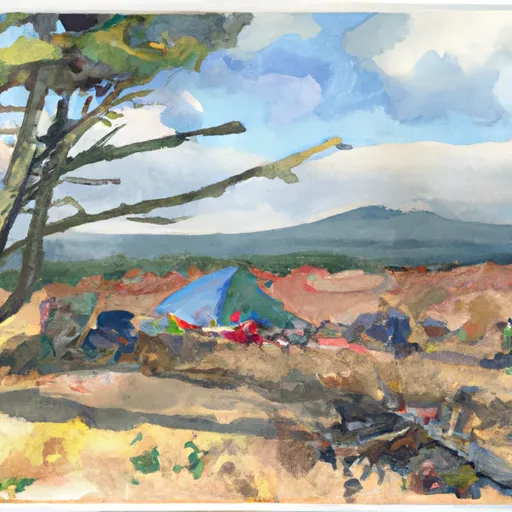
Lb4a-User Created Campground
Community Reviews
Been here? Share the conditions.
Reviews, ratings & photos are added in the free Snoflo iOS app — rate a spot, tag the conditions, and your visit is verified by location. Add or manage your reviews from the app.
Lb4a-User Created
The campground amenities are basic, with no electricity or water hookups, but there is a pit toilet available for use. Visitors must bring their own water and pack out all trash. It's important to note that there are no fires allowed in this area.
Interesting facts about the area include the Donner Und Blitzen River being home to several species of trout, including rainbow, cutthroat, and brook trout. It's also been said that the area was named after a thunderstorm that occurred during a cattle drive in the 1800s.
The best time of year to visit is during the summer months, from June to September, with average temperatures ranging from 50-80°F. It's important to note that the weather can change quickly in this area, and visitors should come prepared with appropriate clothing and gear.
Sources:
- https://www.fs.usda.gov/recarea/fremont-winema/recreation/camping-cabins/recarea/?recid=59776&actid=29
- https://www.outdoorproject.com/united-states/oregon/lb4a-user-created-campsite
- https://www.visitbaker.com/things-to-do/outdoor-recreation/donner-und-blitzen-river/
What's on-site at Lb4a-User Created
Key facilities Snoflo tracks for this campground. Confirm with the operator before booking -- amenities can change seasonally.
Plan your trip down to the hour
Same weather feed Snoflo's iOS app uses -- updated continuously from NOAA / yr.no.
Next 5 days, hour by hour
Temperature line with weather symbols on top, snow + rain accumulation as columns, humidity as a dotted line.
5-day forecast table
Every 3 hours, broken out across temperature, snow, rain, humidity, and wind. Each cell is colour-coded relative to the column min/max so trends jump out at a glance.
| Time | Condition | Temp (°F) | Snow (in) | Rain (in) | Humidity (%) | Wind (mps) | Wind dir |
|---|---|---|---|---|---|---|---|
| Loading detailed forecast… | |||||||
15-day temperature & precipitation
Daily temperatures, snow, and rain projected over the next two weeks. Hover any point for the full breakdown.
Other campgrounds in the area
Snoflo-tracked campsites within driving distance of Lb4a-User Created, with reservations status.
| Campground | Reservations | Toilets | View |
|---|---|---|---|
| Lb4-User Created | ✗ | ✗ | → |
| Lb3a-User Created | ✗ | ✗ | → |
| Lb3-User Created | ✗ | ✗ | → |
| Lb2-User Created | ✗ | ✗ | → |
| Lb5-User Created | ✗ | ✗ | → |
Nearby streamflow
USGS streamgauges within reach of Lb4a-User Created -- pulled live from the National Water Information System.
| Streamgauge | Discharge | View |
|---|---|---|
| Donner Und Blitzen River Nr Frenchglen Or | 34 cfs | → |
| Owyhee River Nr Rome Or | 69 cfs | → |
Nearby snow depths
NRCS SNOTEL stations within reach of Lb4a-User Created -- relevant when planning a shoulder-season or alpine trip.
| SNOTEL station | Snowpack | 24h Snowfall | View |
|---|---|---|---|
| Fish Creek | 0.0 in | 0.0 in | → |
| Fish Creek | 0.0 in | 0.0 in | → |
| Nohrsc Silvies | 0.0 in | 0.0 in | → |
| Silvies | 0.0 in | 0.0 in | → |
Plan a longer trip
The closest parks, lakes, boat launches, and paddle runs so a camping night can grow into a full weekend.
Parks
- Malheur National Wildlife Refuge
- Frenchglen Hotel State Heritage Site
- Steens Mountain Wilderness
- Pete French Round Barn State Heritage Site
Boat launches
Camping essentials & Leave No Trace
- Pack it in, pack it out
- Take all trash, food scraps, and gear back with you to keep campsites clean and protect wildlife.
- Respect wildlife
- Observe animals from a distance, store food securely, and never feed wildlife to maintain natural behavior and safety.
- Know before you go
- Check weather, fire restrictions, trail conditions, and permit requirements to ensure a safe and well-planned trip.
- Minimize campfire impact
- Use established fire rings, keep fires small, fully extinguish them, or opt for a camp stove when fires are restricted.
- Leave what you find
- Preserve natural and cultural features by avoiding removal of plants, rocks, artifacts, or other elements of the environment.
Set push alerts in the Snoflo app
Save Lb4a-User Created as a favorite, set a custom threshold (precipitation, snowpack, freezing temperatures), and the iOS app will push the moment conditions cross.
About Lb4a-User Created
Can I make reservations at Lb4a-User Created?
This campground does not appear to accept reservations -- it's typically first-come, first-served. Arrive early on summer weekends.
How fresh is the weather data on this page?
The hourly forecast updates throughout the day from the NOAA / yr.no public feeds. Streamflow data is pulled live from USGS streamgauges and snowpack from the NRCS SNOTEL network.
What's the best time of year to visit?
Use the 15-day temperature & precipitation outlook on this page to plan -- pick a window with comfortable temperatures and low precipitation. For longer trips, the 5-day hourly meteogram shows snow + rain accumulation hour-by-hour.
How do I get to Lb4a-User Created?
Tap Directions in the hero above to open driving directions in Google Maps, or Open in map to center the Snoflo interactive map on the campground.
Can I get alerts when conditions change?
Yes -- alerts are managed through the Snoflo iOS app. Favorite this campground, set a threshold (temperature, snowpack, precipitation), and you'll get a push the moment it crosses.
Other campgrounds near here
Snoflo-tracked campgrounds within driving distance of Lb4a-User Created.