Ollokot Campground
Community Reviews
Been here? Share the conditions.
Reviews, ratings & photos are added in the free Snoflo iOS app — rate a spot, tag the conditions, and your visit is verified by location. Add or manage your reviews from the app.
Ollokot
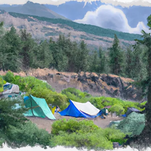
Reservations are not accepted at Olkotot camping area, making it a first-come, first-served campground. This means that campers should plan their visit accordingly and arrive early to secure a spot, especially during peak seasons. The best time to visit this camping area is during the summer months when the weather is generally pleasant and the campground is more likely to have availability. It is advisable to check the current status of the campground before heading out to ensure it is open and accessible.
While camping at Olkotot, visitors can explore the surrounding natural beauty. The campground offers access to hiking trails that lead to stunning vistas, wildlife viewing opportunities, and fishing spots. However, it is important to be cautious of potential hazards such as uneven terrain, wildlife encounters, and unpredictable weather conditions. Campers should also be mindful of fire safety regulations and practice proper food storage to minimize encounters with wildlife. By being well-prepared and respectful of the environment, campers can have an enjoyable and memorable experience at Olkotot camping area in Oregon.
What's on-site at Ollokot
Key facilities Snoflo tracks for this campground. Confirm with the operator before booking -- amenities can change seasonally.
Plan your trip down to the hour
Same weather feed Snoflo's iOS app uses -- updated continuously from NOAA / yr.no.
Next 5 days, hour by hour
Temperature line with weather symbols on top, snow + rain accumulation as columns, humidity as a dotted line.
5-day forecast table
Every 3 hours, broken out across temperature, snow, rain, humidity, and wind. Each cell is colour-coded relative to the column min/max so trends jump out at a glance.
| Time | Condition | Temp (°F) | Snow (in) | Rain (in) | Humidity (%) | Wind (mps) | Wind dir |
|---|---|---|---|---|---|---|---|
| Loading detailed forecast… | |||||||
15-day temperature & precipitation
Daily temperatures, snow, and rain projected over the next two weeks. Hover any point for the full breakdown.
Other campgrounds in the area
Snoflo-tracked campsites within driving distance of Ollokot, with reservations status.
| Campground | Reservations | Toilets | View |
|---|---|---|---|
| Ollokot Campground | ✗ | ✗ | → |
| Blackhorse Campground | ✗ | ✗ | → |
| Blackhorse | ✗ | ✓ | → |
| Coverdale Campground | ✗ | ✗ | → |
| Coverdale | ✗ | ✓ | → |
Nearby streamflow
USGS streamgauges within reach of Ollokot -- pulled live from the National Water Information System.
| Streamgauge | Discharge | View |
|---|---|---|
| Snake River At Hells Canyon Dam Id-Or State Line | 19,200 cfs | → |
| Imnaha River At Imnaha | 150 cfs | → |
| Little Salmon River At Riggins Id | 253 cfs | → |
| Nf Payette River At Mccall Id | 55 cfs | → |
| Weiser River Nr Cambridge Id | 91 cfs | → |
| Lake Fork Payette River Ab Jumbo Cr Nr Mccall Id | 43 cfs | → |
Nearby snow depths
NRCS SNOTEL stations within reach of Ollokot -- relevant when planning a shoulder-season or alpine trip.
| SNOTEL station | Snowpack | 24h Snowfall | View |
|---|---|---|---|
| Aneroid Lake #2 | 0.0 in | 0.0 in | → |
| Nohrsc Aneroid Lake #2 | 0.0 in | 0.0 in | → |
| Mt. Howard | 0.0 in | 0.0 in | → |
| Nohrsc Mt. Howard | 1.0 in | 0.0 in | → |
| Schneider Meadows | 0.0 in | 0.0 in | → |
| Nohrsc Schneider Meadows | 0.0 in | 0.0 in | → |
Plan a longer trip
The closest parks, lakes, boat launches, and paddle runs so a camping night can grow into a full weekend.
Parks
- Wilderness Hells Canyon
- National Wild And Scenic River Snake, Idaho And Oregon
- Hells Canyon National Recreation Area
- Wallowa Lake State Park
- National Wild And Scenic River Eagle Creek, Oregon (Wallowa-Whitman Nf)
- Iwetemlaykin State Heritage Site
Boat launches
- Copper Creek Boat Launch
- Allison Creek Trail Adams County
- Hells Canyon Road Adams County
- Bob Creek
- Hells Canyon Creek Recreation Site
- Copperfield Boat Launch
Camping essentials & Leave No Trace
- Pack it in, pack it out
- Take all trash, food scraps, and gear back with you to keep campsites clean and protect wildlife.
- Respect wildlife
- Observe animals from a distance, store food securely, and never feed wildlife to maintain natural behavior and safety.
- Know before you go
- Check weather, fire restrictions, trail conditions, and permit requirements to ensure a safe and well-planned trip.
- Minimize campfire impact
- Use established fire rings, keep fires small, fully extinguish them, or opt for a camp stove when fires are restricted.
- Leave what you find
- Preserve natural and cultural features by avoiding removal of plants, rocks, artifacts, or other elements of the environment.
Set push alerts in the Snoflo app
Save Ollokot as a favorite, set a custom threshold (precipitation, snowpack, freezing temperatures), and the iOS app will push the moment conditions cross.
About Ollokot
Can I make reservations at Ollokot?
This campground does not appear to accept reservations -- it's typically first-come, first-served. Arrive early on summer weekends.
How fresh is the weather data on this page?
The hourly forecast updates throughout the day from the NOAA / yr.no public feeds. Streamflow data is pulled live from USGS streamgauges and snowpack from the NRCS SNOTEL network.
What's the best time of year to visit?
Use the 15-day temperature & precipitation outlook on this page to plan -- pick a window with comfortable temperatures and low precipitation. For longer trips, the 5-day hourly meteogram shows snow + rain accumulation hour-by-hour.
How do I get to Ollokot?
Tap Directions in the hero above to open driving directions in Google Maps, or Open in map to center the Snoflo interactive map on the campground.
Can I get alerts when conditions change?
Yes -- alerts are managed through the Snoflo iOS app. Favorite this campground, set a threshold (temperature, snowpack, precipitation), and you'll get a push the moment it crosses.
Other campgrounds near here
Snoflo-tracked campgrounds within driving distance of Ollokot.