21 Mile 53 Campground
Community Reviews
Been here? Share the conditions.
Reviews, ratings & photos are added in the free Snoflo iOS app — rate a spot, tag the conditions, and your visit is verified by location. Add or manage your reviews from the app.
21 Mile 53
Reservations are not required to camp at 21 Mile 53, as the sites are available on a first-come, first-served basis. However, it is recommended to arrive early, especially during peak seasons, to secure a spot.
The best time of year to visit this camping area is during the spring and fall when the weather is mild and pleasant. Summers can be hot and humid, while winters are known to be chilly. It is important to pack appropriate clothing and gear to ensure a comfortable stay.
Campers should be cautious of wildlife in the area, as encounters with bears and snakes have been reported. It is essential to store food properly and be aware of surroundings. Additionally, it is advisable to bring insect repellent as mosquitoes and ticks can be prevalent in this region.
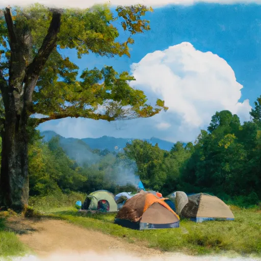
Overall, 21 Mile 53 camping area in Tennessee offers a serene and natural setting, with basic amenities provided. It is a great destination for those looking for a rustic camping experience and an opportunity to disconnect from the hustle and bustle of everyday life.
What's on-site at 21 Mile 53
Key facilities Snoflo tracks for this campground. Confirm with the operator before booking -- amenities can change seasonally.
Plan your trip down to the hour
Same weather feed Snoflo's iOS app uses -- updated continuously from NOAA / yr.no.
Next 5 days, hour by hour
Temperature line with weather symbols on top, snow + rain accumulation as columns, humidity as a dotted line.
5-day forecast table
Every 3 hours, broken out across temperature, snow, rain, humidity, and wind. Each cell is colour-coded relative to the column min/max so trends jump out at a glance.
| Time | Condition | Temp (°F) | Snow (in) | Rain (in) | Humidity (%) | Wind (mps) | Wind dir |
|---|---|---|---|---|---|---|---|
| Loading detailed forecast… | |||||||
15-day temperature & precipitation
Daily temperatures, snow, and rain projected over the next two weeks. Hover any point for the full breakdown.
Other campgrounds in the area
Snoflo-tracked campsites within driving distance of 21 Mile 53, with reservations status.
| Campground | Reservations | Toilets | View |
|---|---|---|---|
| 24 Rough Creek | ✗ | ✗ | → |
| Elkmont Campground | ✗ | ✗ | → |
| Elkmont - Great Smoky Mountains National Park | ✓ | ✗ | → |
| Elkmont Group Campground | ✗ | ✗ | → |
| #23 Camp Rock | ✗ | ✗ | → |
Nearby streamflow
USGS streamgauges within reach of 21 Mile 53 -- pulled live from the National Water Information System.
| Streamgauge | Discharge | View |
|---|---|---|
| Little River Above Townsend | 636 cfs | → |
| Tuckasegee River At Bryson City | 2,070 cfs | → |
| Oconaluftee River At Birdtown | 911 cfs | → |
| Little Pigeon River At Sevierville | 1,450 cfs | → |
| Little Tennessee River At Needmore | 635 cfs | → |
| Little River Near Maryville | 946 cfs | → |
Nearby snow depths
NRCS SNOTEL stations within reach of 21 Mile 53 -- relevant when planning a shoulder-season or alpine trip.
| SNOTEL station | Snowpack | 24h Snowfall | View |
|---|---|---|---|
| Gatlinburg | 0.0 in | 0.0 in | → |
| New Found Gap | 2.9 in | 0.0 in | → |
| Bryson City 4 | 0.0 in | 0.0 in | → |
| Dillard 0.7 Nnw | 0.0 in | 0.0 in | → |
Plan a longer trip
The closest parks, lakes, boat launches, and paddle runs so a camping night can grow into a full weekend.
Parks
- Swain County Park
- Sevierville City Park
- Great Smoky Mountains National Park
- Bower Field
- Kimberlin Heights Park
- John Sevier Park
Boat launches
Fishing spots
- Birchfield Branch
- Augerhole Branch
- Santeetlah Lake
- Massey Branch Fishing Pier
- Citico Creek
- Indian Boundary Lake
Points of interest
- Carlos Campbell (North) Overlook
- Elkmont Club Cabin # B, Spence
- Elkmont Club Cabin # 13, Cook
- Elkmont Club Cabin # 15, Hale
- Mayna Treanor Avent Cabin/Studio
- Elkmont Club Cabin # 11, Scruggs / Brisco
Paddle runs
- Natahala Powerhouse To Lake Fontana (River Mile 4)
- Polecat Branch To Snowbird Picnic Area
- Owlcamp Branch To Polecat Branch
- Headwaters Near Mitchell Lick To Owlcamp Branch
- Headwaters In Standing Indian Basin To Slackwater Of Natahala Lake
- Headwaters Near Graham County Line To Nc/Tn State Line
Camping essentials & Leave No Trace
- Pack it in, pack it out
- Take all trash, food scraps, and gear back with you to keep campsites clean and protect wildlife.
- Respect wildlife
- Observe animals from a distance, store food securely, and never feed wildlife to maintain natural behavior and safety.
- Know before you go
- Check weather, fire restrictions, trail conditions, and permit requirements to ensure a safe and well-planned trip.
- Minimize campfire impact
- Use established fire rings, keep fires small, fully extinguish them, or opt for a camp stove when fires are restricted.
- Leave what you find
- Preserve natural and cultural features by avoiding removal of plants, rocks, artifacts, or other elements of the environment.
Set push alerts in the Snoflo app
Save 21 Mile 53 as a favorite, set a custom threshold (precipitation, snowpack, freezing temperatures), and the iOS app will push the moment conditions cross.
About 21 Mile 53
Can I make reservations at 21 Mile 53?
This campground does not appear to accept reservations -- it's typically first-come, first-served. Arrive early on summer weekends.
How fresh is the weather data on this page?
The hourly forecast updates throughout the day from the NOAA / yr.no public feeds. Streamflow data is pulled live from USGS streamgauges and snowpack from the NRCS SNOTEL network.
What's the best time of year to visit?
Use the 15-day temperature & precipitation outlook on this page to plan -- pick a window with comfortable temperatures and low precipitation. For longer trips, the 5-day hourly meteogram shows snow + rain accumulation hour-by-hour.
How do I get to 21 Mile 53?
Tap Directions in the hero above to open driving directions in Google Maps, or Open in map to center the Snoflo interactive map on the campground.
Can I get alerts when conditions change?
Yes -- alerts are managed through the Snoflo iOS app. Favorite this campground, set a threshold (temperature, snowpack, precipitation), and you'll get a push the moment it crosses.
Other campgrounds near here
Snoflo-tracked campgrounds within driving distance of 21 Mile 53.