Forest Camp Site Campground
Community Reviews
Been here? Share the conditions.
Reviews, ratings & photos are added in the free Snoflo iOS app — rate a spot, tag the conditions, and your visit is verified by location. Add or manage your reviews from the app.
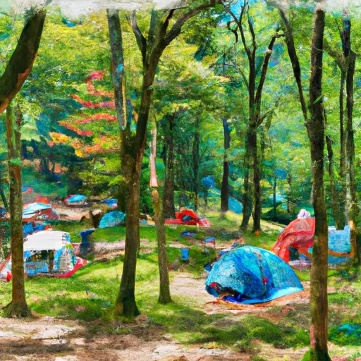
Forest Camp Site
What's on-site at Forest Camp Site
Key facilities Snoflo tracks for this campground. Confirm with the operator before booking -- amenities can change seasonally.
Plan your trip down to the hour
Same weather feed Snoflo's iOS app uses -- updated continuously from NOAA / yr.no.
Next 5 days, hour by hour
Temperature line with weather symbols on top, snow + rain accumulation as columns, humidity as a dotted line.
5-day forecast table
Every 3 hours, broken out across temperature, snow, rain, humidity, and wind. Each cell is colour-coded relative to the column min/max so trends jump out at a glance.
| Time | Condition | Temp (°F) | Snow (in) | Rain (in) | Humidity (%) | Wind (mps) | Wind dir |
|---|---|---|---|---|---|---|---|
| Loading detailed forecast… | |||||||
15-day temperature & precipitation
Daily temperatures, snow, and rain projected over the next two weeks. Hover any point for the full breakdown.
Other campgrounds in the area
Snoflo-tracked campsites within driving distance of Forest Camp Site, with reservations status.
| Campground | Reservations | Toilets | View |
|---|---|---|---|
| Jacobs Creek Recreation Area | ✓ | ✗ | → |
| Little Oak Campground | ✗ | ✗ | → |
| Little Oak | ✗ | ✗ | → |
| Jacobs Creek Campground | ✗ | ✗ | → |
| Jacobs Creek Rec Area | ✗ | ✗ | → |
Nearby streamflow
USGS streamgauges within reach of Forest Camp Site -- pulled live from the National Water Information System.
| Streamgauge | Discharge | View |
|---|---|---|
| S F Holston River Near Damascus | 248 cfs | → |
| Beaver Creek At Bristol | 18 cfs | → |
| Doe River At Elizabethton | 293 cfs | → |
| Watauga River At Elizabethton | 690 cfs | → |
| Watauga River Near Sugar Grove | 60 cfs | → |
| M F Holston River Near Meadowview | 255 cfs | → |
Nearby snow depths
NRCS SNOTEL stations within reach of Forest Camp Site -- relevant when planning a shoulder-season or alpine trip.
| SNOTEL station | Snowpack | 24h Snowfall | View |
|---|---|---|---|
| Vilas 6.3 Nnw | 0.0 in | 0.0 in | → |
| Abingdon 3s | 0.0 in | 0.0 in | → |
| Flat Springs 1e | 0.0 in | 0.0 in | → |
| Flat Springs 1.2 E | 0.0 in | 0.0 in | → |
| Elizabethton | 0.0 in | 0.0 in | → |
| Beech Mountain | 0.0 in | 0.0 in | → |
Plan a longer trip
The closest parks, lakes, boat launches, and paddle runs so a camping night can grow into a full weekend.
Parks
- Wilderness Big Laurel Brcanch
- Holston View Park
- Watauga Point Recreational Area
- Defriece Park
- Haynesfield Park
- Mumpower Park
Boat launches
- Sullivan County
- Friendship Marina
- Sink Mountain Launch Road Johnson County
- Baumgardner
- Bayview Family Campground And Marina
Fishing spots
Points of interest
- Welcome Center And Museum
- Bristol Caverns
- Wautauga Dam
- Bristol Municipal Stadium
- William King Museum
- Elizabethton Covered Bridge
Paddle runs
- Headwaters To Tn/Va State Line
- Watauga Reservoir To Tn/Nc State Line
- Green Cove--Jefferson Nf Near Confluence Of Star Hill Branch To Confluence With Whitetop Laurel
- Whitetop Laurel--Jefferson Nf Boundary (Intersection Of Hwy 58 And Sr 859) To Jefferson Nf Boundary Above Damascus
- Headwaters Above Linville Gap To Blue Ridge Parkway Boundary
- Blue Ridge Parkway Boundary To Linville Gorge Boundary
Camping essentials & Leave No Trace
- Pack it in, pack it out
- Take all trash, food scraps, and gear back with you to keep campsites clean and protect wildlife.
- Respect wildlife
- Observe animals from a distance, store food securely, and never feed wildlife to maintain natural behavior and safety.
- Know before you go
- Check weather, fire restrictions, trail conditions, and permit requirements to ensure a safe and well-planned trip.
- Minimize campfire impact
- Use established fire rings, keep fires small, fully extinguish them, or opt for a camp stove when fires are restricted.
- Leave what you find
- Preserve natural and cultural features by avoiding removal of plants, rocks, artifacts, or other elements of the environment.
Set push alerts in the Snoflo app
Save Forest Camp Site as a favorite, set a custom threshold (precipitation, snowpack, freezing temperatures), and the iOS app will push the moment conditions cross.
About Forest Camp Site
Can I make reservations at Forest Camp Site?
This campground does not appear to accept reservations -- it's typically first-come, first-served. Arrive early on summer weekends.
How fresh is the weather data on this page?
The hourly forecast updates throughout the day from the NOAA / yr.no public feeds. Streamflow data is pulled live from USGS streamgauges and snowpack from the NRCS SNOTEL network.
What's the best time of year to visit?
Use the 15-day temperature & precipitation outlook on this page to plan -- pick a window with comfortable temperatures and low precipitation. For longer trips, the 5-day hourly meteogram shows snow + rain accumulation hour-by-hour.
How do I get to Forest Camp Site?
Tap Directions in the hero above to open driving directions in Google Maps, or Open in map to center the Snoflo interactive map on the campground.
Can I get alerts when conditions change?
Yes -- alerts are managed through the Snoflo iOS app. Favorite this campground, set a threshold (temperature, snowpack, precipitation), and you'll get a push the moment it crosses.
Other campgrounds near here
Snoflo-tracked campgrounds within driving distance of Forest Camp Site.