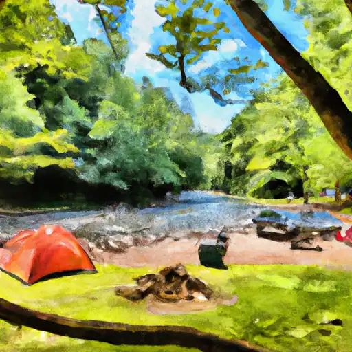
Gee Creek Campground
Community Reviews
Been here? Share the conditions.
Reviews, ratings & photos are added in the free Snoflo iOS app — rate a spot, tag the conditions, and your visit is verified by location. Add or manage your reviews from the app.
Gee Creek
What's on-site at Gee Creek
Key facilities Snoflo tracks for this campground. Confirm with the operator before booking -- amenities can change seasonally.
Plan your trip down to the hour
Same weather feed Snoflo's iOS app uses -- updated continuously from NOAA / yr.no.
Next 5 days, hour by hour
Temperature line with weather symbols on top, snow + rain accumulation as columns, humidity as a dotted line.
5-day forecast table
Every 3 hours, broken out across temperature, snow, rain, humidity, and wind. Each cell is colour-coded relative to the column min/max so trends jump out at a glance.
| Time | Condition | Temp (°F) | Snow (in) | Rain (in) | Humidity (%) | Wind (mps) | Wind dir |
|---|---|---|---|---|---|---|---|
| Loading detailed forecast… | |||||||
15-day temperature & precipitation
Daily temperatures, snow, and rain projected over the next two weeks. Hover any point for the full breakdown.
Other campgrounds in the area
Snoflo-tracked campsites within driving distance of Gee Creek, with reservations status.
| Campground | Reservations | Toilets | View |
|---|---|---|---|
| Quinn Springs Rec Area | ✗ | ✗ | → |
| Chilhowee Recreation Area | ✓ | ✗ | → |
| Chilhowee Rec Area | ✗ | ✗ | → |
| Chilhowee Campground | ✗ | ✗ | → |
| Campground Host | ✗ | ✗ | → |
Nearby streamflow
USGS streamgauges within reach of Gee Creek -- pulled live from the National Water Information System.
| Streamgauge | Discharge | View |
|---|---|---|
| Oostanaula Creek Near Sanford | 39 cfs | → |
| Hiwassee River At Charleston | 10,400 cfs | → |
| Tellico River At Tellico Plains | 346 cfs | → |
| Ocoee River At Copperhill | 9,480 cfs | → |
| Sewee Creek Near Decatur | 73 cfs | → |
| Mill Creek Near Crandall | 9 cfs | → |
Plan a longer trip
The closest parks, lakes, boat launches, and paddle runs so a camping night can grow into a full weekend.
Parks
- Wilderness Gee Creek
- Wilderness Little Frog Mountain
- Prof Powers Park
- Bradley County Recreational Park
- Wilderness Cohutta
- Wilderness Big Frog
Boat launches
- Highway 30 5514, Benton
- Highway 411 Bridge
- Ellis Creek Road 155, Reliance
- Patty Road 1527, Delano
- Towee Creek Launch
- Dentville Road 266-362, Benton
Fishing spots
Points of interest
- Prayer Mountain
- Arise And Shine Marker
- Garden Tomb
- Golgotha Hill
- Ten Commandments
- Fields Of The Wood
Paddle runs
- Apalachia Powerhouse (Rm 53.5) To Us411 Bridge (Rm 43.0)
- Nf Boundary To Taylor's Creek In Cherokee Nf (Tn)
- Northern Boundary Cohutta Wilderness To Confluence With Conasauga River
- Tn/Nc State Line (Rm 48.0) To Tn360 Bridge (Rm 30.0)
- Southern Boundary Cohutta Wilderness Near Peter Cove To Northern Boundary Cohutta Wilderness Near Alaculsy
- Taylors Creek (Rm 74.5) To Nf Boundary (Rm 70.0)
Camping essentials & Leave No Trace
- Pack it in, pack it out
- Take all trash, food scraps, and gear back with you to keep campsites clean and protect wildlife.
- Respect wildlife
- Observe animals from a distance, store food securely, and never feed wildlife to maintain natural behavior and safety.
- Know before you go
- Check weather, fire restrictions, trail conditions, and permit requirements to ensure a safe and well-planned trip.
- Minimize campfire impact
- Use established fire rings, keep fires small, fully extinguish them, or opt for a camp stove when fires are restricted.
- Leave what you find
- Preserve natural and cultural features by avoiding removal of plants, rocks, artifacts, or other elements of the environment.
Set push alerts in the Snoflo app
Save Gee Creek as a favorite, set a custom threshold (precipitation, snowpack, freezing temperatures), and the iOS app will push the moment conditions cross.
About Gee Creek
Can I make reservations at Gee Creek?
Yes -- this campground accepts reservations. Snoflo recommends booking early for peak season; check the operator (Recreation.gov / state park system / private operator) for the booking window and cancellation policy.
How fresh is the weather data on this page?
The hourly forecast updates throughout the day from the NOAA / yr.no public feeds. Streamflow data is pulled live from USGS streamgauges and snowpack from the NRCS SNOTEL network.
What's the best time of year to visit?
Use the 15-day temperature & precipitation outlook on this page to plan -- pick a window with comfortable temperatures and low precipitation. For longer trips, the 5-day hourly meteogram shows snow + rain accumulation hour-by-hour.
How do I get to Gee Creek?
Tap Directions in the hero above to open driving directions in Google Maps, or Open in map to center the Snoflo interactive map on the campground.
Can I get alerts when conditions change?
Yes -- alerts are managed through the Snoflo iOS app. Favorite this campground, set a threshold (temperature, snowpack, precipitation), and you'll get a push the moment it crosses.
Other campgrounds near here
Snoflo-tracked campgrounds within driving distance of Gee Creek.