Sugarloaf campground
Community Reviews
Been here? Share the conditions.
Reviews, ratings & photos are added in the free Snoflo iOS app — rate a spot, tag the conditions, and your visit is verified by location. Add or manage your reviews from the app.
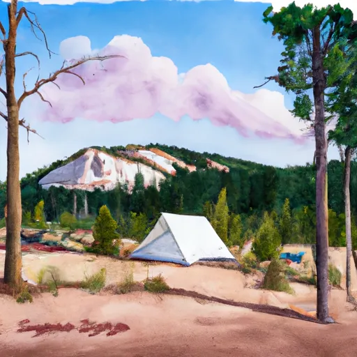
Sugarloaf
The best time to visit Sugarloaf camping area is during the summer months when the weather is mild and conducive to outdoor activities. The campground provides easy access to various recreational opportunities such as hiking, fishing, and wildlife viewing. It is advisable to check the local weather conditions before heading to the area as sudden changes can occur, and it is important to be prepared for any potential weather-related challenges. Additionally, campers should take precautions to store food properly and be aware of their surroundings, as the camping area is known to have bear activity. By adhering to proper food storage techniques and practicing bear safety, visitors can ensure a safe and enjoyable camping experience at Sugarloaf camping area.
What's on-site at Sugarloaf
Key facilities Snoflo tracks for this campground. Confirm with the operator before booking -- amenities can change seasonally.
Plan your trip down to the hour
Same weather feed Snoflo's iOS app uses -- updated continuously from NOAA / yr.no.
Next 5 days, hour by hour
Temperature line with weather symbols on top, snow + rain accumulation as columns, humidity as a dotted line.
5-day forecast table
Every 3 hours, broken out across temperature, snow, rain, humidity, and wind. Each cell is colour-coded relative to the column min/max so trends jump out at a glance.
| Time | Condition | Temp (°F) | Snow (in) | Rain (in) | Humidity (%) | Wind (mps) | Wind dir |
|---|---|---|---|---|---|---|---|
| Loading detailed forecast… | |||||||
15-day temperature & precipitation
Daily temperatures, snow, and rain projected over the next two weeks. Hover any point for the full breakdown.
Other campgrounds in the area
Snoflo-tracked campsites within driving distance of Sugarloaf, with reservations status.
| Campground | Reservations | Toilets | View |
|---|---|---|---|
| Little Brooklyn Guard Station | ✓ | ✗ | → |
| Brooklyn Lake Campground | ✓ | ✗ | → |
| Brooklyn Lake | ✓ | ✓ | → |
| Nash Fork Campground | ✗ | ✓ | → |
| Nash Fork | ✗ | ✓ | → |
Nearby streamflow
USGS streamgauges within reach of Sugarloaf -- pulled live from the National Water Information System.
| Streamgauge | Discharge | View |
|---|---|---|
| North Brush Creek Near Saratoga | 16 cfs | → |
| South Brush Creek Near Saratoga | 18 cfs | → |
| Little Laramie River Near Filmore | 671 cfs | → |
| Rock Creek Ab King Canyon Canal | 53 cfs | → |
| Encampment River At Mouth | 91 cfs | → |
| Pioneer Canal Near Woods | 174 cfs | → |
Nearby snow depths
NRCS SNOTEL stations within reach of Sugarloaf -- relevant when planning a shoulder-season or alpine trip.
| SNOTEL station | Snowpack | 24h Snowfall | View |
|---|---|---|---|
| Nohrsc Med Bow | 0.0 in | 0.0 in | → |
| Brooklyn Lake | 0.0 in | 0.0 in | → |
| Med Bow | 1.0 in | 0.0 in | → |
| Brooklyn Lake | 0.0 in | 0.0 in | → |
| North French Creek | 1.0 in | 0.0 in | → |
| Nohrsc North French Creek | 1.0 in | 0.0 in | → |
Plan a longer trip
The closest parks, lakes, boat launches, and paddle runs so a camping night can grow into a full weekend.
Parks
- Cinnabar Park
- Wilderness Savage Run
- Flume Creek Park
- Mortenson Lake National Wildlife Refuge
- Wilderness Platte River
- Medicine Bow National Forest
Boat launches
- Blm 3404 Carbon County
- Bennett Creek Campground Boat Ramp
- Lake Hattie Reservoir Boat Ramp
- Lake Hattie Road Albany County
- Twin Buttes Reservoir Boat Ramp
- Twin Buttes Reservoir Boat Launch
Fishing spots
Camping essentials & Leave No Trace
- Pack it in, pack it out
- Take all trash, food scraps, and gear back with you to keep campsites clean and protect wildlife.
- Respect wildlife
- Observe animals from a distance, store food securely, and never feed wildlife to maintain natural behavior and safety.
- Know before you go
- Check weather, fire restrictions, trail conditions, and permit requirements to ensure a safe and well-planned trip.
- Minimize campfire impact
- Use established fire rings, keep fires small, fully extinguish them, or opt for a camp stove when fires are restricted.
- Leave what you find
- Preserve natural and cultural features by avoiding removal of plants, rocks, artifacts, or other elements of the environment.
Set push alerts in the Snoflo app
Save Sugarloaf as a favorite, set a custom threshold (precipitation, snowpack, freezing temperatures), and the iOS app will push the moment conditions cross.
About Sugarloaf
Can I make reservations at Sugarloaf?
Yes -- this campground accepts reservations. Snoflo recommends booking early for peak season; check the operator (Recreation.gov / state park system / private operator) for the booking window and cancellation policy.
How fresh is the weather data on this page?
The hourly forecast updates throughout the day from the NOAA / yr.no public feeds. Streamflow data is pulled live from USGS streamgauges and snowpack from the NRCS SNOTEL network.
What's the best time of year to visit?
Use the 15-day temperature & precipitation outlook on this page to plan -- pick a window with comfortable temperatures and low precipitation. For longer trips, the 5-day hourly meteogram shows snow + rain accumulation hour-by-hour.
How do I get to Sugarloaf?
Tap Directions in the hero above to open driving directions in Google Maps, or Open in map to center the Snoflo interactive map on the campground.
Can I get alerts when conditions change?
Yes -- alerts are managed through the Snoflo iOS app. Favorite this campground, set a threshold (temperature, snowpack, precipitation), and you'll get a push the moment it crosses.
Other campgrounds near here
Snoflo-tracked campgrounds within driving distance of Sugarloaf.