Alsop Lake Fishing
As of July 22, 2026, the nearest streamgauge to Alsop Lake — Laramie River At Laramie — reports 12 cfs. Source: USGS gauge data, refreshed throughout the day.
Community Reviews
Been here? Share the conditions.
Reviews, ratings & photos are added in the free Snoflo iOS app — rate a spot, tag the conditions, and your visit is verified by location. Add or manage your reviews from the app.
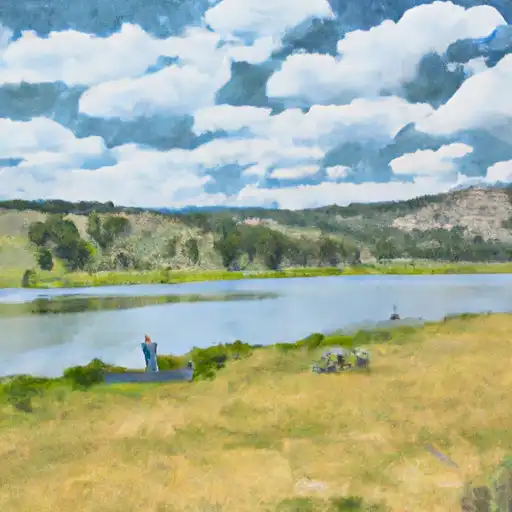
Alsop Lake
What's biting at Alsop Lake
Species commonly reported here -- tap any card for techniques, target seasons, and other waters where it's been caught.
Plan your trip down to the hour
Same weather feed Snoflo's iOS app uses -- updated continuously from NOAA / yr.no.
Next 5 days, hour by hour
Temperature line with weather symbols on top, snow + rain accumulation as columns, humidity as a dotted line.
5-day forecast table
Every 3 hours, broken out across temperature, snow, rain, humidity, and wind. Each cell is colour-coded relative to the column min/max so trends jump out at a glance.
| Time | Condition | Temp (°F) | Snow (in) | Rain (in) | Humidity (%) | Wind (mps) | Wind dir |
|---|---|---|---|---|---|---|---|
| Loading detailed forecast… | |||||||
15-day temperature & precipitation
Daily temperatures, snow, and rain projected over the next two weeks. Hover any point for the full breakdown.
Nearby streamflow
USGS streamgauges within reach of Alsop Lake -- updated continuously from the National Water Information System.
| Streamgauge | Discharge | View |
|---|---|---|
| Laramie River At Laramie | 12 cfs | → |
| Laramie River Near Bosler | 1,950 cfs | → |
| Little Laramie River Near Filmore | 671 cfs | → |
| Pioneer Canal Near Woods | 174 cfs | → |
| Laramie R Bl Pioneer Canal Nr Woods Landing | 1,010 cfs | → |
| Rock Creek Ab King Canyon Canal | 30 cfs | → |
Plan a longer trip
The closest campgrounds, parks, boat launches, and reservoirs so a fishing run can grow into a weekend.
Campgrounds
- Koa Kampground
- Twin Buttes Reservoir Public Access - Wgf
- Lake Hattie Public Access Area - Wgf
- Meeboer Lake Access Area - Wgf
Parks
- Bamforth National Wildlife Refuge
- O'Dell Mini Park
- Undine Park
- Harbon Park
- Laprell Park
- Mortenson Lake National Wildlife Refuge
Reservoirs
- James Lake
- Laramie Wastewater Treatment(Cell 1)
- Twin Buttes
- Old Smuggler
- Lake Hattie
- Soda Lake Draw No. 1
Boat launches
- Herrick Lane Albany County
- Twin Buttes Reservoir Boat Launch
- Twin Buttes Reservoir Boat Ramp
- Lake Hattie Road Albany County
- Lake Hattie Reservoir Boat Ramp
- Albany County
Points of interest
- Wyoming Territorial Penitentiary
- Wyoming Territorial Prison State Historic Site
- Lincoln Community Center
- Charles E. Blair House
- Laramie Plains Museum
- Durlacher House
Paddle runs
- Upper North Fork
- Road West Of Creedmore Lakes To Junction Of Intermittent Stream In Sw 1/4, Sec 29, T11n, R72w
- Co/Wy Stateline To Douglas Creek
- Intermittent Stream To Junction With Co Division Of Wildlife Angler Access Trail In Sw 1/4 Sec 22, T11n, R72w
- Pearl Creek To Junction Of Road West Of Creedmore Lakes In Sw 1/4 Sec 5, T10n, R73e
- End Of Four-Wheel Drive Road To Pearl Creek In Se 1/4 Sec 21, T10n, R74w
Angling safety & ethics
- Know the regulations
- Check local fishing rules, seasons, size limits, and license requirements to ensure legal and sustainable angling.
- Handle fish responsibly
- Use wet hands, minimize air exposure, and release fish gently to improve survival rates when practicing catch-and-release.
- Choose the right gear
- Match your rod, line, and tackle to the species and conditions to increase success and reduce unnecessary harm to fish.
- Respect the waterway
- Avoid disturbing habitat, prevent bank erosion, and keep a safe distance from spawning areas to protect ecosystems.
- Keep it clean
- Pack out all line, hooks, bait containers, and trash. Discarded gear can injure wildlife and degrade waterways.
Set push alerts in the Snoflo app
Save Alsop Lake as a favorite, set a custom threshold (water temperature, streamflow, snowpack), and the iOS app will push the moment conditions cross.
About Alsop Lake
What fish species are found at Alsop Lake?
Snoflo tracks the species commonly reported at Alsop Lake -- see the Fish Species panel above for the live list with images and links to per-species pages.
How fresh is the weather data on this page?
The hourly forecast updates throughout the day from the NOAA / yr.no public feeds. Streamflow data comes live from USGS streamgauges, also refreshed continuously.
Can I get alerts when conditions change?
Yes -- alerts are managed through the Snoflo iOS app. Favorite this area, set a threshold (water temperature, streamflow, snowpack), and you'll get a push the moment it crosses.
Do I need a fishing license?
Yes. Check your state agency's regulations for license requirements, seasons, size limits, and any waterbody-specific rules before fishing Alsop Lake.
How do I get to Alsop Lake?
Tap Open in map in the hero above to center the Snoflo interactive map on this area, or grab the coordinates from the location facts panel.
Other angling spots near here
Snoflo-tracked fishing areas within driving distance of Alsop Lake.