Backbone Rock Campground Campground
Community Reviews
Been here? Share the conditions.
Reviews, ratings & photos are added in the free Snoflo iOS app — rate a spot, tag the conditions, and your visit is verified by location. Add or manage your reviews from the app.
Backbone Rock Campground
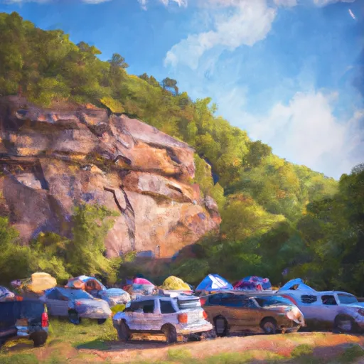
Reservations are accepted at Backbone Rock Campground, ensuring campers a spot during their desired dates. It is recommended to make reservations in advance, especially during peak seasons, as this campground tends to get busy. The best time of year to visit is during the spring and fall when the weather is mild, and the surrounding nature is at its most vibrant. It's important to note that the campground does not have electrical hookups, so campers should prepare accordingly.
One of the highlights of this camping area is the Backbone Rock Tunnel, a historic feature carved out of solid rock that offers an interesting sightseeing opportunity. Moreover, the campground is conveniently located near the scenic South Holston Lake, allowing visitors to enjoy a variety of water activities such as fishing, boating, and swimming. However, it is essential to be cautious while swimming in the lake, as there might not be lifeguards on duty.
Overall, Backbone Rock Campground in Virginia provides a serene and well-equipped camping experience. With its beautiful surroundings, amenities, and nearby attractions, it is an ideal destination for nature lovers and outdoor enthusiasts.
What's on-site at Backbone Rock Campground
Key facilities Snoflo tracks for this campground. Confirm with the operator before booking -- amenities can change seasonally.
Plan your trip down to the hour
Same weather feed Snoflo's iOS app uses -- updated continuously from NOAA / yr.no.
Next 5 days, hour by hour
Temperature line with weather symbols on top, snow + rain accumulation as columns, humidity as a dotted line.
5-day forecast table
Every 3 hours, broken out across temperature, snow, rain, humidity, and wind. Each cell is colour-coded relative to the column min/max so trends jump out at a glance.
| Time | Condition | Temp (°F) | Snow (in) | Rain (in) | Humidity (%) | Wind (mps) | Wind dir |
|---|---|---|---|---|---|---|---|
| Loading detailed forecast… | |||||||
15-day temperature & precipitation
Daily temperatures, snow, and rain projected over the next two weeks. Hover any point for the full breakdown.
Other campgrounds in the area
Snoflo-tracked campsites within driving distance of Backbone Rock Campground, with reservations status.
| Campground | Reservations | Toilets | View |
|---|---|---|---|
| Backbone Rock Recreation Area | ✓ | ✗ | → |
| Backbone Rock Rec Area | ✗ | ✗ | → |
| Beartree | ✓ | ✗ | → |
| Beartree Recreation Area | ✓ | ✗ | → |
| Jacobs Creek Recreation Area | ✓ | ✗ | → |
Nearby streamflow
USGS streamgauges within reach of Backbone Rock Campground -- pulled live from the National Water Information System.
| Streamgauge | Discharge | View |
|---|---|---|
| S F Holston River Near Damascus | 174 cfs | → |
| M F Holston River Near Meadowview | 120 cfs | → |
| S F Holston River At Riverside Nr Chilhowie | 40 cfs | → |
| Beaver Creek At Bristol | 23 cfs | → |
| M F Holston River At Seven Mile Ford | 85 cfs | → |
| N F Holston River Near Saltville | 122 cfs | → |
Nearby snow depths
NRCS SNOTEL stations within reach of Backbone Rock Campground -- relevant when planning a shoulder-season or alpine trip.
| SNOTEL station | Snowpack | 24h Snowfall | View |
|---|---|---|---|
| Abingdon 3s | 0.0 in | 0.0 in | → |
| Whitetop Coop | 0.0 in | 0.0 in | → |
| Vilas 6.3 Nnw | 0.0 in | 0.0 in | → |
| Flat Springs 1e | 0.0 in | 0.0 in | → |
| Flat Springs 1.2 E | 0.0 in | 0.0 in | → |
| Jefferson 2 E | 0.0 in | 0.0 in | → |
Plan a longer trip
The closest parks, lakes, boat launches, and paddle runs so a camping night can grow into a full weekend.
Parks
- Pond Mountain Game Land
- Wilderness Lewis Fork
- Three Top Mountain Game Land
- Channels State Forest
- Holston View Park
- Grayson Highlands State Park
Boat launches
- Whitaker Hollow Road Washington County
- Parks Mill Road 22115, Washington County
- Baumgardner
- Friendship Marina
- Painter Creek Marina
- Sullivan County
Fishing spots
Points of interest
- Welcome Center And Museum
- William King Museum
- Whitetop Mountain Observation Site
- Bristol Caverns
- Big Pinnacle
- Clark-Miller Roller Mill
Paddle runs
- Green Cove--Jefferson Nf Near Confluence Of Star Hill Branch To Confluence With Whitetop Laurel
- Whitetop Laurel--Jefferson Nf Boundary (Intersection Of Hwy 58 And Sr 859) To Jefferson Nf Boundary Above Damascus
- Headwaters To Tn/Va State Line
- Watauga Reservoir To Tn/Nc State Line
- Confluence With Guest River To Confluence With Little Stony Creek
- State Route 72 Bridge To Confluence With Clinch River
Camping essentials & Leave No Trace
- Pack it in, pack it out
- Take all trash, food scraps, and gear back with you to keep campsites clean and protect wildlife.
- Respect wildlife
- Observe animals from a distance, store food securely, and never feed wildlife to maintain natural behavior and safety.
- Know before you go
- Check weather, fire restrictions, trail conditions, and permit requirements to ensure a safe and well-planned trip.
- Minimize campfire impact
- Use established fire rings, keep fires small, fully extinguish them, or opt for a camp stove when fires are restricted.
- Leave what you find
- Preserve natural and cultural features by avoiding removal of plants, rocks, artifacts, or other elements of the environment.
Set push alerts in the Snoflo app
Save Backbone Rock Campground as a favorite, set a custom threshold (precipitation, snowpack, freezing temperatures), and the iOS app will push the moment conditions cross.
About Backbone Rock Campground
Can I make reservations at Backbone Rock Campground?
This campground does not appear to accept reservations -- it's typically first-come, first-served. Arrive early on summer weekends.
How fresh is the weather data on this page?
The hourly forecast updates throughout the day from the NOAA / yr.no public feeds. Streamflow data is pulled live from USGS streamgauges and snowpack from the NRCS SNOTEL network.
What's the best time of year to visit?
Use the 15-day temperature & precipitation outlook on this page to plan -- pick a window with comfortable temperatures and low precipitation. For longer trips, the 5-day hourly meteogram shows snow + rain accumulation hour-by-hour.
How do I get to Backbone Rock Campground?
Tap Directions in the hero above to open driving directions in Google Maps, or Open in map to center the Snoflo interactive map on the campground.
Can I get alerts when conditions change?
Yes -- alerts are managed through the Snoflo iOS app. Favorite this campground, set a threshold (temperature, snowpack, precipitation), and you'll get a push the moment it crosses.
Other campgrounds near here
Snoflo-tracked campgrounds within driving distance of Backbone Rock Campground.