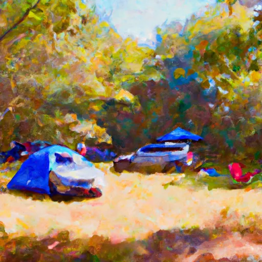
Cedarville State Forest campground
Community Reviews
Been here? Share the conditions.
Reviews, ratings & photos are added in the free Snoflo iOS app — rate a spot, tag the conditions, and your visit is verified by location. Add or manage your reviews from the app.
Cedarville State Forest
What's on-site at Cedarville State Forest
Key facilities Snoflo tracks for this campground. Confirm with the operator before booking -- amenities can change seasonally.
Plan your trip down to the hour
Same weather feed Snoflo's iOS app uses -- updated continuously from NOAA / yr.no.
Next 5 days, hour by hour
Temperature line with weather symbols on top, snow + rain accumulation as columns, humidity as a dotted line.
5-day forecast table
Every 3 hours, broken out across temperature, snow, rain, humidity, and wind. Each cell is colour-coded relative to the column min/max so trends jump out at a glance.
| Time | Condition | Temp (°F) | Snow (in) | Rain (in) | Humidity (%) | Wind (mps) | Wind dir |
|---|---|---|---|---|---|---|---|
| Loading detailed forecast… | |||||||
15-day temperature & precipitation
Daily temperatures, snow, and rain projected over the next two weeks. Hover any point for the full breakdown.
Other campgrounds in the area
Snoflo-tracked campsites within driving distance of Cedarville State Forest, with reservations status.
| Campground | Reservations | Toilets | View |
|---|---|---|---|
| Youth Camp | ✗ | ✗ | → |
| Louise F. Cosca Regional Park | ✓ | ✗ | → |
| Selby's Landing | ✓ | ✗ | → |
| Andrews Afb Military | ✓ | ✗ | → |
| Port Tobacco Rv Resort | ✗ | ✗ | → |
Nearby streamflow
USGS streamgauges within reach of Cedarville State Forest -- pulled live from the National Water Information System.
| Streamgauge | Discharge | View |
|---|---|---|
| Piscataway Creek At Piscataway | 1 cfs | → |
| Western Branch At Upper Marlboro | 11 cfs | → |
| Zekiah Swamp Run Near Newtown | 13 cfs | → |
| Mattawoman Creek Near Pomonkey | 3 cfs | → |
| Watts Branch At Washington | 1 cfs | → |
| Cameron Run At Alexandria | 6 cfs | → |
Nearby snow depths
NRCS SNOTEL stations within reach of Cedarville State Forest -- relevant when planning a shoulder-season or alpine trip.
| SNOTEL station | Snowpack | 24h Snowfall | View |
|---|---|---|---|
| Dalecarlia Reservoir Coop | 0.0 in | 0.0 in | → |
| Vienna Coop | 0.0 in | 0.0 in | → |
| Ashton-Sandy Spring 1.8 Nnw | 0.0 in | 0.1 in | → |
| Montgomery Village 1.1 Ene | 0.0 in | 0.0 in | → |
| Wfo Sterling Coop | 0.0 in | 0.0 in | → |
| Damascus 3 Ssw Coop | 0.0 in | 0.0 in | → |
Plan a longer trip
The closest parks, lakes, boat launches, and paddle runs so a camping night can grow into a full weekend.
Parks
- Pinefield Community Park
- Cedarville State Forest
- Brandywine Area Recreation Center
- Cheltenham Acres Park
- Piscataway Creek Stream Valley Park
- Cheltenham Woods Park
Boat launches
- Magruders Ferry Road 17901, Brandywine
- Critical Area Driving Tour Prince George's County
- Wharf Road Accokeek
- Gilbert Run Boat Ramp
- Ft. Washington Marina
- Hallowing Point Road 6935, Calvert County
Fishing spots
Camping essentials & Leave No Trace
- Pack it in, pack it out
- Take all trash, food scraps, and gear back with you to keep campsites clean and protect wildlife.
- Respect wildlife
- Observe animals from a distance, store food securely, and never feed wildlife to maintain natural behavior and safety.
- Know before you go
- Check weather, fire restrictions, trail conditions, and permit requirements to ensure a safe and well-planned trip.
- Minimize campfire impact
- Use established fire rings, keep fires small, fully extinguish them, or opt for a camp stove when fires are restricted.
- Leave what you find
- Preserve natural and cultural features by avoiding removal of plants, rocks, artifacts, or other elements of the environment.
Set push alerts in the Snoflo app
Save Cedarville State Forest as a favorite, set a custom threshold (precipitation, snowpack, freezing temperatures), and the iOS app will push the moment conditions cross.
About Cedarville State Forest
Can I make reservations at Cedarville State Forest?
Yes -- this campground accepts reservations. Snoflo recommends booking early for peak season; check the operator (Recreation.gov / state park system / private operator) for the booking window and cancellation policy.
How fresh is the weather data on this page?
The hourly forecast updates throughout the day from the NOAA / yr.no public feeds. Streamflow data is pulled live from USGS streamgauges and snowpack from the NRCS SNOTEL network.
What's the best time of year to visit?
Use the 15-day temperature & precipitation outlook on this page to plan -- pick a window with comfortable temperatures and low precipitation. For longer trips, the 5-day hourly meteogram shows snow + rain accumulation hour-by-hour.
How do I get to Cedarville State Forest?
Tap Directions in the hero above to open driving directions in Google Maps, or Open in map to center the Snoflo interactive map on the campground.
Can I get alerts when conditions change?
Yes -- alerts are managed through the Snoflo iOS app. Favorite this campground, set a threshold (temperature, snowpack, precipitation), and you'll get a push the moment it crosses.
Other campgrounds near here
Snoflo-tracked campgrounds within driving distance of Cedarville State Forest.