Peaks Of Otter - Blue Ridge Parkway Campground
Community Reviews
Been here? Share the conditions.
Reviews, ratings & photos are added in the free Snoflo iOS app — rate a spot, tag the conditions, and your visit is verified by location. Add or manage your reviews from the app.
Peaks Of Otter - Blue Ridge Parkway
Reservations are accepted at Peaks of Otter campground, guaranteeing campers a spot during their desired timeframe. It is advised to make reservations in advance, especially during peak seasons, as the popularity of this campground can lead to limited availability. The best time of year to visit Peaks of Otter is during the spring and fall seasons when the weather is more moderate, offering pleasant temperatures for outdoor activities such as hiking and fishing. However, it is important to note that the campground operates on a first-come, first-served basis during the winter season.
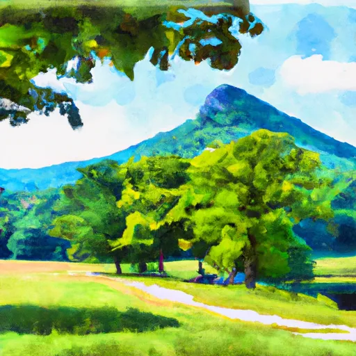
Peaks of Otter is surrounded by several attractions, making it an ideal destination for nature enthusiasts. Sharp Top Mountain, Flat Top Mountain, and Harkening Hill are popular hiking trails in the area, offering breathtaking views of the surrounding landscape. Campers are advised to stay cautious of wildlife encounters, particularly black bears, and are encouraged to properly store food to prevent attracting them to the camping area. In conclusion, Peaks of Otter campground on the Blue Ridge Parkway in Virginia provides a range of amenities, accepts reservations, and offers an ideal camping experience throughout the year with specific precautions to be taken into account.
What's on-site at Peaks Of Otter - Blue Ridge Parkway
Key facilities Snoflo tracks for this campground. Confirm with the operator before booking -- amenities can change seasonally.
Plan your trip down to the hour
Same weather feed Snoflo's iOS app uses -- updated continuously from NOAA / yr.no.
Next 5 days, hour by hour
Temperature line with weather symbols on top, snow + rain accumulation as columns, humidity as a dotted line.
5-day forecast table
Every 3 hours, broken out across temperature, snow, rain, humidity, and wind. Each cell is colour-coded relative to the column min/max so trends jump out at a glance.
| Time | Condition | Temp (°F) | Snow (in) | Rain (in) | Humidity (%) | Wind (mps) | Wind dir |
|---|---|---|---|---|---|---|---|
| Loading detailed forecast… | |||||||
15-day temperature & precipitation
Daily temperatures, snow, and rain projected over the next two weeks. Hover any point for the full breakdown.
Other campgrounds in the area
Snoflo-tracked campsites within driving distance of Peaks Of Otter - Blue Ridge Parkway, with reservations status.
| Campground | Reservations | Toilets | View |
|---|---|---|---|
| Peaks Of Otter Campground | ✗ | ✗ | → |
| North Creek Campground | ✗ | ✗ | → |
| North Creek | ✗ | ✓ | → |
| Hopper Creek Group Campground | ✗ | ✗ | → |
| Cave Mountain Lake | ✓ | ✗ | → |
Nearby streamflow
USGS streamgauges within reach of Peaks Of Otter - Blue Ridge Parkway -- pulled live from the National Water Information System.
| Streamgauge | Discharge | View |
|---|---|---|
| James River At Buchanan | 650 cfs | → |
| Big Otter River Near Bedford | 53 cfs | → |
| Tinker Creek Near Daleville | 1 cfs | → |
| James River At Holcomb Rock | 922 cfs | → |
| Goose Creek Near Huddleston | 40 cfs | → |
| Roanoke River At Niagara | 169 cfs | → |
Nearby snow depths
NRCS SNOTEL stations within reach of Peaks Of Otter - Blue Ridge Parkway -- relevant when planning a shoulder-season or alpine trip.
| SNOTEL station | Snowpack | 24h Snowfall | View |
|---|---|---|---|
| Radio Stn Wblt | 0.0 in | 0.0 in | → |
| Big Island | 0.0 in | 0.0 in | → |
| Glasgow 1 Se | 0.0 in | 0.0 in | → |
| Huddleston 4 Sw | 0.0 in | 0.0 in | → |
| Buena Vista | 0.0 in | 0.0 in | → |
| Covington Filter Plant | 0.0 in | 0.0 in | → |
Plan a longer trip
The closest parks, lakes, boat launches, and paddle runs so a camping night can grow into a full weekend.
Parks
- Blue Ridge Parkway
- Wilderness Thunder Ridge
- Liberty Lake Park
- Wilderness James River Face
- Forest Recreation Park
- East Gate Park
Boat launches
- Lowe Street Buchanan
- Arcadia Road Botetourt County
- Springwood
- Horseshoe Bend
- Reed Creek Landing
- Locker Landing
Points of interest
- Peaks Of Otter Visitor Center
- Flat Top Mountain Trail Parking
- Fallingwater Cascades Parking Area
- Upper Goose Creek Valley Park Widening
- Headforemost Mountain Pullout
- Porter Mountain Overlook
Paddle runs
- Top Of Apple Orchards Falls To Confluence Of North Creek With Jennings Creek
- 1 Mile Southeast Of Buchanan (At End Of Nfs Land) To Snowden Dam Reservoir
- Segment A--Route 42 Bridge To Confluence With Jackson River
- Segment B--Confluence With Bullpasture River To Route 42 Bridge
- Segment D--Gathright Dam To State Route 687 Bridge At Clearwater Park
- Headwaters South Of Flint Mountain To St. Mary's Wilderness Boundary
Camping essentials & Leave No Trace
- Pack it in, pack it out
- Take all trash, food scraps, and gear back with you to keep campsites clean and protect wildlife.
- Respect wildlife
- Observe animals from a distance, store food securely, and never feed wildlife to maintain natural behavior and safety.
- Know before you go
- Check weather, fire restrictions, trail conditions, and permit requirements to ensure a safe and well-planned trip.
- Minimize campfire impact
- Use established fire rings, keep fires small, fully extinguish them, or opt for a camp stove when fires are restricted.
- Leave what you find
- Preserve natural and cultural features by avoiding removal of plants, rocks, artifacts, or other elements of the environment.
Set push alerts in the Snoflo app
Save Peaks Of Otter - Blue Ridge Parkway as a favorite, set a custom threshold (precipitation, snowpack, freezing temperatures), and the iOS app will push the moment conditions cross.
About Peaks Of Otter - Blue Ridge Parkway
Can I make reservations at Peaks Of Otter - Blue Ridge Parkway?
Yes -- this campground accepts reservations. Snoflo recommends booking early for peak season; check the operator (Recreation.gov / state park system / private operator) for the booking window and cancellation policy.
How fresh is the weather data on this page?
The hourly forecast updates throughout the day from the NOAA / yr.no public feeds. Streamflow data is pulled live from USGS streamgauges and snowpack from the NRCS SNOTEL network.
What's the best time of year to visit?
Use the 15-day temperature & precipitation outlook on this page to plan -- pick a window with comfortable temperatures and low precipitation. For longer trips, the 5-day hourly meteogram shows snow + rain accumulation hour-by-hour.
How do I get to Peaks Of Otter - Blue Ridge Parkway?
Tap Directions in the hero above to open driving directions in Google Maps, or Open in map to center the Snoflo interactive map on the campground.
Can I get alerts when conditions change?
Yes -- alerts are managed through the Snoflo iOS app. Favorite this campground, set a threshold (temperature, snowpack, precipitation), and you'll get a push the moment it crosses.
Other campgrounds near here
Snoflo-tracked campgrounds within driving distance of Peaks Of Otter - Blue Ridge Parkway.