Rock Creek Rec Area campground
Community Reviews
Been here? Share the conditions.
Reviews, ratings & photos are added in the free Snoflo iOS app — rate a spot, tag the conditions, and your visit is verified by location. Add or manage your reviews from the app.
Rock Creek Rec Area
Reservations are accepted at Rock Creek Rec Area, allowing campers to secure their preferred campsites in advance. This is especially useful during peak seasons when the campground tends to be busier. However, walk-in availability is also an option for those who prefer a more spontaneous camping trip.
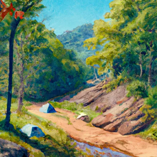
The best time to visit Rock Creek Rec Area is during the spring and fall seasons when the weather is pleasant and the campground is less crowded. The vibrant foliage during the fall months adds to the beauty of the surroundings. It is important to note that the campground can become busy during holidays and weekends throughout the year.
While exploring the camping area, campers can indulge in various activities such as hiking, fishing, and wildlife watching. The nearby Rock Creek offers opportunities for fishing enthusiasts, with a variety of fish species to catch. However, caution should be exercised as the water currents can be fast-moving. Additionally, it is advisable to take precautions against ticks and other insects, as they are abundant in the area. Overall, Rock Creek Rec Area is an ideal camping destination with its scenic beauty, amenities, and recreational opportunities for nature lovers.
What's on-site at Rock Creek Rec Area
Key facilities Snoflo tracks for this campground. Confirm with the operator before booking -- amenities can change seasonally.
Plan your trip down to the hour
Same weather feed Snoflo's iOS app uses -- updated continuously from NOAA / yr.no.
Next 5 days, hour by hour
Temperature line with weather symbols on top, snow + rain accumulation as columns, humidity as a dotted line.
5-day forecast table
Every 3 hours, broken out across temperature, snow, rain, humidity, and wind. Each cell is colour-coded relative to the column min/max so trends jump out at a glance.
| Time | Condition | Temp (°F) | Snow (in) | Rain (in) | Humidity (%) | Wind (mps) | Wind dir |
|---|---|---|---|---|---|---|---|
| Loading detailed forecast… | |||||||
15-day temperature & precipitation
Daily temperatures, snow, and rain projected over the next two weeks. Hover any point for the full breakdown.
Other campgrounds in the area
Snoflo-tracked campsites within driving distance of Rock Creek Rec Area, with reservations status.
| Campground | Reservations | Toilets | View |
|---|---|---|---|
| Spivey Gap Recreation Area | ✗ | ✗ | → |
| Persimmon Ridge City Park | ✗ | ✗ | → |
| Living Waters Campground | ✗ | ✗ | → |
| Lil Rock Creek Campground | ✗ | ✗ | → |
| Saylor Lake Rv Park | ✗ | ✗ | → |
Nearby streamflow
USGS streamgauges within reach of Rock Creek Rec Area -- pulled live from the National Water Information System.
| Streamgauge | Discharge | View |
|---|---|---|
| Nolichucky River At Embreeville | 2,020 cfs | → |
| Doe River At Elizabethton | 293 cfs | → |
| Watauga River At Elizabethton | 533 cfs | → |
| Big Limestone Creek Near Limestone | 29 cfs | → |
| South Toe River Near Celo | 37 cfs | → |
| Nolichucky River Below Nolichucky Dam | 1,320 cfs | → |
Nearby snow depths
NRCS SNOTEL stations within reach of Rock Creek Rec Area -- relevant when planning a shoulder-season or alpine trip.
| SNOTEL station | Snowpack | 24h Snowfall | View |
|---|---|---|---|
| Erwin | 0.0 in | 0.0 in | → |
| Elizabethton | 0.0 in | 0.0 in | → |
| Flat Springs 1e | 0.0 in | 0.0 in | → |
| Flat Springs 1.2 E | 0.0 in | 0.0 in | → |
| Banner Elk | 0.0 in | 0.0 in | → |
| Barnardsville 2 Se | 0.0 in | 0.0 in | → |
Plan a longer trip
The closest parks, lakes, boat launches, and paddle runs so a camping night can grow into a full weekend.
Parks
- Wilderness Unaka Mountain
- Buffalo Mountain Park
- Powell Square Park
- D R Beeson Park
- Old Kiwanis Park
- New Kiwanis Park
Boat launches
- Mitchell County
- Blevins 221-259, Johnson City
- Wagner Road, Watauga
- Lovers Lane 338, Carter County
- Us 321;Sr 67 Carter County
- Lands End Court Johnson City
Fishing spots
Points of interest
- Pinnacle Mountain Lookout
- Three Knobs Overlook
- North Toe River Valley Overlook
- Deer Lick Gap Overlook
- Loops Overlook At Apple Orchard Overlook
- Linville Falls River Bridge Overlook
Paddle runs
- Tn/Nc State Line (Rm 100.6) To Mine Branch (Rm 99.3)
- Boundary Between Mitchell And Yancy Counties To Nc/Tn Stateline
- Watauga Reservoir To Tn/Nc State Line
- Headwaters Above Linville Gap To Blue Ridge Parkway Boundary
- Blue Ridge Parkway Boundary To Linville Gorge Boundary
- Headwaters To Tn/Va State Line
Camping essentials & Leave No Trace
- Pack it in, pack it out
- Take all trash, food scraps, and gear back with you to keep campsites clean and protect wildlife.
- Respect wildlife
- Observe animals from a distance, store food securely, and never feed wildlife to maintain natural behavior and safety.
- Know before you go
- Check weather, fire restrictions, trail conditions, and permit requirements to ensure a safe and well-planned trip.
- Minimize campfire impact
- Use established fire rings, keep fires small, fully extinguish them, or opt for a camp stove when fires are restricted.
- Leave what you find
- Preserve natural and cultural features by avoiding removal of plants, rocks, artifacts, or other elements of the environment.
Set push alerts in the Snoflo app
Save Rock Creek Rec Area as a favorite, set a custom threshold (precipitation, snowpack, freezing temperatures), and the iOS app will push the moment conditions cross.
About Rock Creek Rec Area
Can I make reservations at Rock Creek Rec Area?
This campground does not appear to accept reservations -- it's typically first-come, first-served. Arrive early on summer weekends.
How fresh is the weather data on this page?
The hourly forecast updates throughout the day from the NOAA / yr.no public feeds. Streamflow data is pulled live from USGS streamgauges and snowpack from the NRCS SNOTEL network.
What's the best time of year to visit?
Use the 15-day temperature & precipitation outlook on this page to plan -- pick a window with comfortable temperatures and low precipitation. For longer trips, the 5-day hourly meteogram shows snow + rain accumulation hour-by-hour.
How do I get to Rock Creek Rec Area?
Tap Directions in the hero above to open driving directions in Google Maps, or Open in map to center the Snoflo interactive map on the campground.
Can I get alerts when conditions change?
Yes -- alerts are managed through the Snoflo iOS app. Favorite this campground, set a threshold (temperature, snowpack, precipitation), and you'll get a push the moment it crosses.
Other campgrounds near here
Snoflo-tracked campgrounds within driving distance of Rock Creek Rec Area.