Site 8 - Camp Robinson Campground
Community Reviews
Been here? Share the conditions.
Reviews, ratings & photos are added in the free Snoflo iOS app — rate a spot, tag the conditions, and your visit is verified by location. Add or manage your reviews from the app.
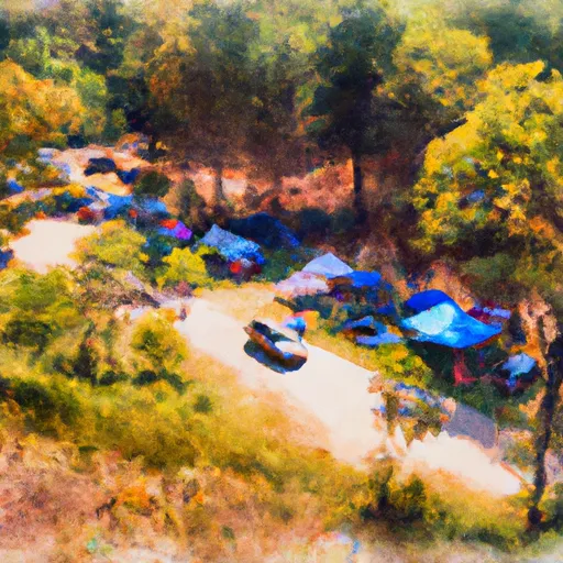
Site 8 - Camp Robinson
Reservations are accepted at Site 8 - Camp Robinson, ensuring campers have a guaranteed spot upon arrival. It is advisable to make a reservation in advance, especially during peak seasons, to secure a desired camping spot.
The best time to visit Camp Robinson is during the spring and fall when the weather is mild, and nature displays its vibrant colors. However, camping is available year-round, and each season offers its unique charm. Campers should be cautious of wildlife in the area, particularly when hiking or leaving food unattended. It is essential to follow proper food storage practices and to respect the environment by leaving no trace.
In conclusion, Site 8 - Camp Robinson provides a wonderful camping experience in Virginia. With its amenities, the option for reservations, and its beautiful natural surroundings, it is a great destination for outdoor enthusiasts. Whether visiting in spring, summer, fall, or winter, campers can appreciate the diverse offerings and enjoy a memorable camping trip at Camp Robinson.
What's on-site at Site 8 - Camp Robinson
Key facilities Snoflo tracks for this campground. Confirm with the operator before booking -- amenities can change seasonally.
Plan your trip down to the hour
Same weather feed Snoflo's iOS app uses -- updated continuously from NOAA / yr.no.
Next 5 days, hour by hour
Temperature line with weather symbols on top, snow + rain accumulation as columns, humidity as a dotted line.
5-day forecast table
Every 3 hours, broken out across temperature, snow, rain, humidity, and wind. Each cell is colour-coded relative to the column min/max so trends jump out at a glance.
| Time | Condition | Temp (°F) | Snow (in) | Rain (in) | Humidity (%) | Wind (mps) | Wind dir |
|---|---|---|---|---|---|---|---|
| Loading detailed forecast… | |||||||
15-day temperature & precipitation
Daily temperatures, snow, and rain projected over the next two weeks. Hover any point for the full breakdown.
Other campgrounds in the area
Snoflo-tracked campsites within driving distance of Site 8 - Camp Robinson, with reservations status.
| Campground | Reservations | Toilets | View |
|---|---|---|---|
| Site 7 - Dudley | ✗ | ✗ | → |
| Site 3 - Glenmont Hills | ✗ | ✗ | → |
| Site 12 - Camp Knadle | ✗ | ✗ | → |
| Site 6 - Haynes | ✗ | ✗ | → |
| Site 11 - Eaton | ✗ | ✗ | → |
Nearby streamflow
USGS streamgauges within reach of Site 8 - Camp Robinson -- pulled live from the National Water Information System.
| Streamgauge | Discharge | View |
|---|---|---|
| Calfpasture River Above Mill Creek At Goshen | 12 cfs | → |
| Maury River At Rockbridge Baths | 39 cfs | → |
| Kerrs Creek Near Lexington | 5 cfs | → |
| Maury River Near Buena Vista | 84 cfs | → |
| Bullpasture River At Williamsville | 41 cfs | → |
| Pedlar River At Forest Road Near Buena Vista | 5 cfs | → |
Nearby snow depths
NRCS SNOTEL stations within reach of Site 8 - Camp Robinson -- relevant when planning a shoulder-season or alpine trip.
| SNOTEL station | Snowpack | 24h Snowfall | View |
|---|---|---|---|
| Millboro 0.3 Nw | 0.0 in | 0.0 in | → |
| Buena Vista | 0.0 in | 0.0 in | → |
| Hot Springs | 0.0 in | 0.0 in | → |
| Glasgow 1 Se | 0.0 in | 0.0 in | → |
| Monterey 6.5 Ssw | 0.0 in | 0.0 in | → |
| Gathright Dam | 0.0 in | 0.0 in | → |
Plan a longer trip
The closest parks, lakes, boat launches, and paddle runs so a camping night can grow into a full weekend.
Parks
- Goshen Pass State Natural Area Preserve
- Lake Robertson Park
- Wilderness Rich Hole
- Wilderness Rough Mountain
- Mount Joy Pond State Natural Area Preserve
- Wilderness Saint Mary's
Boat launches
- Walton Tract Canoe Access Point
- Lake Robertson
- Vmi Route 60 Bridge
- Douthat State Park Road Bath County
- Walter Robinson Canoe Access Point
- Botetourt Road Botetourt County
Fishing spots
- Braley Pond Day Use Area
- Elkhorn Lake Day Use Area
- Staunton Dam Day Use Area
- Briery Branch Day Use Area
Points of interest
- Estaline Schoolhouse
- Virginia Military Institute Museum
- The Wilderness
- Nelson Gallery
- The Cabell Gallery
- Stonewall Jackson House
Paddle runs
- Headwaters South Of Flint Mountain To St. Mary's Wilderness Boundary
- Segment B--Confluence With Bullpasture River To Route 42 Bridge
- Ford Where Route 609 Departs From Route 678 To Confluence With Cowpasture River
- Segment B--Northern Boundary, Hidden Valley Tract To Southern Boundary Of Hidden Valley Tract
- Segment A--Route 42 Bridge To Confluence With Jackson River
- Segment C--Southern Boundary Hidden Valley Tract To Mcclintic Bridge
Camping essentials & Leave No Trace
- Pack it in, pack it out
- Take all trash, food scraps, and gear back with you to keep campsites clean and protect wildlife.
- Respect wildlife
- Observe animals from a distance, store food securely, and never feed wildlife to maintain natural behavior and safety.
- Know before you go
- Check weather, fire restrictions, trail conditions, and permit requirements to ensure a safe and well-planned trip.
- Minimize campfire impact
- Use established fire rings, keep fires small, fully extinguish them, or opt for a camp stove when fires are restricted.
- Leave what you find
- Preserve natural and cultural features by avoiding removal of plants, rocks, artifacts, or other elements of the environment.
Set push alerts in the Snoflo app
Save Site 8 - Camp Robinson as a favorite, set a custom threshold (precipitation, snowpack, freezing temperatures), and the iOS app will push the moment conditions cross.
About Site 8 - Camp Robinson
Can I make reservations at Site 8 - Camp Robinson?
This campground does not appear to accept reservations -- it's typically first-come, first-served. Arrive early on summer weekends.
How fresh is the weather data on this page?
The hourly forecast updates throughout the day from the NOAA / yr.no public feeds. Streamflow data is pulled live from USGS streamgauges and snowpack from the NRCS SNOTEL network.
What's the best time of year to visit?
Use the 15-day temperature & precipitation outlook on this page to plan -- pick a window with comfortable temperatures and low precipitation. For longer trips, the 5-day hourly meteogram shows snow + rain accumulation hour-by-hour.
How do I get to Site 8 - Camp Robinson?
Tap Directions in the hero above to open driving directions in Google Maps, or Open in map to center the Snoflo interactive map on the campground.
Can I get alerts when conditions change?
Yes -- alerts are managed through the Snoflo iOS app. Favorite this campground, set a threshold (temperature, snowpack, precipitation), and you'll get a push the moment it crosses.
Other campgrounds near here
Snoflo-tracked campgrounds within driving distance of Site 8 - Camp Robinson.