Cougar Island Camp Campground
Community Reviews
Been here? Share the conditions.
Reviews, ratings & photos are added in the free Snoflo iOS app — rate a spot, tag the conditions, and your visit is verified by location. Add or manage your reviews from the app.
Cougar Island Camp
One of the most popular nearby attractions is Fort Spokane, which is just a short drive away. Visitors can tour the historic buildings and learn about the role the fort played in the settling of the West. Other nearby points of interest include the Spokane River Centennial Trail, which offers both hiking and biking opportunities, and the Colville National Forest, which is a great place for hiking and fishing.
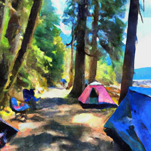
The Cougar Island Camp campground has 22 sites that are available on a first-come, first-served basis. The amenities include picnic tables, fire pits, and vault toilets. There are no water or electrical hookups, so visitors should plan accordingly.
Lake Roosevelt National Recreation Area is home to a variety of wildlife, including bald eagles, ospreys, and mule deer. Visitors should be aware that cougars have been spotted in the area, so it's important to take precautions and stay aware of your surroundings.
The best time of year to visit Cougar Island Camp is during the summer months, when temperatures average in the mid-70s. The campground is typically open from May through September, but visitors should check with the National Park Service for the most up-to-date information.
Overall, Cougar Island Camp is a great place to enjoy the beautiful scenery and outdoor activities that Lake Roosevelt National Recreation Area has to offer. Whether you're interested in hiking, fishing, or just relaxing by the campfire, there's something for everyone to enjoy.
What's on-site at Cougar Island Camp
Key facilities Snoflo tracks for this campground. Confirm with the operator before booking -- amenities can change seasonally.
Plan your trip down to the hour
Same weather feed Snoflo's iOS app uses -- updated continuously from NOAA / yr.no.
Next 5 days, hour by hour
Temperature line with weather symbols on top, snow + rain accumulation as columns, humidity as a dotted line.
5-day forecast table
Every 3 hours, broken out across temperature, snow, rain, humidity, and wind. Each cell is colour-coded relative to the column min/max so trends jump out at a glance.
| Time | Condition | Temp (°F) | Snow (in) | Rain (in) | Humidity (%) | Wind (mps) | Wind dir |
|---|---|---|---|---|---|---|---|
| Loading detailed forecast… | |||||||
15-day temperature & precipitation
Daily temperatures, snow, and rain projected over the next two weeks. Hover any point for the full breakdown.
Other campgrounds in the area
Snoflo-tracked campsites within driving distance of Cougar Island Camp, with reservations status.
| Campground | Reservations | Toilets | View |
|---|---|---|---|
| Cougar Island | ✗ | ✗ | → |
| Roland Point | ✗ | ✗ | → |
| Roland Point Camp | ✗ | ✗ | → |
| Roland Creek | ✗ | ✗ | → |
| Mcmillan Camp | ✗ | ✗ | → |
Nearby streamflow
USGS streamgauges within reach of Cougar Island Camp -- pulled live from the National Water Information System.
| Streamgauge | Discharge | View |
|---|---|---|
| Thunder Creek Near Newhalem | 918 cfs | → |
| Skagit River At Newhalem | 3,610 cfs | → |
| Newhalem Creek Near Newhalem | 32 cfs | → |
| Bacon Creek Below Oakes Creek Near Marblemount | 157 cfs | → |
| Cascade River At Marblemount | 651 cfs | → |
| Skagit River At Marblemount | 4,130 cfs | → |
Nearby snow depths
NRCS SNOTEL stations within reach of Cougar Island Camp -- relevant when planning a shoulder-season or alpine trip.
| SNOTEL station | Snowpack | 24h Snowfall | View |
|---|---|---|---|
| Diablo Dam | 0.0 in | 0.0 in | → |
| Diablo Reservoir | 0.0 in | 0.0 in | → |
| Newhalem | 211.5 in | 0.0 in | → |
| Nohrsc Beaver Pass | 0.0 in | 0.0 in | → |
| Beaver Pass | 0.0 in | 0.0 in | → |
| Nohrsc Brown Top | 0.0 in | 0.0 in | → |
Plan a longer trip
The closest parks, lakes, boat launches, and paddle runs so a camping night can grow into a full weekend.
Parks
- Ross Lake National Recreation Area
- Wilderness Noisy-Diobsud
- Wilderness Pasayten
- North Cascades National Park
- Rockport State Park
- Mount Baker National Recreation Area
Boat launches
Points of interest
- Sourdough Mountain Lookout
- Gorge Powerhouse Visitor Gallery
- "Old Number 6" Seattle City Light Locomotive
- Rock Cabin
- Pasayten Airstrip Guard Station
- Copper Mountain Fire Lookout
Paddle runs
- Ross Lake National Recreation Area Boundary To Slack Water Of Ross Lake
- Confluence Of Canyon And Granite Creeks To Ross Lake National Recreation Area Boundary
- Point On Range Line To Ruby Creek
- Pasayten Wilderness Boundary To Point On Range Line Between Sec 12, R14e And Sec 17, R16e
- Begins Below Gorge Powerhouse To Ross Lake National Recreation Area Boundary
- Begins Upstream Of The Diversion Dam (Rm 1) To Confluence With Skagit River
Camping essentials & Leave No Trace
- Pack it in, pack it out
- Take all trash, food scraps, and gear back with you to keep campsites clean and protect wildlife.
- Respect wildlife
- Observe animals from a distance, store food securely, and never feed wildlife to maintain natural behavior and safety.
- Know before you go
- Check weather, fire restrictions, trail conditions, and permit requirements to ensure a safe and well-planned trip.
- Minimize campfire impact
- Use established fire rings, keep fires small, fully extinguish them, or opt for a camp stove when fires are restricted.
- Leave what you find
- Preserve natural and cultural features by avoiding removal of plants, rocks, artifacts, or other elements of the environment.
Set push alerts in the Snoflo app
Save Cougar Island Camp as a favorite, set a custom threshold (precipitation, snowpack, freezing temperatures), and the iOS app will push the moment conditions cross.
About Cougar Island Camp
Can I make reservations at Cougar Island Camp?
This campground does not appear to accept reservations -- it's typically first-come, first-served. Arrive early on summer weekends.
How fresh is the weather data on this page?
The hourly forecast updates throughout the day from the NOAA / yr.no public feeds. Streamflow data is pulled live from USGS streamgauges and snowpack from the NRCS SNOTEL network.
What's the best time of year to visit?
Use the 15-day temperature & precipitation outlook on this page to plan -- pick a window with comfortable temperatures and low precipitation. For longer trips, the 5-day hourly meteogram shows snow + rain accumulation hour-by-hour.
How do I get to Cougar Island Camp?
Tap Directions in the hero above to open driving directions in Google Maps, or Open in map to center the Snoflo interactive map on the campground.
Can I get alerts when conditions change?
Yes -- alerts are managed through the Snoflo iOS app. Favorite this campground, set a threshold (temperature, snowpack, precipitation), and you'll get a push the moment it crosses.
Other campgrounds near here
Snoflo-tracked campgrounds within driving distance of Cougar Island Camp.