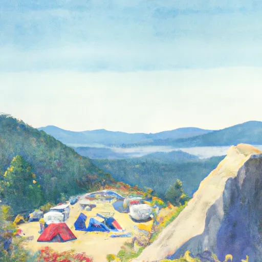
Cougar Rock Campground
Community Reviews
Been here? Share the conditions.
Reviews, ratings & photos are added in the free Snoflo iOS app — rate a spot, tag the conditions, and your visit is verified by location. Add or manage your reviews from the app.
Cougar Rock
Cougar Rock is situated near several popular hiking trails, including the Wonderland Trail and the Nisqually Vista Trail. Nearby attractions include the Longmire Historic District, which features a museum and several historic buildings, and the Paradise Visitor Center, which offers stunning views of the mountain and a variety of exhibits.
The campground amenities include restrooms, picnic tables, fire rings, and potable water. There are also several nearby stores where campers can purchase food and supplies. The campground is open from mid-May through mid-October, and reservations can be made up to six months in advance.
One interesting fact about the area is that it is home to a variety of wildlife, including black bears, deer, and elk. Visitors are advised to take precautions to avoid encounters with these animals.
The best time of year to visit Cougar Rock is during the summer months, when temperatures are mild and there is plenty of daylight for hiking and exploring. The average temperature during this time of year is around 60 degrees Fahrenheit. Visitors should be prepared for cooler temperatures at night and should bring warm clothing and camping gear.
What's on-site at Cougar Rock
Key facilities Snoflo tracks for this campground. Confirm with the operator before booking -- amenities can change seasonally.
Plan your trip down to the hour
Same weather feed Snoflo's iOS app uses -- updated continuously from NOAA / yr.no.
Next 5 days, hour by hour
Temperature line with weather symbols on top, snow + rain accumulation as columns, humidity as a dotted line.
5-day forecast table
Every 3 hours, broken out across temperature, snow, rain, humidity, and wind. Each cell is colour-coded relative to the column min/max so trends jump out at a glance.
| Time | Condition | Temp (°F) | Snow (in) | Rain (in) | Humidity (%) | Wind (mps) | Wind dir |
|---|---|---|---|---|---|---|---|
| Loading detailed forecast… | |||||||
15-day temperature & precipitation
Daily temperatures, snow, and rain projected over the next two weeks. Hover any point for the full breakdown.
Other campgrounds in the area
Snoflo-tracked campsites within driving distance of Cougar Rock, with reservations status.
| Campground | Reservations | Toilets | View |
|---|---|---|---|
| Cougar Rock - Mount Rainier National Park | ✓ | ✗ | → |
| Devil's Dream Camp | ✓ | ✗ | → |
| Snow Lake Camp | ✓ | ✓ | → |
| South Puyallup River Camp | ✓ | ✗ | → |
| Camp Hazard | ✓ | ✗ | → |
Nearby streamflow
USGS streamgauges within reach of Cougar Rock -- pulled live from the National Water Information System.
| Streamgauge | Discharge | View |
|---|---|---|
| Cowlitz River At Packwood | 593 cfs | → |
| Nisqually River Near National | 634 cfs | → |
| Puyallup River Near Electron | 571 cfs | → |
| Mineral Creek Near Mineral | 31 cfs | → |
| Cowlitz River At Randle | 940 cfs | → |
| Carbon River Near Fairfax | 410 cfs | → |
Nearby snow depths
NRCS SNOTEL stations within reach of Cougar Rock -- relevant when planning a shoulder-season or alpine trip.
| SNOTEL station | Snowpack | 24h Snowfall | View |
|---|---|---|---|
| Nohrsc Paradise | 0.0 in | 0.0 in | → |
| Paradise | 0.0 in | 0.0 in | → |
| Paradise | 5.9 in | 0.0 in | → |
| Rainier Paradise Ranger Stn | 0.0 in | 0.0 in | → |
| Skate Creek | 0.0 in | 0.0 in | → |
| Skate Creek | 0.0 in | 0.0 in | → |
Plan a longer trip
The closest parks, lakes, boat launches, and paddle runs so a camping night can grow into a full weekend.
Parks
- Wilderness Glacier View
- Wilderness Tatoosh
- Mount Rainier National Park
- Wilderness Clearwater
- Wilderness William O. Douglas
- Wilderness Norse Peak
Boat launches
- Lion's Den Park
- Mineral Lake
- Rocky Point Recreation Area
- Peters Road Lewis County
- Dog Lake Campground
- Alder Lake Park
Points of interest
- Longmire Museum
- Transportation Exhibit
- Nisqually Vista
- Gobbler's Knob Fire Lookout
- The Trident
- Coffee Cup
Paddle runs
- Headwaters At The Terminus Of The Ingraham Glacier To Ends 1/4 Mile North Of Box Canyon
- Begins 1/4 Mile South Of Box Canyon To Southern Boundary Of Mount Rainier National Park
- Begins 1/4 Mile North Of Box Canyon To Ends 1/4 Mile South Of Box Canyon
- Headwaters On The Southeast Flank Of Mount Rainier At An Elevation Of 5500 Ft To Confluence With Chinook Creek
- Headwaters In The Mystic Lake Basin On The North Side Of Mount Rainier To Northern Boundary Of Mount Rainier National Park
- Gifford Pinchot Nf Boundary To Tatoosh Wilderness Boundary
Camping essentials & Leave No Trace
- Pack it in, pack it out
- Take all trash, food scraps, and gear back with you to keep campsites clean and protect wildlife.
- Respect wildlife
- Observe animals from a distance, store food securely, and never feed wildlife to maintain natural behavior and safety.
- Know before you go
- Check weather, fire restrictions, trail conditions, and permit requirements to ensure a safe and well-planned trip.
- Minimize campfire impact
- Use established fire rings, keep fires small, fully extinguish them, or opt for a camp stove when fires are restricted.
- Leave what you find
- Preserve natural and cultural features by avoiding removal of plants, rocks, artifacts, or other elements of the environment.
Set push alerts in the Snoflo app
Save Cougar Rock as a favorite, set a custom threshold (precipitation, snowpack, freezing temperatures), and the iOS app will push the moment conditions cross.
About Cougar Rock
Can I make reservations at Cougar Rock?
This campground does not appear to accept reservations -- it's typically first-come, first-served. Arrive early on summer weekends.
How fresh is the weather data on this page?
The hourly forecast updates throughout the day from the NOAA / yr.no public feeds. Streamflow data is pulled live from USGS streamgauges and snowpack from the NRCS SNOTEL network.
What's the best time of year to visit?
Use the 15-day temperature & precipitation outlook on this page to plan -- pick a window with comfortable temperatures and low precipitation. For longer trips, the 5-day hourly meteogram shows snow + rain accumulation hour-by-hour.
How do I get to Cougar Rock?
Tap Directions in the hero above to open driving directions in Google Maps, or Open in map to center the Snoflo interactive map on the campground.
Can I get alerts when conditions change?
Yes -- alerts are managed through the Snoflo iOS app. Favorite this campground, set a threshold (temperature, snowpack, precipitation), and you'll get a push the moment it crosses.
Other campgrounds near here
Snoflo-tracked campgrounds within driving distance of Cougar Rock.