Mineral Springs - Wdfw Campground
Community Reviews
Been here? Share the conditions.
Reviews, ratings & photos are added in the free Snoflo iOS app — rate a spot, tag the conditions, and your visit is verified by location. Add or manage your reviews from the app.
Mineral Springs - Wdfw
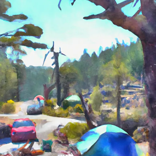
Reservations are accepted for Mineral Springs, allowing campers to secure their spot in advance. This is particularly recommended during peak seasons, as the campground can get busy. The best time to visit this camping area is during the summer months, from June to September, when the weather is generally pleasant, and outdoor activities can be fully enjoyed.
For nature enthusiasts and hikers, Mineral Springs offers access to several trails that wind through the beautiful surrounding forest. It is a great opportunity to spot wildlife and immerse oneself in the peaceful atmosphere. However, it is crucial to be cautious of the possibility of encountering black bears in the area. Proper food storage practices are essential to avoid attracting these animals to the campsite. Overall, Mineral Springs is a fantastic camping destination in Washington, providing campers with the chance to relax in nature and explore the scenic trails of the region.
What's on-site at Mineral Springs - Wdfw
Key facilities Snoflo tracks for this campground. Confirm with the operator before booking -- amenities can change seasonally.
Plan your trip down to the hour
Same weather feed Snoflo's iOS app uses -- updated continuously from NOAA / yr.no.
Next 5 days, hour by hour
Temperature line with weather symbols on top, snow + rain accumulation as columns, humidity as a dotted line.
5-day forecast table
Every 3 hours, broken out across temperature, snow, rain, humidity, and wind. Each cell is colour-coded relative to the column min/max so trends jump out at a glance.
| Time | Condition | Temp (°F) | Snow (in) | Rain (in) | Humidity (%) | Wind (mps) | Wind dir |
|---|---|---|---|---|---|---|---|
| Loading detailed forecast… | |||||||
15-day temperature & precipitation
Daily temperatures, snow, and rain projected over the next two weeks. Hover any point for the full breakdown.
Other campgrounds in the area
Snoflo-tracked campsites within driving distance of Mineral Springs - Wdfw, with reservations status.
| Campground | Reservations | Toilets | View |
|---|---|---|---|
| Soda Springs Campground | ✗ | ✗ | → |
| Canyon Creek Campground | ✗ | ✗ | → |
| Stinson Flats Campground | ✗ | ✗ | → |
| Stimpson Flats - Wdfw | ✗ | ✓ | → |
| Turkey Hole - Wdfw | ✗ | ✓ | → |
Nearby streamflow
USGS streamgauges within reach of Mineral Springs - Wdfw -- pulled live from the National Water Information System.
| Streamgauge | Discharge | View |
|---|---|---|
| Klickitat River Near Pitt | 775 cfs | → |
| Klickitat River Bl Summit Creek Near Glenwood | 1,820 cfs | → |
| Columbia River At The Dalles | 120,000 cfs | → |
| Deschutes River At Moody | 3,890 cfs | → |
| Mosier Creek Near Mosier | 1 cfs | → |
| White Salmon River Near Underwood | 533 cfs | → |
Nearby snow depths
NRCS SNOTEL stations within reach of Mineral Springs - Wdfw -- relevant when planning a shoulder-season or alpine trip.
| SNOTEL station | Snowpack | 24h Snowfall | View |
|---|---|---|---|
| Snowden | 0.0 in | 0.0 in | → |
| Nohrsc Indian Rock | 0.0 in | 0.0 in | → |
| Indian Rock | 0.0 in | 0.0 in | → |
| Hood River | 0.0 in | 0.0 in | → |
| Trout Lake 0.8 Ssw | 0.0 in | 0.0 in | → |
| 20d01 - Satus Pass | 0.0 in | 0.0 in | → |
Plan a longer trip
The closest parks, lakes, boat launches, and paddle runs so a camping night can grow into a full weekend.
Parks
- Columbia Hills Natural Area Preserve
- Lyle Park
- Horsethief Lake State Park
- Mayer State Park
- Memaloose State Park
- Celilo Park
Boat launches
- Mineral Springs
- Stinson Flat Road Klickitat County
- Glenwood Highway Klickitat County
- Avery Park
- Lyle
- Horsethief State Park
Camping essentials & Leave No Trace
- Pack it in, pack it out
- Take all trash, food scraps, and gear back with you to keep campsites clean and protect wildlife.
- Respect wildlife
- Observe animals from a distance, store food securely, and never feed wildlife to maintain natural behavior and safety.
- Know before you go
- Check weather, fire restrictions, trail conditions, and permit requirements to ensure a safe and well-planned trip.
- Minimize campfire impact
- Use established fire rings, keep fires small, fully extinguish them, or opt for a camp stove when fires are restricted.
- Leave what you find
- Preserve natural and cultural features by avoiding removal of plants, rocks, artifacts, or other elements of the environment.
Set push alerts in the Snoflo app
Save Mineral Springs - Wdfw as a favorite, set a custom threshold (precipitation, snowpack, freezing temperatures), and the iOS app will push the moment conditions cross.
About Mineral Springs - Wdfw
Can I make reservations at Mineral Springs - Wdfw?
This campground does not appear to accept reservations -- it's typically first-come, first-served. Arrive early on summer weekends.
How fresh is the weather data on this page?
The hourly forecast updates throughout the day from the NOAA / yr.no public feeds. Streamflow data is pulled live from USGS streamgauges and snowpack from the NRCS SNOTEL network.
What's the best time of year to visit?
Use the 15-day temperature & precipitation outlook on this page to plan -- pick a window with comfortable temperatures and low precipitation. For longer trips, the 5-day hourly meteogram shows snow + rain accumulation hour-by-hour.
How do I get to Mineral Springs - Wdfw?
Tap Directions in the hero above to open driving directions in Google Maps, or Open in map to center the Snoflo interactive map on the campground.
Can I get alerts when conditions change?
Yes -- alerts are managed through the Snoflo iOS app. Favorite this campground, set a threshold (temperature, snowpack, precipitation), and you'll get a push the moment it crosses.
Other campgrounds near here
Snoflo-tracked campgrounds within driving distance of Mineral Springs - Wdfw.