Crow Creek Campground Campground
Community Reviews
Been here? Share the conditions.
Reviews, ratings & photos are added in the free Snoflo iOS app — rate a spot, tag the conditions, and your visit is verified by location. Add or manage your reviews from the app.
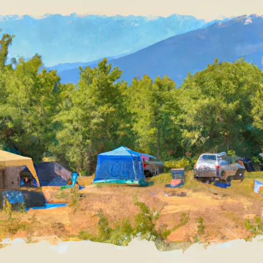
Crow Creek Campground
Reservations are required at Crow Creek Campground, allowing campers to secure their spot in advance. This ensures a stress-free experience and guarantees availability, especially during peak seasons. The best time to visit this campground is during the summer months when the weather is pleasant, reaching its peak in July and August. Nature enthusiasts can revel in the lush greenery, abundant wildlife, and the opportunity to engage in activities like hiking and birdwatching. However, it is important to note that the campground's popularity during this season may require early booking.
While enjoying the serene surroundings of Crow Creek Campground, campers should be cautious of potential wildlife encounters. Being in a natural habitat, visitors should properly store food to avoid attracting animals such as bears. It is advisable to keep a safe distance from any wildlife encountered and follow the guidelines provided by park officials. Overall, Crow Creek Campground offers a memorable camping experience with its amenities, reservation system, and the opportunity to appreciate the natural beauty of Washington state.
What's on-site at Crow Creek Campground
Key facilities Snoflo tracks for this campground. Confirm with the operator before booking -- amenities can change seasonally.
Plan your trip down to the hour
Same weather feed Snoflo's iOS app uses -- updated continuously from NOAA / yr.no.
Next 5 days, hour by hour
Temperature line with weather symbols on top, snow + rain accumulation as columns, humidity as a dotted line.
5-day forecast table
Every 3 hours, broken out across temperature, snow, rain, humidity, and wind. Each cell is colour-coded relative to the column min/max so trends jump out at a glance.
| Time | Condition | Temp (°F) | Snow (in) | Rain (in) | Humidity (%) | Wind (mps) | Wind dir |
|---|---|---|---|---|---|---|---|
| Loading detailed forecast… | |||||||
15-day temperature & precipitation
Daily temperatures, snow, and rain projected over the next two weeks. Hover any point for the full breakdown.
Other campgrounds in the area
Snoflo-tracked campsites within driving distance of Crow Creek Campground, with reservations status.
| Campground | Reservations | Toilets | View |
|---|---|---|---|
| Crow Creek | ✗ | ✓ | → |
| Longmire Meadow | ✓ | ✗ | → |
| Kaner Flat Riverfront Group Campground | ✓ | ✗ | → |
| Kaner Flat | ✗ | ✓ | → |
| Kaner Flat Campground | ✗ | ✗ | → |
Nearby streamflow
USGS streamgauges within reach of Crow Creek Campground -- pulled live from the National Water Information System.
| Streamgauge | Discharge | View |
|---|---|---|
| American River Near Nile | 57 cfs | → |
| Greenwater River At Greenwater | 45 cfs | → |
| Cedar River Below Bear Creek Near Cedar Falls | 21 cfs | → |
| Yakima River At Umtanum | 3,700 cfs | → |
| Cedar River Near Cedar Falls | 35 cfs | → |
| Rex River Near Cedar Falls | 9 cfs | → |
Nearby snow depths
NRCS SNOTEL stations within reach of Crow Creek Campground -- relevant when planning a shoulder-season or alpine trip.
| SNOTEL station | Snowpack | 24h Snowfall | View |
|---|---|---|---|
| Corral Pass | 0.0 in | 0.0 in | → |
| Nohrsc Corral Pass | 0.0 in | 0.0 in | → |
| Bumping Ridge | 0.0 in | 0.0 in | → |
| Sawmill Ridge | 0.0 in | 0.0 in | → |
| Nohrsc Sawmill Ridge | 0.0 in | 0.0 in | → |
| Nohrsc Bumping Ridge | 0.0 in | 0.0 in | → |
Plan a longer trip
The closest parks, lakes, boat launches, and paddle runs so a camping night can grow into a full weekend.
Parks
- Wenatchee National Forest
- Wilderness Norse Peak
- Lake Easton State Park
- Conservation Land Fort Tilton Historical Marker
- Wilderness Alpine Lakes
- Federation Forest State Park
Boat launches
- Bumping Lake Marina
- Bumping Lake Public Boat Landing
- Lake Easton State Park
- Lake Cabins Road Kittitas County
- Teanaway Junction
- Wish Poosh Campground And Picnic Area
Points of interest
- Salmon Falls Interpretive Site
- Mather Memorial East Portal Information Site
- South Cle Elum Rail Yard Interpretive Center
- Palouse To Cascades State Park
- Carpenter Museum
- Telephone Museum
Paddle runs
- Confluence With Ranier Fork To Confluence With Bumping River
- Headwaters At American Lake To Confluence With Ranier Fork
- Mt. Baker-Snoqualmie Nf/Mt. Ranier Np Boundary At North Section Line Of Sec 3, T17 N, R10e To Confluence With Huckleberry Creek
- Private Land Boundary To Head Of Lake Cle Elum Reservoir
- Confluence With Chinook Creek To Southern Boundary Of Mount Rainier National Park
- Headwaters On The Southeast Flank Of Mount Rainier At An Elevation Of 5500 Ft To Confluence With Chinook Creek
Camping essentials & Leave No Trace
- Pack it in, pack it out
- Take all trash, food scraps, and gear back with you to keep campsites clean and protect wildlife.
- Respect wildlife
- Observe animals from a distance, store food securely, and never feed wildlife to maintain natural behavior and safety.
- Know before you go
- Check weather, fire restrictions, trail conditions, and permit requirements to ensure a safe and well-planned trip.
- Minimize campfire impact
- Use established fire rings, keep fires small, fully extinguish them, or opt for a camp stove when fires are restricted.
- Leave what you find
- Preserve natural and cultural features by avoiding removal of plants, rocks, artifacts, or other elements of the environment.
Set push alerts in the Snoflo app
Save Crow Creek Campground as a favorite, set a custom threshold (precipitation, snowpack, freezing temperatures), and the iOS app will push the moment conditions cross.
About Crow Creek Campground
Can I make reservations at Crow Creek Campground?
This campground does not appear to accept reservations -- it's typically first-come, first-served. Arrive early on summer weekends.
How fresh is the weather data on this page?
The hourly forecast updates throughout the day from the NOAA / yr.no public feeds. Streamflow data is pulled live from USGS streamgauges and snowpack from the NRCS SNOTEL network.
What's the best time of year to visit?
Use the 15-day temperature & precipitation outlook on this page to plan -- pick a window with comfortable temperatures and low precipitation. For longer trips, the 5-day hourly meteogram shows snow + rain accumulation hour-by-hour.
How do I get to Crow Creek Campground?
Tap Directions in the hero above to open driving directions in Google Maps, or Open in map to center the Snoflo interactive map on the campground.
Can I get alerts when conditions change?
Yes -- alerts are managed through the Snoflo iOS app. Favorite this campground, set a threshold (temperature, snowpack, precipitation), and you'll get a push the moment it crosses.
Other campgrounds near here
Snoflo-tracked campgrounds within driving distance of Crow Creek Campground.