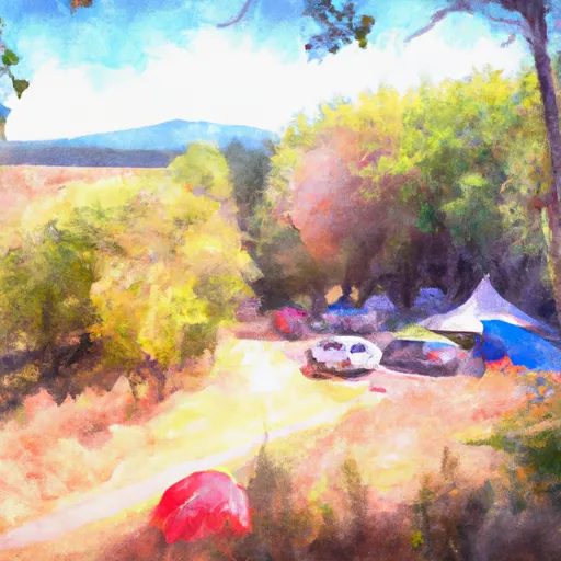
Daroga State Park Campground
Community Reviews
Been here? Share the conditions.
Reviews, ratings & photos are added in the free Snoflo iOS app — rate a spot, tag the conditions, and your visit is verified by location. Add or manage your reviews from the app.
Daroga State Park
Reservations are accepted at Daroga State Park, allowing campers to secure their spot in advance. This is particularly recommended during peak seasons, as the campground tends to fill up quickly. It is advisable to book reservations well in advance to guarantee availability.
The best time to visit Daroga State Park is during the summer months, from June to September, when the weather is warm and ideal for outdoor activities. The camping area offers beautiful scenery, including breathtaking views of the surrounding mountains and access to fishing opportunities. Hikers will also enjoy exploring the nearby trails. However, it is important to be cautious of wildlife in the area, such as bears and cougars. Campers should store food securely and be aware of their surroundings. In summary, Daroga State Park provides a well-equipped camping area with essential amenities and accepts reservations. The best time to visit is during the summer months, but caution should be exercised due to potential encounters with wildlife.
What's on-site at Daroga State Park
Key facilities Snoflo tracks for this campground. Confirm with the operator before booking -- amenities can change seasonally.
Plan your trip down to the hour
Same weather feed Snoflo's iOS app uses -- updated continuously from NOAA / yr.no.
Next 5 days, hour by hour
Temperature line with weather symbols on top, snow + rain accumulation as columns, humidity as a dotted line.
5-day forecast table
Every 3 hours, broken out across temperature, snow, rain, humidity, and wind. Each cell is colour-coded relative to the column min/max so trends jump out at a glance.
| Time | Condition | Temp (°F) | Snow (in) | Rain (in) | Humidity (%) | Wind (mps) | Wind dir |
|---|---|---|---|---|---|---|---|
| Loading detailed forecast… | |||||||
15-day temperature & precipitation
Daily temperatures, snow, and rain projected over the next two weeks. Hover any point for the full breakdown.
Other campgrounds in the area
Snoflo-tracked campsites within driving distance of Daroga State Park, with reservations status.
| Campground | Reservations | Toilets | View |
|---|---|---|---|
| Entiat City Park | ✗ | ✗ | → |
| Pine Flat Campground | ✗ | ✗ | → |
| Lake Chelan State Park | ✓ | ✗ | → |
| Lakeshore Rv Park | ✗ | ✗ | → |
| Lincoln Rock State Park | ✓ | ✗ | → |
Nearby streamflow
USGS streamgauges within reach of Daroga State Park -- pulled live from the National Water Information System.
| Streamgauge | Discharge | View |
|---|---|---|
| Entiat River Near Entiat | 179 cfs | → |
| Mad River At Ardenvoir | 20 cfs | → |
| Entiat River Near Ardenvoir | 148 cfs | → |
| Chelan River At Chelan | 80 cfs | → |
| Wenatchee River At Monitor | 905 cfs | → |
| Wenatchee River At Peshastin | 901 cfs | → |
Nearby snow depths
NRCS SNOTEL stations within reach of Daroga State Park -- relevant when planning a shoulder-season or alpine trip.
| SNOTEL station | Snowpack | 24h Snowfall | View |
|---|---|---|---|
| Entiat Fish Hatchery | 0.0 in | 0.0 in | → |
| Chelan | 0.0 in | 0.0 in | → |
| Plain | 0.0 in | 0.0 in | → |
| Leavenworth | 0.0 in | 0.0 in | → |
| Nohrsc Pope Ridge | 0.0 in | 0.0 in | → |
| Pope Ridge | 1.0 in | 1.0 in | → |
Plan a longer trip
The closest parks, lakes, boat launches, and paddle runs so a camping night can grow into a full weekend.
Parks
- Daroga State Park
- Silicosaska Park
- Lake Chelan State Park
- Lincoln Rock State Park
- Cashmere Riverside Park
- Cottage Ave Park
Boat launches
- Lakeshore Drive Entiat
- Orondo Park
- Lake Front Road Douglas County
- Katya Lane 2943, Chelan County
- Lake Chelan State Park
- Chelan Marina
Points of interest
- Earthquake Point
- Columbia Breaks Fire Interpretive Center
- Douglas County Historical Museum
- Lake Chelan Historical Society Museum
- Beebe Bridge
- Rocky Reach Dam Discovery Center
Paddle runs
- Glacier Peak Wilderness Boundary To Confluence With Wenatchee River
- Outlet Of Lake Wenatchee To Wenatchee Nf Boundary
- Douglas Creek
- Alpine Lakes Wilderness Boundary To City Of Leavenworth Water Intake In Se1/4 Of Sec 28, T24n, R17e
- Point At East Section Line Of Sec 13, T28n, R15e To Lake Wenatchee
- Cottonwood Trailhead To Private Land Boundary In Ne1/4 Of Sec 29, T28n, R19e
Camping essentials & Leave No Trace
- Pack it in, pack it out
- Take all trash, food scraps, and gear back with you to keep campsites clean and protect wildlife.
- Respect wildlife
- Observe animals from a distance, store food securely, and never feed wildlife to maintain natural behavior and safety.
- Know before you go
- Check weather, fire restrictions, trail conditions, and permit requirements to ensure a safe and well-planned trip.
- Minimize campfire impact
- Use established fire rings, keep fires small, fully extinguish them, or opt for a camp stove when fires are restricted.
- Leave what you find
- Preserve natural and cultural features by avoiding removal of plants, rocks, artifacts, or other elements of the environment.
Set push alerts in the Snoflo app
Save Daroga State Park as a favorite, set a custom threshold (precipitation, snowpack, freezing temperatures), and the iOS app will push the moment conditions cross.
About Daroga State Park
Can I make reservations at Daroga State Park?
This campground does not appear to accept reservations -- it's typically first-come, first-served. Arrive early on summer weekends.
How fresh is the weather data on this page?
The hourly forecast updates throughout the day from the NOAA / yr.no public feeds. Streamflow data is pulled live from USGS streamgauges and snowpack from the NRCS SNOTEL network.
What's the best time of year to visit?
Use the 15-day temperature & precipitation outlook on this page to plan -- pick a window with comfortable temperatures and low precipitation. For longer trips, the 5-day hourly meteogram shows snow + rain accumulation hour-by-hour.
How do I get to Daroga State Park?
Tap Directions in the hero above to open driving directions in Google Maps, or Open in map to center the Snoflo interactive map on the campground.
Can I get alerts when conditions change?
Yes -- alerts are managed through the Snoflo iOS app. Favorite this campground, set a threshold (temperature, snowpack, precipitation), and you'll get a push the moment it crosses.
Other campgrounds near here
Snoflo-tracked campgrounds within driving distance of Daroga State Park.