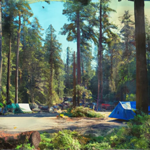
Silver Fir Campground Campground
Community Reviews
Been here? Share the conditions.
Reviews, ratings & photos are added in the free Snoflo iOS app — rate a spot, tag the conditions, and your visit is verified by location. Add or manage your reviews from the app.
Silver Fir Campground
The campground provides several amenities, including picnic tables, fire pits, and vault toilets. However, it is important to note that there is no potable water available on-site, so campers need to bring their own or be prepared to treat water from nearby sources. Additionally, there are no electrical hook-ups or showers at Silver Fir Campground.
Reservations are not accepted at this campground and all sites are available on a first-come, first-served basis. It is recommended to arrive early, especially during the peak summer months, to secure a campsite. The best time to visit Silver Fir Campground is during the summer season when the weather is pleasant and the trails are easily accessible. However, it is important to be prepared for cooler temperatures and potential rainfall, as the campground is located in a mountainous area.
While exploring the camping area, campers can enjoy various activities such as hiking, fishing, and wildlife watching. The campground is located near the Pacific Crest Trail, offering opportunities for longer hikes and backpacking trips. It is essential to be cautious of bears and other wildlife in the area and store food securely to avoid attracting animals. Overall, Silver Fir Campground provides a rustic camping experience in a stunning natural setting, perfect for those seeking a peaceful retreat in the Washington wilderness.
What's on-site at Silver Fir Campground
Key facilities Snoflo tracks for this campground. Confirm with the operator before booking -- amenities can change seasonally.
Plan your trip down to the hour
Same weather feed Snoflo's iOS app uses -- updated continuously from NOAA / yr.no.
Next 5 days, hour by hour
Temperature line with weather symbols on top, snow + rain accumulation as columns, humidity as a dotted line.
5-day forecast table
Every 3 hours, broken out across temperature, snow, rain, humidity, and wind. Each cell is colour-coded relative to the column min/max so trends jump out at a glance.
| Time | Condition | Temp (°F) | Snow (in) | Rain (in) | Humidity (%) | Wind (mps) | Wind dir |
|---|---|---|---|---|---|---|---|
| Loading detailed forecast… | |||||||
15-day temperature & precipitation
Daily temperatures, snow, and rain projected over the next two weeks. Hover any point for the full breakdown.
Other campgrounds in the area
Snoflo-tracked campsites within driving distance of Silver Fir Campground, with reservations status.
| Campground | Reservations | Toilets | View |
|---|---|---|---|
| Silver Fir | ✓ | ✓ | → |
| Mazama Camp | ✗ | ✗ | → |
| Excelsior Group Campground | ✓ | ✗ | → |
| Excelsior | ✓ | ✓ | → |
| Camp Kiser | ✗ | ✗ | → |
Nearby streamflow
USGS streamgauges within reach of Silver Fir Campground -- pulled live from the National Water Information System.
| Streamgauge | Discharge | View |
|---|---|---|
| Nf Nooksack River Bl Cascade Creek Nr Glacier | 610 cfs | → |
| Clearwater Creek Near Welcome | 39 cfs | → |
| Racehorse Creek At North Fork Road Nr Kendall | 23 cfs | → |
| Mf Nooksack River Near Deming | 212 cfs | → |
| Bacon Creek Below Oakes Creek Near Marblemount | 146 cfs | → |
| Skookum Creek Above Diversion Near Wickersham | 16 cfs | → |
Nearby snow depths
NRCS SNOTEL stations within reach of Silver Fir Campground -- relevant when planning a shoulder-season or alpine trip.
| SNOTEL station | Snowpack | 24h Snowfall | View |
|---|---|---|---|
| Mt. Baker - Heather Meadows | 7.1 in | 0.0 in | → |
| Wells Creek | 0.0 in | 0.0 in | → |
| Nohrsc Wells Creek | 0.0 in | 0.0 in | → |
| Marten Ridge | 0.0 in | 0.0 in | → |
| Nohrsc Marten Ridge | 0.0 in | 0.0 in | → |
| Mf Nooksack | 0.0 in | -1.0 in | → |
Plan a longer trip
The closest parks, lakes, boat launches, and paddle runs so a camping night can grow into a full weekend.
Parks
- Mount Baker National Recreation Area
- Wilderness Mount Baker
- Wilderness Noisy-Diobsud
- Upper Skagit Garden Club Park
- Ross Lake National Recreation Area
- Rockport State Park
Boat launches
- National Forest Development Road 1150 Whatcom County
- National Forest Development Road 1142 Whatcom County
- National Forest Development Road 11, Concrete
- National Forest Development Road 012 Whatcom County
- National Forest Development Road Whatcom County
- Whatcom County
Points of interest
- Winchester Mountain Lookout
- Mcguire Snow Cabin
- Copper Mountain Fire Lookout
- Treeweaver
- Pillar Of Pi
- Chilliwack River Rafting
Paddle runs
- Mt. Baker Wilderness Boundary To Nooksack Falls Diversion Dam
- Mt. Baker-Snoqualmie Nf/North Cascades Np To Mt. Baker Wilderness Boundary
- Nooksack Falls Diversion Dam To Nooksack Falls Power Plant
- Headwaters To U.S./Canadian Border
- Headwaters To North Cascades National Park Boundary
- Douglas Fir Campground To Mt. Baker Highway
Camping essentials & Leave No Trace
- Pack it in, pack it out
- Take all trash, food scraps, and gear back with you to keep campsites clean and protect wildlife.
- Respect wildlife
- Observe animals from a distance, store food securely, and never feed wildlife to maintain natural behavior and safety.
- Know before you go
- Check weather, fire restrictions, trail conditions, and permit requirements to ensure a safe and well-planned trip.
- Minimize campfire impact
- Use established fire rings, keep fires small, fully extinguish them, or opt for a camp stove when fires are restricted.
- Leave what you find
- Preserve natural and cultural features by avoiding removal of plants, rocks, artifacts, or other elements of the environment.
Set push alerts in the Snoflo app
Save Silver Fir Campground as a favorite, set a custom threshold (precipitation, snowpack, freezing temperatures), and the iOS app will push the moment conditions cross.
About Silver Fir Campground
Can I make reservations at Silver Fir Campground?
Yes -- this campground accepts reservations. Snoflo recommends booking early for peak season; check the operator (Recreation.gov / state park system / private operator) for the booking window and cancellation policy.
How fresh is the weather data on this page?
The hourly forecast updates throughout the day from the NOAA / yr.no public feeds. Streamflow data is pulled live from USGS streamgauges and snowpack from the NRCS SNOTEL network.
What's the best time of year to visit?
Use the 15-day temperature & precipitation outlook on this page to plan -- pick a window with comfortable temperatures and low precipitation. For longer trips, the 5-day hourly meteogram shows snow + rain accumulation hour-by-hour.
How do I get to Silver Fir Campground?
Tap Directions in the hero above to open driving directions in Google Maps, or Open in map to center the Snoflo interactive map on the campground.
Can I get alerts when conditions change?
Yes -- alerts are managed through the Snoflo iOS app. Favorite this campground, set a threshold (temperature, snowpack, precipitation), and you'll get a push the moment it crosses.
Other campgrounds near here
Snoflo-tracked campgrounds within driving distance of Silver Fir Campground.