Trout Lake Campground Campground
Community Reviews
Been here? Share the conditions.
Reviews, ratings & photos are added in the free Snoflo iOS app — rate a spot, tag the conditions, and your visit is verified by location. Add or manage your reviews from the app.
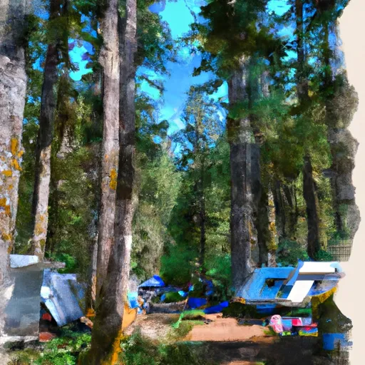
Trout Lake Campground
Reservations are not accepted at Trout Lake Campground, making it a first-come, first-served camping area. It is advisable to arrive early, especially during peak seasons, to secure a spot. The best time to visit this campground is during the summer months, from June to September, when the weather is pleasant and ideal for outdoor activities like hiking and fishing.
While camping at Trout Lake Campground, there are a few specific points of interest and precautions to keep in mind. The campground is located near the base of Mount Adams, offering stunning views and ample opportunities for hiking enthusiasts. However, it is important to be cautious of wildlife, such as bears and cougars, and to store food securely to avoid attracting them. Additionally, campers should be mindful of fire safety and adhere to any restrictions or guidelines in place to prevent wildfires.
In summary, Trout Lake Campground in Washington state provides a serene and well-equipped camping area. With basic amenities available, a first-come, first-served policy, and the best time to visit being during the summer months, campers can enjoy a delightful outdoor experience. It's advisable to remain cautious of wildlife and follow fire safety guidelines while exploring the beautiful surroundings.
What's on-site at Trout Lake Campground
Key facilities Snoflo tracks for this campground. Confirm with the operator before booking -- amenities can change seasonally.
Plan your trip down to the hour
Same weather feed Snoflo's iOS app uses -- updated continuously from NOAA / yr.no.
Next 5 days, hour by hour
Temperature line with weather symbols on top, snow + rain accumulation as columns, humidity as a dotted line.
5-day forecast table
Every 3 hours, broken out across temperature, snow, rain, humidity, and wind. Each cell is colour-coded relative to the column min/max so trends jump out at a glance.
| Time | Condition | Temp (°F) | Snow (in) | Rain (in) | Humidity (%) | Wind (mps) | Wind dir |
|---|---|---|---|---|---|---|---|
| Loading detailed forecast… | |||||||
15-day temperature & precipitation
Daily temperatures, snow, and rain projected over the next two weeks. Hover any point for the full breakdown.
Other campgrounds in the area
Snoflo-tracked campsites within driving distance of Trout Lake Campground, with reservations status.
| Campground | Reservations | Toilets | View |
|---|---|---|---|
| Trout Lake | ✗ | ✓ | → |
| Canyon Creek | ✗ | ✓ | → |
| Kettle Falls Campground | ✗ | ✗ | → |
| Kettle Falls Campgrounds | ✗ | ✗ | → |
| Kettle Falls - Lake Roosevelt National Rec Area | ✓ | ✗ | → |
Nearby streamflow
USGS streamgauges within reach of Trout Lake Campground -- pulled live from the National Water Information System.
| Streamgauge | Discharge | View |
|---|---|---|
| Colville River At Kettle Falls | 35 cfs | → |
| Kettle River Near Laurier | 360 cfs | → |
| Kettle River Near Ferry | 117 cfs | → |
| Columbia River At International Boundary | 97,700 cfs | → |
| Pend Oreille River Below Box Canyon Near Ione | 9,700 cfs | → |
| Outlet Creek Near Metaline Falls | 19 cfs | → |
Nearby snow depths
NRCS SNOTEL stations within reach of Trout Lake Campground -- relevant when planning a shoulder-season or alpine trip.
| SNOTEL station | Snowpack | 24h Snowfall | View |
|---|---|---|---|
| Nohrsc Kettle Falls 10.2 Nw | 0.0 in | 0.0 in | → |
| Nohrsc Sentinel Butte | 0.0 in | 0.0 in | → |
| Sentinel Butte | 0.0 in | 0.0 in | → |
| Republic 8.4 Nne | 0.0 in | 0.0 in | → |
| Republic 4.2 N | 0.0 in | 0.0 in | → |
| Gold Mountain | 0.0 in | 0.0 in | → |
Plan a longer trip
The closest parks, lakes, boat launches, and paddle runs so a camping night can grow into a full weekend.
Parks
- Douglas Falls Grange Park
- Angus Mcdonald Park
- Yep-Kanum-Colville City Park
- Curlew Lake State Park
- Little Pend Oreille National Wildlife Refuge
- Chewelah Park
Boat launches
- Kettle Falls Marina
- Marcus Island Campground
- Highway 25 1834-1836, Kettle Falls
- Inchelium Kettle Falls Road 4273-4385, Kettle Falls
- Napoleon Road, Kettle Falls
- Northport Flat Creek Road 2122-2396, Kettle Falls
Points of interest
Camping essentials & Leave No Trace
- Pack it in, pack it out
- Take all trash, food scraps, and gear back with you to keep campsites clean and protect wildlife.
- Respect wildlife
- Observe animals from a distance, store food securely, and never feed wildlife to maintain natural behavior and safety.
- Know before you go
- Check weather, fire restrictions, trail conditions, and permit requirements to ensure a safe and well-planned trip.
- Minimize campfire impact
- Use established fire rings, keep fires small, fully extinguish them, or opt for a camp stove when fires are restricted.
- Leave what you find
- Preserve natural and cultural features by avoiding removal of plants, rocks, artifacts, or other elements of the environment.
Set push alerts in the Snoflo app
Save Trout Lake Campground as a favorite, set a custom threshold (precipitation, snowpack, freezing temperatures), and the iOS app will push the moment conditions cross.
About Trout Lake Campground
Can I make reservations at Trout Lake Campground?
Yes -- this campground accepts reservations. Snoflo recommends booking early for peak season; check the operator (Recreation.gov / state park system / private operator) for the booking window and cancellation policy.
How fresh is the weather data on this page?
The hourly forecast updates throughout the day from the NOAA / yr.no public feeds. Streamflow data is pulled live from USGS streamgauges and snowpack from the NRCS SNOTEL network.
What's the best time of year to visit?
Use the 15-day temperature & precipitation outlook on this page to plan -- pick a window with comfortable temperatures and low precipitation. For longer trips, the 5-day hourly meteogram shows snow + rain accumulation hour-by-hour.
How do I get to Trout Lake Campground?
Tap Directions in the hero above to open driving directions in Google Maps, or Open in map to center the Snoflo interactive map on the campground.
Can I get alerts when conditions change?
Yes -- alerts are managed through the Snoflo iOS app. Favorite this campground, set a threshold (temperature, snowpack, precipitation), and you'll get a push the moment it crosses.
Other campgrounds near here
Snoflo-tracked campgrounds within driving distance of Trout Lake Campground.