Mike Harris Campground Campground
Community Reviews
Been here? Share the conditions.
Reviews, ratings & photos are added in the free Snoflo iOS app — rate a spot, tag the conditions, and your visit is verified by location. Add or manage your reviews from the app.
Mike Harris Campground
Reservations are not accepted at Mike Harris Campground, and sites are available on a first-come, first-served basis. It is advisable to arrive early during peak season to secure a spot. The best time to visit this campground is during the summer months, particularly between June and September when the weather is mild and conducive to outdoor activities.
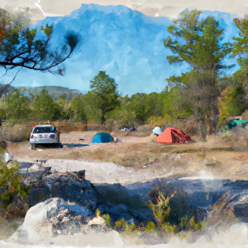
While camping at Mike Harris Campground, visitors can explore the surrounding area's natural beauty. The campground is nestled within a picturesque setting with stunning views of mountains, forests, and lakes. It is a great spot for hiking, fishing, and wildlife observation. However, campers should exercise caution and be aware of the presence of bears and other wildlife in the area. Proper food storage and following bear safety guidelines are essential to ensure a safe camping experience.
What's on-site at Mike Harris Campground
Key facilities Snoflo tracks for this campground. Confirm with the operator before booking -- amenities can change seasonally.
Plan your trip down to the hour
Same weather feed Snoflo's iOS app uses -- updated continuously from NOAA / yr.no.
Next 5 days, hour by hour
Temperature line with weather symbols on top, snow + rain accumulation as columns, humidity as a dotted line.
5-day forecast table
Every 3 hours, broken out across temperature, snow, rain, humidity, and wind. Each cell is colour-coded relative to the column min/max so trends jump out at a glance.
| Time | Condition | Temp (°F) | Snow (in) | Rain (in) | Humidity (%) | Wind (mps) | Wind dir |
|---|---|---|---|---|---|---|---|
| Loading detailed forecast… | |||||||
15-day temperature & precipitation
Daily temperatures, snow, and rain projected over the next two weeks. Hover any point for the full breakdown.
Other campgrounds in the area
Snoflo-tracked campsites within driving distance of Mike Harris Campground, with reservations status.
| Campground | Reservations | Toilets | View |
|---|---|---|---|
| Mike Harris | ✓ | ✓ | → |
| Trail Creek - Victor | ✗ | ✓ | → |
| Middle/South Fork Granite Group Site | ✗ | ✗ | → |
| Marion Lake | ✗ | ✗ | → |
| Middle Fork/South Fork | ✗ | ✗ | → |
Nearby streamflow
USGS streamgauges within reach of Mike Harris Campground -- pulled live from the National Water Information System.
| Streamgauge | Discharge | View |
|---|---|---|
| Fish Creek At Wilson | 424 cfs | → |
| Granite C Ab Granite C Supplemental | 57 cfs | → |
| Flat Creek Bel Cache Creek | 209 cfs | → |
| Gros Ventre River At Zenith Wy | 149 cfs | → |
| Snake River Nr Irwin Id | 13,100 cfs | → |
| Teton River Ab South Leigh Creek Nr Driggs Id | 315 cfs | → |
Nearby snow depths
NRCS SNOTEL stations within reach of Mike Harris Campground -- relevant when planning a shoulder-season or alpine trip.
| SNOTEL station | Snowpack | 24h Snowfall | View |
|---|---|---|---|
| Milepost 12 Snow Study Plot | 0.0 in | 0.0 in | → |
| Pine Creek Pass | 0.0 in | 0.0 in | → |
| Nohrsc Pine Creek Pass | 0.0 in | 0.0 in | → |
| Nohrsc Phillips Bench Snotel | 0.0 in | 0.0 in | → |
| Phillips Bench | 0.0 in | 0.0 in | → |
| Mount Baird - Snow | 11.0 in | 0.0 in | → |
Plan a longer trip
The closest parks, lakes, boat launches, and paddle runs so a camping night can grow into a full weekend.
Parks
- Jedediah Smith Wilderness
- Emily Stevens Park
- Powderhorn Park
- Karns Meadow Park
- Smith's Park
- Mateosky Park
Boat launches
- Fox Creek West
- Teton Creek
- Bates Bridge
- Rainey Bridge
- Palisades Creek
- Big Elk Creek Road 100, Bonneville County
Fishing spots
- Palisades Reservoir
- Jenny Lake
- Pritchard Boating Site
- Astoria Boating Site
- Elbow Boating Site
- Ashton Reservoir
Points of interest
- Darby Ice Cave
- Rendevous Mtn Trail
- Hardeman Barns
- Death Canyon Barn
- Laurance S. Rockefeller Preserve Center
- Jackson Hole And Greater Yellowstone Visitor Center
Paddle runs
- Headwaters Of North And South Forks And Mainstem To Boundary Of Jedediah Smith Wilderness
- Source To Upper Palisades Lake
- Confluence Of North Fork Palisades Creek And Corral Canyon To Palisades Campground
- Tie Canyon To Targhee Nf Boundary
- Palisades Dam To Confluence With Pine Creek
- Mainstem And Lower 2 Miles Of North, South And Siddoway Forks To One Mile Above Trailhead
Camping essentials & Leave No Trace
- Pack it in, pack it out
- Take all trash, food scraps, and gear back with you to keep campsites clean and protect wildlife.
- Respect wildlife
- Observe animals from a distance, store food securely, and never feed wildlife to maintain natural behavior and safety.
- Know before you go
- Check weather, fire restrictions, trail conditions, and permit requirements to ensure a safe and well-planned trip.
- Minimize campfire impact
- Use established fire rings, keep fires small, fully extinguish them, or opt for a camp stove when fires are restricted.
- Leave what you find
- Preserve natural and cultural features by avoiding removal of plants, rocks, artifacts, or other elements of the environment.
Set push alerts in the Snoflo app
Save Mike Harris Campground as a favorite, set a custom threshold (precipitation, snowpack, freezing temperatures), and the iOS app will push the moment conditions cross.
About Mike Harris Campground
Can I make reservations at Mike Harris Campground?
Yes -- this campground accepts reservations. Snoflo recommends booking early for peak season; check the operator (Recreation.gov / state park system / private operator) for the booking window and cancellation policy.
How fresh is the weather data on this page?
The hourly forecast updates throughout the day from the NOAA / yr.no public feeds. Streamflow data is pulled live from USGS streamgauges and snowpack from the NRCS SNOTEL network.
What's the best time of year to visit?
Use the 15-day temperature & precipitation outlook on this page to plan -- pick a window with comfortable temperatures and low precipitation. For longer trips, the 5-day hourly meteogram shows snow + rain accumulation hour-by-hour.
How do I get to Mike Harris Campground?
Tap Directions in the hero above to open driving directions in Google Maps, or Open in map to center the Snoflo interactive map on the campground.
Can I get alerts when conditions change?
Yes -- alerts are managed through the Snoflo iOS app. Favorite this campground, set a threshold (temperature, snowpack, precipitation), and you'll get a push the moment it crosses.
Other campgrounds near here
Snoflo-tracked campgrounds within driving distance of Mike Harris Campground.