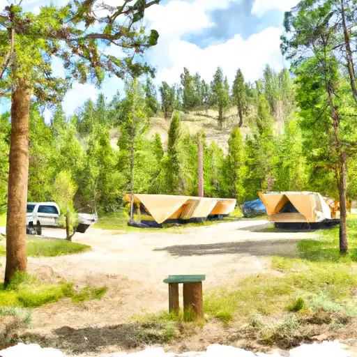
Trails End Campground
Community Reviews
Been here? Share the conditions.
Reviews, ratings & photos are added in the free Snoflo iOS app — rate a spot, tag the conditions, and your visit is verified by location. Add or manage your reviews from the app.
Trails End
The campground operates on a first-come, first-serve basis, with 17 campsites available for visitors. An interesting fact about the area is that it was once a stop for stagecoaches traveling between Lander and Yellowstone. The best time of year to visit is from June to August when the temperatures range from 70 to 85 degrees Fahrenheit. Visitors can enjoy hiking, fishing, and other outdoor activities during this time.
Overall, Trail's End Campground is an excellent choice for those seeking a peaceful and natural camping experience. With its beautiful surroundings and range of amenities, it's an ideal spot for both seasoned and novice campers.
What's on-site at Trails End
Key facilities Snoflo tracks for this campground. Confirm with the operator before booking -- amenities can change seasonally.
Plan your trip down to the hour
Same weather feed Snoflo's iOS app uses -- updated continuously from NOAA / yr.no.
Next 5 days, hour by hour
Temperature line with weather symbols on top, snow + rain accumulation as columns, humidity as a dotted line.
5-day forecast table
Every 3 hours, broken out across temperature, snow, rain, humidity, and wind. Each cell is colour-coded relative to the column min/max so trends jump out at a glance.
| Time | Condition | Temp (°F) | Snow (in) | Rain (in) | Humidity (%) | Wind (mps) | Wind dir |
|---|---|---|---|---|---|---|---|
| Loading detailed forecast… | |||||||
15-day temperature & precipitation
Daily temperatures, snow, and rain projected over the next two weeks. Hover any point for the full breakdown.
Other campgrounds in the area
Snoflo-tracked campsites within driving distance of Trails End, with reservations status.
| Campground | Reservations | Toilets | View |
|---|---|---|---|
| Fremont Lake Campground And Group Campground | ✓ | ✗ | → |
| Half Moon Lake | ✗ | ✓ | → |
| Half Moon Lake Campground | ✓ | ✗ | → |
| Fremont Lake | ✓ | ✓ | → |
| Soda Lake Whma - East Boat Ramp - Wgf | ✗ | ✓ | → |
Nearby streamflow
USGS streamgauges within reach of Trails End -- pulled live from the National Water Information System.
| Streamgauge | Discharge | View |
|---|---|---|
| Pine Creek Above Fremont Lake | 237 cfs | → |
| Green River At Warren Bridge | 769 cfs | → |
| Dinwoody Creek Above Lakes | 476 cfs | → |
| Bull Lake Creek Above Bull Lake | 677 cfs | → |
| New Fork River Near Big Piney | 701 cfs | → |
| Wind River Above Red Creek | 910 cfs | → |
Nearby snow depths
NRCS SNOTEL stations within reach of Trails End -- relevant when planning a shoulder-season or alpine trip.
| SNOTEL station | Snowpack | 24h Snowfall | View |
|---|---|---|---|
| Nohrsc Elkhart Park G.S. Snotel | 0.0 in | 0.0 in | → |
| Elkhart Park G.S. | 0.0 in | 0.0 in | → |
| New Fork Lake | 0.0 in | 0.0 in | → |
| Nohrsc New Fork Lake Snotel | 0.0 in | 0.0 in | → |
| Pinedale 1.9 Wsw | 0.0 in | 0.0 in | → |
| Pinedale 13.8 Nw | 0.3 in | 0.0 in | → |
Plan a longer trip
The closest parks, lakes, boat launches, and paddle runs so a camping night can grow into a full weekend.
Boat launches
- Halfmoon Lake
- Soda Lake
- Willow Lake
- Fremont Lake Boat Ramp
- North Boulder Lake Campground Boat Launch
Fishing spots
Camping essentials & Leave No Trace
- Pack it in, pack it out
- Take all trash, food scraps, and gear back with you to keep campsites clean and protect wildlife.
- Respect wildlife
- Observe animals from a distance, store food securely, and never feed wildlife to maintain natural behavior and safety.
- Know before you go
- Check weather, fire restrictions, trail conditions, and permit requirements to ensure a safe and well-planned trip.
- Minimize campfire impact
- Use established fire rings, keep fires small, fully extinguish them, or opt for a camp stove when fires are restricted.
- Leave what you find
- Preserve natural and cultural features by avoiding removal of plants, rocks, artifacts, or other elements of the environment.
Set push alerts in the Snoflo app
Save Trails End as a favorite, set a custom threshold (precipitation, snowpack, freezing temperatures), and the iOS app will push the moment conditions cross.
About Trails End
Can I make reservations at Trails End?
This campground does not appear to accept reservations -- it's typically first-come, first-served. Arrive early on summer weekends.
How fresh is the weather data on this page?
The hourly forecast updates throughout the day from the NOAA / yr.no public feeds. Streamflow data is pulled live from USGS streamgauges and snowpack from the NRCS SNOTEL network.
What's the best time of year to visit?
Use the 15-day temperature & precipitation outlook on this page to plan -- pick a window with comfortable temperatures and low precipitation. For longer trips, the 5-day hourly meteogram shows snow + rain accumulation hour-by-hour.
How do I get to Trails End?
Tap Directions in the hero above to open driving directions in Google Maps, or Open in map to center the Snoflo interactive map on the campground.
Can I get alerts when conditions change?
Yes -- alerts are managed through the Snoflo iOS app. Favorite this campground, set a threshold (temperature, snowpack, precipitation), and you'll get a push the moment it crosses.
Other campgrounds near here
Snoflo-tracked campgrounds within driving distance of Trails End.