Walton Creek campground
Community Reviews
Been here? Share the conditions.
Reviews, ratings & photos are added in the free Snoflo iOS app — rate a spot, tag the conditions, and your visit is verified by location. Add or manage your reviews from the app.
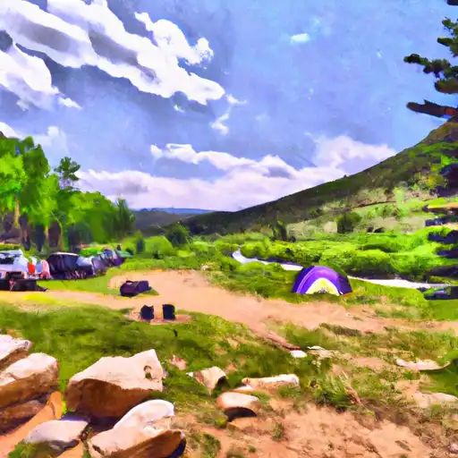
Walton Creek
An interesting fact about the area is that it was home to several Native American tribes, such as the Ute and Arapaho, and was used as a hunting ground for centuries. Today, visitors can still see evidence of the area's past with petroglyphs and other archaeological sites.
The best time of year to visit Walton Creek Camping Area is during the summer months, between June and August, when the average temperature is around 75 degrees Fahrenheit during the day and 40 degrees Fahrenheit at night. Visitors should come prepared for cooler temperatures, as the campground is at a higher elevation, and temperatures can drop significantly at night. Overall, the Walton Creek Camping Area is a great destination for anyone looking to enjoy the beauty of Colorado's mountains and forests.
What's on-site at Walton Creek
Key facilities Snoflo tracks for this campground. Confirm with the operator before booking -- amenities can change seasonally.
Plan your trip down to the hour
Same weather feed Snoflo's iOS app uses -- updated continuously from NOAA / yr.no.
Next 5 days, hour by hour
Temperature line with weather symbols on top, snow + rain accumulation as columns, humidity as a dotted line.
5-day forecast table
Every 3 hours, broken out across temperature, snow, rain, humidity, and wind. Each cell is colour-coded relative to the column min/max so trends jump out at a glance.
| Time | Condition | Temp (°F) | Snow (in) | Rain (in) | Humidity (%) | Wind (mps) | Wind dir |
|---|---|---|---|---|---|---|---|
| Loading detailed forecast… | |||||||
15-day temperature & precipitation
Daily temperatures, snow, and rain projected over the next two weeks. Hover any point for the full breakdown.
Other campgrounds in the area
Snoflo-tracked campsites within driving distance of Walton Creek, with reservations status.
| Campground | Reservations | Toilets | View |
|---|---|---|---|
| Meadows | ✗ | ✓ | → |
| Rabbit Ears Pass Camp | ✗ | ✗ | → |
| Dumont Lake | ✓ | ✓ | → |
| Dumont Lake Campground | ✓ | ✗ | → |
| Granite | ✗ | ✓ | → |
Nearby streamflow
USGS streamgauges within reach of Walton Creek -- pulled live from the National Water Information System.
| Streamgauge | Discharge | View |
|---|---|---|
| Walton Creek Near Steamboat Springs | 20 cfs | → |
| Fish Cr At Upper Sta Nr Steamboat Springs | 22 cfs | → |
| Yampa River Below Stagecoach Reservoir | 20 cfs | → |
| Yampa River At Steamboat Springs | 86 cfs | → |
| Yampa River Above Stagecoach Reservoir | 3 cfs | → |
| Elk River Near Milner | 246 cfs | → |
Nearby snow depths
NRCS SNOTEL stations within reach of Walton Creek -- relevant when planning a shoulder-season or alpine trip.
| SNOTEL station | Snowpack | 24h Snowfall | View |
|---|---|---|---|
| Rabbit Ears | 0.0 in | 0.0 in | → |
| Rabbit Ears | 0.0 in | 0.0 in | → |
| Nohrsc Columbine | 0.0 in | 0.0 in | → |
| Columbine | 0.0 in | 0.0 in | → |
| Steamboat Springs 0.7 Ese | 0.0 in | 0.0 in | → |
| Steamboat Springs 0.6 Nnw | 0.0 in | 0.0 in | → |
Plan a longer trip
The closest parks, lakes, boat launches, and paddle runs so a camping night can grow into a full weekend.
Parks
- Emerald Field
- Iron Springs Park
- Wilderness Mount Zirkel
- Stagecoach State Park
- Arapaho National Wildlife Refuge
- Wilderness Sarvis Creek
Boat launches
- Uncompahgre Road Routt County
- Stagecoach State Park
- Teal Lake Boating Site
- Seymour Lake State Wildlife Area
Fishing spots
Points of interest
- Sarvis Creek Patio/Observation
- Emerald Mountain Ridge Trailhead Kiosk
- Emerald Mountain Beall Trailhead Kiosk
- Emerald Mountain Ridge/Rotary Kiosk
- Wolford Red Desert Overlook
- Hebron Waterfowl Area
Paddle runs
- Lower Fish Creek
- Headwaters Of North, Middle And South Forks To Confluence Of South Fork With Encampment River
- Roaring Fork (West Section Line Sec 28 T9n, R82w); Red Canyon (Nw1/4 Sec 5, T8n, R82w) To East Section Line Sec 34, T9n, R82w
- Pumphouse To Double Bridges
- South Section Line Sec 34, T1n, R83w To Confluence With Decker Creek
- Colorado River Segment 4
Camping essentials & Leave No Trace
- Pack it in, pack it out
- Take all trash, food scraps, and gear back with you to keep campsites clean and protect wildlife.
- Respect wildlife
- Observe animals from a distance, store food securely, and never feed wildlife to maintain natural behavior and safety.
- Know before you go
- Check weather, fire restrictions, trail conditions, and permit requirements to ensure a safe and well-planned trip.
- Minimize campfire impact
- Use established fire rings, keep fires small, fully extinguish them, or opt for a camp stove when fires are restricted.
- Leave what you find
- Preserve natural and cultural features by avoiding removal of plants, rocks, artifacts, or other elements of the environment.
Set push alerts in the Snoflo app
Save Walton Creek as a favorite, set a custom threshold (precipitation, snowpack, freezing temperatures), and the iOS app will push the moment conditions cross.
About Walton Creek
Can I make reservations at Walton Creek?
This campground does not appear to accept reservations -- it's typically first-come, first-served. Arrive early on summer weekends.
How fresh is the weather data on this page?
The hourly forecast updates throughout the day from the NOAA / yr.no public feeds. Streamflow data is pulled live from USGS streamgauges and snowpack from the NRCS SNOTEL network.
What's the best time of year to visit?
Use the 15-day temperature & precipitation outlook on this page to plan -- pick a window with comfortable temperatures and low precipitation. For longer trips, the 5-day hourly meteogram shows snow + rain accumulation hour-by-hour.
How do I get to Walton Creek?
Tap Directions in the hero above to open driving directions in Google Maps, or Open in map to center the Snoflo interactive map on the campground.
Can I get alerts when conditions change?
Yes -- alerts are managed through the Snoflo iOS app. Favorite this campground, set a threshold (temperature, snowpack, precipitation), and you'll get a push the moment it crosses.
Other campgrounds near here
Snoflo-tracked campgrounds within driving distance of Walton Creek.