

-
 Snoflo Premium
Get unlimited access to all our content
With no Ad interruptions! - Start Your Free Trial Login with existing account
Tonto-Basin
Eden Index
Climate
9.2
•
Recreation
4.8
•
Community
•
Safeguard
5.4/10
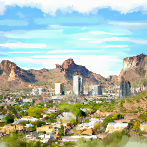
Tonto Basin is a small community located in Gila County, Arizona. The area is characterized by its diverse climate, beautiful landscapes, and abundant outdoor recreation opportunities.
Climate-wise, Tonto Basin experiences hot and dry summers with temperatures often exceeding 100°F (38°C), while winters are mild with occasional frost and daytime temperatures ranging from 50°F to 70°F (10°C to 21°C). The area receives most of its rainfall during the summer monsoon season, typically between July and September.
Tonto Basin is surrounded by several hydrological features, including the Tonto Creek and Roosevelt Lake. Tonto Creek offers opportunities for fishing, tubing, and kayaking, while Roosevelt Lake provides ample opportunities for boating, water skiing, and fishing for various species such as bass and catfish.
Outdoor enthusiasts will find numerous recreational activities in Tonto Basin. The Tonto National Forest offers hiking and mountain biking trails, camping areas, and picnic spots. Tonto National Monument, located nearby, features ancient cliff dwellings and provides educational and cultural experiences for visitors.
In summary, Tonto Basin, Arizona offers a unique blend of diverse climate, hydrological features, and outdoor recreation opportunities, making it an attractive destination for nature lovers and adventure seekers alike.
What is the Eden Index?
The Snoflo Eden Index serves as a comprehensive rating system for regions, evaluating their desirability through a holistic assessment of climate health, outdoor recreation opportunities, and natural disaster risk, acknowledging the profound impact of these factors on livability and well-being.
Climate Health Indicator (CHI): 9.2
Tonto-Basin receives approximately
481mm of rain per year,
with humidity levels near 46%
and air temperatures averaging around
19°C.
Tonto-Basin has a plant hardyness factor of
9, meaning
plants and agriculture in this region tend to thrive here all year round.
By considering the ideal temperature range, reliable water supplies, clean air, and stable seasonal rain or snowpacks, the Climate Health Indicator (CHI) underscores the significance of a healthy climate as the foundation for quality living.
A healthy climate is paramount for ensuring a high quality of life and livability in a region, fostering both physical well-being and environmental harmony. This can be characterized by ideal temperatures, reliable access to water supplies, clean air, and consistent seasonal rain or snowpacks.
Weather Forecast
Streamflow Conditions
Salt
Area Rivers
Salt
Snowpack Depths
Salt
Reservoir Storage Capacity
Salt
Groundwater Levels
Recreational Opportunity Index (ROI): 4.8
The Recreational Opportunity Index (ROI) recognizes the value of outdoor recreational options, such as parks, hiking trails, camping sites, and fishing spots, while acknowledging that climate plays a pivotal role in ensuring the comfort and consistency of these experiences.
Access to outdoor recreational opportunities, encompassing activities such as parks, hiking, camping, and fishing, is crucial for overall well-being, and the climate plays a pivotal role in enabling and enhancing these experiences, ensuring that individuals can engage in nature-based activities comfortably and consistently.
Camping Areas
| Campground | Campsites | Reservations | Toilets | Showers | Elevation |
|---|---|---|---|---|---|
| Davis Wash | 30 | 1,972 ft | |||
| Windy Hill | 347 | 2,167 ft | |||
| Crabtree Wash | 30 | 1,948 ft | |||
| Cholla Bay | 20 | 2,149 ft | |||
| Bachelors Cove | 100 | 2,133 ft | |||
| Tortilla | 76 | 1,727 ft | |||
| Burnt Corral | 13 | 1,940 ft | |||
| Lost Dutchman State Park | 70 | 2,068 ft | |||
| Mills Cove | 10 | 2,176 ft | |||
| Upper Burnt Corral | 30 | 1,951 ft |
Nearby Fishing
Catastrophe Safeguard Index (CSI):
The Catastrophe Safeguard Index (CSI) recognizes that natural disaster risk, encompassing floods, fires, hurricanes, and tornadoes, can drastically affect safety and the overall appeal of an area.
The level of natural disaster risk in a region significantly affects safety and the overall livability, with climate change amplifying these risks by potentially increasing the frequency and intensity of events like floods, fires, hurricanes, and tornadoes, thereby posing substantial challenges to community resilience and well-being.
Community Resilience Indicator (CRI):
The Community Resilience Indicator (CRI) recognizes that education, healthcare, and socioeconomics are crucial to the well-being of a region. The CRI acknowledges the profound impact of these elements on residents' overall quality of life. By evaluating educational resources, healthcare accessibility, and economic inclusivity, the index captures the essential aspects that contribute to a thriving community, fostering resident satisfaction, equity, and social cohesion.