Crabtree Wash Campground
Community Reviews
Been here? Share the conditions.
Reviews, ratings & photos are added in the free Snoflo iOS app — rate a spot, tag the conditions, and your visit is verified by location. Add or manage your reviews from the app.
Crabtree Wash
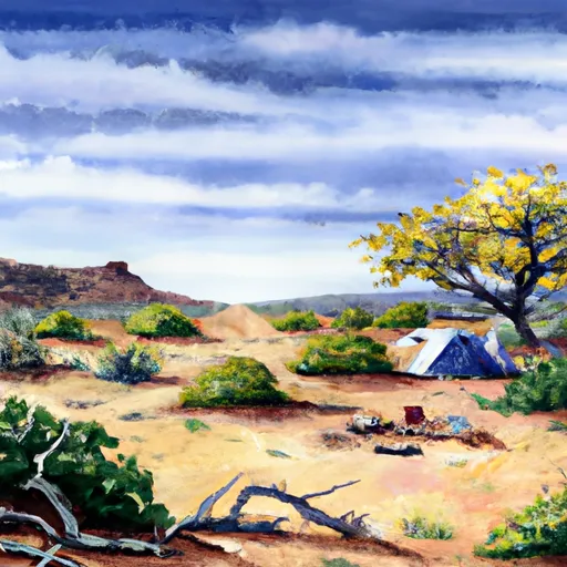
One of the notable aspects of Crabtree Wash camping area is that reservations are not accepted. This means that campsites are available on a first-come, first-served basis, adding an element of spontaneity to your camping trip. It is advisable to arrive early to secure a spot, especially during peak seasons.
The best time to visit Crabtree Wash camping area is during the spring and fall months when the temperatures are milder. Summers can be scorchingly hot, while winters can be quite chilly. As for the specific attractions in the area, Crabtree Wash offers access to the stunning Mogollon Rim and the nearby Tonto National Forest. Hikers and nature enthusiasts will appreciate the picturesque trails and breathtaking views.
While enjoying your time at Crabtree Wash, it is vital to be cautious of potential dangers. The area is known for flash floods during monsoon season, so it is important to monitor weather conditions and be aware of higher ground. Additionally, it is advisable to bring sufficient water and supplies, as the campground does not offer potable water or hookups.
In conclusion, Crabtree Wash camping area in Arizona is a fantastic destination for those seeking a rustic camping experience. With its amenities, first-come, first-served policy, and beautiful natural surroundings, it is a must-visit location for outdoor enthusiasts. Just remember to plan your visit during the optimal seasons, be cautious of flash floods, and come prepared with essential supplies.
What's on-site at Crabtree Wash
Key facilities Snoflo tracks for this campground. Confirm with the operator before booking -- amenities can change seasonally.
Plan your trip down to the hour
Same weather feed Snoflo's iOS app uses -- updated continuously from NOAA / yr.no.
Next 5 days, hour by hour
Temperature line with weather symbols on top, snow + rain accumulation as columns, humidity as a dotted line.
5-day forecast table
Every 3 hours, broken out across temperature, snow, rain, humidity, and wind. Each cell is colour-coded relative to the column min/max so trends jump out at a glance.
| Time | Condition | Temp (°F) | Snow (in) | Rain (in) | Humidity (%) | Wind (mps) | Wind dir |
|---|---|---|---|---|---|---|---|
| Loading detailed forecast… | |||||||
15-day temperature & precipitation
Daily temperatures, snow, and rain projected over the next two weeks. Hover any point for the full breakdown.
Other campgrounds in the area
Snoflo-tracked campsites within driving distance of Crabtree Wash, with reservations status.
| Campground | Reservations | Toilets | View |
|---|---|---|---|
| Crabtree Wash Dispersed | ✗ | ✗ | → |
| Davis Wash | ✗ | ✗ | → |
| Davis Wash Dispersed | ✗ | ✗ | → |
| Burnt Corral Campground And Day Use Area | ✓ | ✗ | → |
| Lower Burnt Corral Dispersed | ✗ | ✗ | → |
Nearby streamflow
USGS streamgauges within reach of Crabtree Wash -- pulled live from the National Water Information System.
| Streamgauge | Discharge | View |
|---|---|---|
| Pinto Creek Near Miami | 252 cfs | → |
| Pinto Cr Blw Haunted Canyon Nr Miami | 325 cfs | → |
| Sycamore Creek Near Fort Mcdowell | 11 cfs | → |
| Salt River Blw Stewart Mountain Dam | 445 cfs | → |
| Queen Creek Below Whitlow Dam Nr Superior | 13 cfs | → |
| Salt River Near Roosevelt | 669 cfs | → |
Nearby snow depths
NRCS SNOTEL stations within reach of Crabtree Wash -- relevant when planning a shoulder-season or alpine trip.
| SNOTEL station | Snowpack | 24h Snowfall | View |
|---|---|---|---|
| Workman Creek | 0.0 in | 0.0 in | → |
| Fountain Hills 1.2 Nne | 0.0 in | 0.0 in | → |
Plan a longer trip
The closest parks, lakes, boat launches, and paddle runs so a camping night can grow into a full weekend.
Parks
- Tonto National Monument
- Wilderness Four Peaks
- Lost Dutchman State Park
- Superstition Wilderness Water Sources, Plo 5368
- Wilderness Salome
- Wilderness Salt River Canyon
Boat launches
- Apache Lake Maricopa County
- Apache Lake - 3
- Apache Lake - 1
- Service Road 183 Maricopa County
- Roosevelt Lake - 4
- Roosevelt Lake - 5
Fishing spots
- Theodore Roosevelt Lake
- Cherry Creek
- Bartlett Reservoir
- Queen Creek
- Deadman Creek
- South Fork Deadman Creek
Points of interest
- Black Rock
- Upper Cliff Dwelling
- Lower Cliff Dwelling
- Circlestone
- Kvit-Fm (Apache Junction)
- Peephole And Little Arch
Paddle runs
- Boundary Of The Primary Jurisdiction Below Stewart Mountain Dam To Salt River Indian Reservation Boundary
- Lower Salt
- Southwest Boundary Of Salt River Canyon Wilderness To State Highway 288 Bridge
- Salt River Indian Reservation Boundary To Immediately Above Granite Reef Dam Impoundment
- Telegraph Creek - Forest Road #4 To Confluence With Arnett Creek
- Arnett Creek - Forest Road #4 To Middle Of Sec 7,T2s, R12e
Camping essentials & Leave No Trace
- Pack it in, pack it out
- Take all trash, food scraps, and gear back with you to keep campsites clean and protect wildlife.
- Respect wildlife
- Observe animals from a distance, store food securely, and never feed wildlife to maintain natural behavior and safety.
- Know before you go
- Check weather, fire restrictions, trail conditions, and permit requirements to ensure a safe and well-planned trip.
- Minimize campfire impact
- Use established fire rings, keep fires small, fully extinguish them, or opt for a camp stove when fires are restricted.
- Leave what you find
- Preserve natural and cultural features by avoiding removal of plants, rocks, artifacts, or other elements of the environment.
Set push alerts in the Snoflo app
Save Crabtree Wash as a favorite, set a custom threshold (precipitation, snowpack, freezing temperatures), and the iOS app will push the moment conditions cross.
About Crabtree Wash
Can I make reservations at Crabtree Wash?
This campground does not appear to accept reservations -- it's typically first-come, first-served. Arrive early on summer weekends.
How fresh is the weather data on this page?
The hourly forecast updates throughout the day from the NOAA / yr.no public feeds. Streamflow data is pulled live from USGS streamgauges and snowpack from the NRCS SNOTEL network.
What's the best time of year to visit?
Use the 15-day temperature & precipitation outlook on this page to plan -- pick a window with comfortable temperatures and low precipitation. For longer trips, the 5-day hourly meteogram shows snow + rain accumulation hour-by-hour.
How do I get to Crabtree Wash?
Tap Directions in the hero above to open driving directions in Google Maps, or Open in map to center the Snoflo interactive map on the campground.
Can I get alerts when conditions change?
Yes -- alerts are managed through the Snoflo iOS app. Favorite this campground, set a threshold (temperature, snowpack, precipitation), and you'll get a push the moment it crosses.
Other campgrounds near here
Snoflo-tracked campgrounds within driving distance of Crabtree Wash.