Tsala Apopka Chain Fishing
As of July 22, 2026, the nearest streamgauge to Tsala Apopka Chain — Withlacoochee River Nr Inverness — reports 83 cfs. Source: USGS gauge data, refreshed throughout the day.
Community Reviews
Been here? Share the conditions.
Reviews, ratings & photos are added in the free Snoflo iOS app — rate a spot, tag the conditions, and your visit is verified by location. Add or manage your reviews from the app.
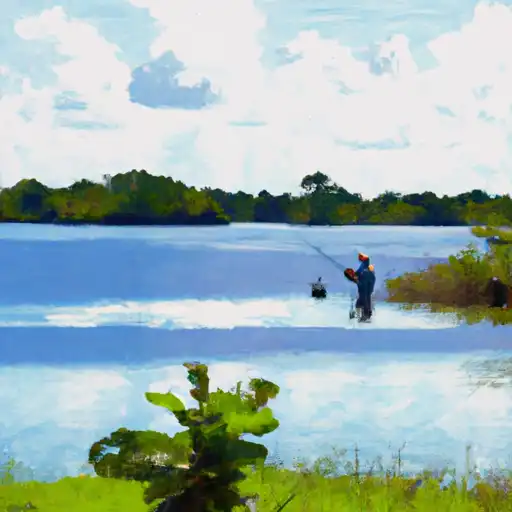
Tsala Apopka Chain
What's biting at Tsala Apopka Chain
Species commonly reported here -- tap any card for techniques, target seasons, and other waters where it's been caught.
Plan your trip down to the hour
Same weather feed Snoflo's iOS app uses -- updated continuously from NOAA / yr.no.
Next 5 days, hour by hour
Temperature line with weather symbols on top, snow + rain accumulation as columns, humidity as a dotted line.
5-day forecast table
Every 3 hours, broken out across temperature, snow, rain, humidity, and wind. Each cell is colour-coded relative to the column min/max so trends jump out at a glance.
| Time | Condition | Temp (°F) | Snow (in) | Rain (in) | Humidity (%) | Wind (mps) | Wind dir |
|---|---|---|---|---|---|---|---|
| Loading detailed forecast… | |||||||
15-day temperature & precipitation
Daily temperatures, snow, and rain projected over the next two weeks. Hover any point for the full breakdown.
Nearby streamflow
USGS streamgauges within reach of Tsala Apopka Chain -- updated continuously from the National Water Information System.
| Streamgauge | Discharge | View |
|---|---|---|
| Withlacoochee River Nr Inverness | 83 cfs | → |
| Withlacoochee River Nr Rutland | 149 cfs | → |
| Withlacoochee River Nr Holder | 221 cfs | → |
| Withlacoochee R At Wysong Dam At Carlson | 88 cfs | → |
| Withlacoochee River Nr Floral City | 0 cfs | → |
| Outlet River At Panacoochee Retreats | 69 cfs | → |
Plan a longer trip
The closest campgrounds, parks, boat launches, and reservoirs so a fishing run can grow into a weekend.
Campgrounds
- Holder Mine - Withlacoochee State Forest
- Withlacoochee State Forest Mutual Mine Recreation Area
- Ross Prairie Primitive Campsite
- Ross Prairie Campground And Trailhead
- Ross Prairie
- Shangri-La Campground And Trailhead
Parks
- Potts Wildlife Management Area
- Holden Community Park
- Fort Cooper State Park
- Half Moon Wildlife Management Area
- Central Ridge District Park
- Ross Prairie State Park
Reservoirs
- Brogden Bridge
- Structure 353
- Golf Course
- Moccasin Slough Structure
- Rufe Wysong Dam And Navigation Lock
- Floral City
Boat launches
- North Apopka Avenue Inverness
- Highway 44 1025, Inverness
- East Turner Camp Road 9499, Citrus County
- Park Lake Terrace, Inverness
- Lake Hernando Park
- Highway 44 6411-6533, Lake Panasoffkee
Points of interest
- Old Courthouse Heritage Museum
- Floral City Heritage Museum
- Historic Duval House
- Museum Of Drag Racing
- Rainbow Springs State Park Tube Rentals
- Captain Mike’S “Swimming With The Manatees”
Paddle runs
- Segment A--Mouth Of Spring On Ocala Nf (At Juniper Springs Wilderness) To Bridge On Sh 19 (At Wilderness Boundary)
- Segment B--Bridge On Sh 19 To Confluence With Lake George
- Segment A--Mouth Of Spring On Ocala Nf To Alexander Springs Wilderness Boundary
- Segment B--Alexander Springs Wilderness Boundary To Confluence With St. Johns River
Angling safety & ethics
- Know the regulations
- Check local fishing rules, seasons, size limits, and license requirements to ensure legal and sustainable angling.
- Handle fish responsibly
- Use wet hands, minimize air exposure, and release fish gently to improve survival rates when practicing catch-and-release.
- Choose the right gear
- Match your rod, line, and tackle to the species and conditions to increase success and reduce unnecessary harm to fish.
- Respect the waterway
- Avoid disturbing habitat, prevent bank erosion, and keep a safe distance from spawning areas to protect ecosystems.
- Keep it clean
- Pack out all line, hooks, bait containers, and trash. Discarded gear can injure wildlife and degrade waterways.
Set push alerts in the Snoflo app
Save Tsala Apopka Chain as a favorite, set a custom threshold (water temperature, streamflow, snowpack), and the iOS app will push the moment conditions cross.
About Tsala Apopka Chain
What fish species are found at Tsala Apopka Chain?
Snoflo tracks the species commonly reported at Tsala Apopka Chain -- see the Fish Species panel above for the live list with images and links to per-species pages.
How fresh is the weather data on this page?
The hourly forecast updates throughout the day from the NOAA / yr.no public feeds. Streamflow data comes live from USGS streamgauges, also refreshed continuously.
Can I get alerts when conditions change?
Yes -- alerts are managed through the Snoflo iOS app. Favorite this area, set a threshold (water temperature, streamflow, snowpack), and you'll get a push the moment it crosses.
Do I need a fishing license?
Yes. Check your state agency's regulations for license requirements, seasons, size limits, and any waterbody-specific rules before fishing Tsala Apopka Chain.
How do I get to Tsala Apopka Chain?
Tap Open in map in the hero above to center the Snoflo interactive map on this area, or grab the coordinates from the location facts panel.
Other angling spots near here
Snoflo-tracked fishing areas within driving distance of Tsala Apopka Chain.