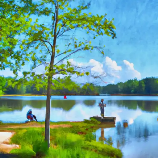
Twin Lakes Fishing
As of July 17, 2026, the nearest streamgauge to Twin Lakes — Middle Oconee River Near Arcade — reports 251 cfs. Source: USGS gauge data, refreshed throughout the day.
Community Reviews
Been here? Share the conditions.
Reviews, ratings & photos are added in the free Snoflo iOS app — rate a spot, tag the conditions, and your visit is verified by location. Add or manage your reviews from the app.
Twin Lakes
What's biting at Twin Lakes
Species commonly reported here -- tap any card for techniques, target seasons, and other waters where it's been caught.
Plan your trip down to the hour
Same weather feed Snoflo's iOS app uses -- updated continuously from NOAA / yr.no.
Next 5 days, hour by hour
Temperature line with weather symbols on top, snow + rain accumulation as columns, humidity as a dotted line.
5-day forecast table
Every 3 hours, broken out across temperature, snow, rain, humidity, and wind. Each cell is colour-coded relative to the column min/max so trends jump out at a glance.
| Time | Condition | Temp (°F) | Snow (in) | Rain (in) | Humidity (%) | Wind (mps) | Wind dir |
|---|---|---|---|---|---|---|---|
| Loading detailed forecast… | |||||||
15-day temperature & precipitation
Daily temperatures, snow, and rain projected over the next two weeks. Hover any point for the full breakdown.
Nearby streamflow
USGS streamgauges within reach of Twin Lakes -- updated continuously from the National Water Information System.
| Streamgauge | Discharge | View |
|---|---|---|
| Middle Oconee River Near Arcade | 251 cfs | → |
| Wheeler Creek At Bill Cheek Road | 1 cfs | → |
| Apalachee River At Fence Road | 5 cfs | → |
| Alcovy River At New Hope Road | 24 cfs | → |
| Alcovy River Near Lawrenceville | 8 cfs | → |
| Middle Oconee River Near Athens | 150 cfs | → |
Plan a longer trip
The closest campgrounds, parks, boat launches, and reservoirs so a fishing run can grow into a weekend.
Parks
- Winder Lions Club
- Barrow County Recreation Department
- Fort Yargo State Park
- Auburn City Park
- Little Mulberry River Park
- Dacula Park
Reservoirs
- Edwards Lower Twin Lake Dam
- Outz Dam
- Fort Yargo Lake State Park Dam
- Masseys Lake Dam
- White Lake Dam
- Marbury Creek Ws Str # 22
Boat launches
- Fort Yargo State Park East
- Fort Yargo State Park West
- Bear Creek Reservoir
- Tribble Mill Park
- Lake Chapman
- Hideaway Bay Marina
Points of interest
- Crawford W Long Medical Museum
- Pendergrass Flea Market
- Elisha Winn House
- Chevrolet 3100
- Taylor-Grady House
- Athens Confederate Monument
Paddle runs
- Lloyd Shoals Dam On Lake Jackson To Georgia State Highway 16
- Martin Branch Bridge To Robertsontown Bridge On Ga Highway 356
- Confluence Of Brasstown Creek And Little Brasstown Creek Just South Of Brasstown Falls Road (Fs 751) To Confluence Of Mill Branch, Brasstown Creek And Boatwright Creek Near Boatwright Road (Fs 753)
- Nf Boundary To Glenwood Springs/Lake Sinclair
- Georgia State Highway 16 To East Juliette Dam
- Old Turnpike Crossing To Martin Branch Bridge
Angling safety & ethics
- Know the regulations
- Check local fishing rules, seasons, size limits, and license requirements to ensure legal and sustainable angling.
- Handle fish responsibly
- Use wet hands, minimize air exposure, and release fish gently to improve survival rates when practicing catch-and-release.
- Choose the right gear
- Match your rod, line, and tackle to the species and conditions to increase success and reduce unnecessary harm to fish.
- Respect the waterway
- Avoid disturbing habitat, prevent bank erosion, and keep a safe distance from spawning areas to protect ecosystems.
- Keep it clean
- Pack out all line, hooks, bait containers, and trash. Discarded gear can injure wildlife and degrade waterways.
Set push alerts in the Snoflo app
Save Twin Lakes as a favorite, set a custom threshold (water temperature, streamflow, snowpack), and the iOS app will push the moment conditions cross.
About Twin Lakes
What fish species are found at Twin Lakes?
Snoflo tracks the species commonly reported at Twin Lakes -- see the Fish Species panel above for the live list with images and links to per-species pages.
How fresh is the weather data on this page?
The hourly forecast updates throughout the day from the NOAA / yr.no public feeds. Streamflow data comes live from USGS streamgauges, also refreshed continuously.
Can I get alerts when conditions change?
Yes -- alerts are managed through the Snoflo iOS app. Favorite this area, set a threshold (water temperature, streamflow, snowpack), and you'll get a push the moment it crosses.
Do I need a fishing license?
Yes. Check your state agency's regulations for license requirements, seasons, size limits, and any waterbody-specific rules before fishing Twin Lakes.
How do I get to Twin Lakes?
Tap Open in map in the hero above to center the Snoflo interactive map on this area, or grab the coordinates from the location facts panel.
Other angling spots near here
Snoflo-tracked fishing areas within driving distance of Twin Lakes.