Forest Road 132c To Forest Raod 179 River Run
Community Reviews
Been here? Share the conditions.
Reviews, ratings & photos are added in the free Snoflo iOS app — rate a spot, tag the conditions, and your visit is verified by location. Add or manage your reviews from the app.
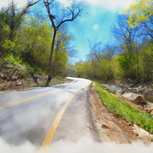
Forest Road 132c To Forest Raod 179
The segment mileage for the run is approximately 7 miles, starting at Forest Road 132C and ending at Forest Road 179. Along the way, there are several notable rapids and obstacles, including "Little Niagara," "S-Turn," and "The Big Slide." These rapids offer exciting challenges for experienced paddlers, but can be dangerous for those without proper training and equipment.
There are several regulations in place for the Whitewater River Run, including a requirement for all paddlers to wear personal flotation devices (PFDs) and helmets. Additionally, visitors are encouraged to practice Leave No Trace principles and respect private property along the river.
Plan your run down to the hour
Same weather feed Snoflo's iOS app uses -- updated continuously from NOAA / yr.no. Watch the precipitation column on the meteogram; rain ahead of a run typically lifts flows 12-48 hours later depending on the basin.
Next 5 days, hour by hour
Temperature line with weather symbols on top, snow + rain accumulation as columns, humidity as a dotted line.
5-day forecast table
Every 3 hours, broken out across temperature, snow, rain, humidity, and wind. Each cell is colour-coded relative to the column min/max.
| Time | Condition | Temp (°F) | Snow (in) | Rain (in) | Humidity (%) | Wind (mps) | Wind dir |
|---|---|---|---|---|---|---|---|
| Loading detailed forecast… | |||||||
15-day temperature & precipitation
Daily temperatures, snow, and rain projected over the next two weeks -- the upstream story that drives next week's flows.
Regional streamflow levels
USGS streamgauges around Forest Road 132c To Forest Raod 179 -- useful for spotting upstream pulses and gauging which tributary is contributing what.
| Streamgauge | Discharge | View |
|---|---|---|
| Maumelle River At Williams Junction | 0 cfs | → |
| Alum Fork Saline River Near Reform | 0 cfs | → |
| Fourche Lafave River Near Aplin | 78 cfs | → |
| Lake Maumelle At State Hwy 10 Near Wye | 293 cfs | → |
| Maumelle River At Maumelle Dam At Natural Steps | · | → |
| Saline River At Benton | 5 cfs | → |
Plan a longer trip
The closest boat launches, other paddle runs, and campgrounds so a day on the water can grow into a full weekend.
Boat launches
Other river runs
- Headwaters Sec 2, T2n, R18w To Forest Road 132c
- Forest Road 179 To East Line Of Nw 1/4 Sec 22, T2n, R17w
- East Line Of Nw 1/4, Sec 22, T2n, R17w To West Line Of Sec 26, T2n, R17w
- Lake Winona Dam To Southern Line Of Sec 16, T2n, R17w
- Headwaters Sec 2, T1n, R20w To Sec 7, T1n, R19w
Campgrounds
Fishing spots
Whitewater safety
- Check the flow before you run
- Use the linked-gauge card and Regional Flow panel above. Class ratings change with flow -- a Class III at low water can become Class IV+ at high water.
- Know your skill ceiling
- Pick runs comfortably below your ceiling. Cold-water and big-water runs raise the consequences of any mistake.
- Wear the right gear
- Helmet, PFD, drysuit / wetsuit when water is below 60°F. Throw bag, knife, and whistle on your person, not in the boat.
- Scout, set safety, and run with a team
- Scout new rapids on foot, set safety with throw bags above the consequence pool, and run with at least one other competent paddler.
- Respect the river
- Strainers, undercuts, low-head dams, and wood can kill at any class rating. When in doubt, portage.
Set push alerts in the Snoflo app
Save Forest Road 132c To Forest Raod 179 as a favorite, set a discharge threshold (e.g. "alert me when flow hits 600 cfs"), and the iOS app pushes the moment the linked gauge crosses.
About Forest Road 132c To Forest Raod 179
What's the optimal flow for Forest Road 132c To Forest Raod 179?
The optimal flow depends on the section and the craft. Check the Run Details panel for the linked gauge and current status.
How fresh is the cfs reading on this page?
The linked USGS streamgauge reports continuously (every 15 minutes); Snoflo refreshes throughout the day. Hover the streamflow sparkline to read individual datapoints.
What's the whitewater class?
See the Run Details panel for the class rating Snoflo tracks for this run. Class ratings change with flow -- a Class III at low water can become Class IV in high water.
Where do I put in / take out?
Tap Directions in the hero above to open driving directions to the put-in. For shuttle planning, check the Nearby Boat Launches panel and the river run operator's site.
Can I get alerts when flows hit the optimal range?
Yes -- alerts are managed in the Snoflo iOS app. Favorite this run, set a discharge threshold, and you'll get a push the moment the gauge crosses.
Other runs near here
Snoflo-tracked paddle runs within driving distance of Forest Road 132c To Forest Raod 179.