Headwaters Near The Tuolumne And Mariposa County Lines To Western Boundary Of Yosemite National Park River Run
Community Reviews
Been here? Share the conditions.
Reviews, ratings & photos are added in the free Snoflo iOS app — rate a spot, tag the conditions, and your visit is verified by location. Add or manage your reviews from the app.
Headwaters Near The Tuolumne And Mariposa County Lines To Western Boundary Of Yosemite National Park
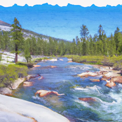
The segment mileage of this river run is approximately 27 miles, starting from the headwaters near the Tuolumne and Mariposa County lines and ending at the western boundary of Yosemite National Park. Along the way, paddlers will encounter a variety of challenging rapids and obstacles, including the infamous Clavey Falls. This rapid is known for its steep drop and technical maneuvering requirements, making it a highlight of the Whitewater River Run.
In addition to the inherent difficulty of this river run, there are also specific regulations that must be followed by anyone attempting the Whitewater River Run. These regulations include permits, safety equipment requirements, and restrictions on camping and fire use in the area. It is important for paddlers to familiarize themselves with these regulations before attempting the Whitewater River Run to ensure a safe and enjoyable experience.
Plan your run down to the hour
Same weather feed Snoflo's iOS app uses -- updated continuously from NOAA / yr.no. Watch the precipitation column on the meteogram; rain ahead of a run typically lifts flows 12-48 hours later depending on the basin.
Next 5 days, hour by hour
Temperature line with weather symbols on top, snow + rain accumulation as columns, humidity as a dotted line.
5-day forecast table
Every 3 hours, broken out across temperature, snow, rain, humidity, and wind. Each cell is colour-coded relative to the column min/max.
| Time | Condition | Temp (°F) | Snow (in) | Rain (in) | Humidity (%) | Wind (mps) | Wind dir |
|---|---|---|---|---|---|---|---|
| Loading detailed forecast… | |||||||
15-day temperature & precipitation
Daily temperatures, snow, and rain projected over the next two weeks -- the upstream story that drives next week's flows.
Regional streamflow levels
USGS streamgauges around Headwaters Near The Tuolumne And Mariposa County Lines To Western Boundary Of Yosemite National Park -- useful for spotting upstream pulses and gauging which tributary is contributing what.
| Streamgauge | Discharge | View |
|---|---|---|
| Tuolumne R A Grand Cyn Of Tuolumne Ab Hetch Hetchy | 131 cfs | → |
| Merced R A Pohono Bridge Nr Yosemite Ca | 128 cfs | → |
| Merced R A Happy Isles Bridge Nr Yosemite Ca | 97 cfs | → |
| Tuolumne R Nr Hetch Hetchy Ca | 113 cfs | → |
| Eleanor C Nr Hetch Hetchy Ca | 22 cfs | → |
| Lk Eleanor Div To Cherry Lake Nr Hetch Hetchy Ca | 1 cfs | → |
Plan a longer trip
The closest boat launches, other paddle runs, and campgrounds so a day on the water can grow into a full weekend.
Other river runs
- Confluence With Middle Fork Tuolumne River To Confluence With Tuolumne River
- Snow Lake To Hoover Wilderness Boundary
- Headwaters Tributaries To Research Natural Area Boundary
- Saddlebag Lake Rna Boundary To State Highway 120
Campgrounds
- Yosemite Creek
- Yosemite Creek Campground
- Yosemite Creek - Yosemite National Park
- White Wolf
- White Wolf - Yosemite National Park
- Porcupine Flat Campground
Fishing spots
Whitewater safety
- Check the flow before you run
- Use the linked-gauge card and Regional Flow panel above. Class ratings change with flow -- a Class III at low water can become Class IV+ at high water.
- Know your skill ceiling
- Pick runs comfortably below your ceiling. Cold-water and big-water runs raise the consequences of any mistake.
- Wear the right gear
- Helmet, PFD, drysuit / wetsuit when water is below 60°F. Throw bag, knife, and whistle on your person, not in the boat.
- Scout, set safety, and run with a team
- Scout new rapids on foot, set safety with throw bags above the consequence pool, and run with at least one other competent paddler.
- Respect the river
- Strainers, undercuts, low-head dams, and wood can kill at any class rating. When in doubt, portage.
Set push alerts in the Snoflo app
Save Headwaters Near The Tuolumne And Mariposa County Lines To Western Boundary Of Yosemite National Park as a favorite, set a discharge threshold (e.g. "alert me when flow hits 600 cfs"), and the iOS app pushes the moment the linked gauge crosses.
About Headwaters Near The Tuolumne And Mariposa County Lines To Western Boundary Of Yosemite National Park
What's the optimal flow for Headwaters Near The Tuolumne And Mariposa County Lines To Western Boundary Of Yosemite National Park ?
The optimal flow depends on the section and the craft. Check the Run Details panel for the linked gauge and current status.
How fresh is the cfs reading on this page?
The linked USGS streamgauge reports continuously (every 15 minutes); Snoflo refreshes throughout the day. Hover the streamflow sparkline to read individual datapoints.
What's the whitewater class?
See the Run Details panel for the class rating Snoflo tracks for this run. Class ratings change with flow -- a Class III at low water can become Class IV in high water.
Where do I put in / take out?
Tap Directions in the hero above to open driving directions to the put-in. For shuttle planning, check the Nearby Boat Launches panel and the river run operator's site.
Can I get alerts when flows hit the optimal range?
Yes -- alerts are managed in the Snoflo iOS app. Favorite this run, set a discharge threshold, and you'll get a push the moment the gauge crosses.
Other runs near here
Snoflo-tracked paddle runs within driving distance of Headwaters Near The Tuolumne And Mariposa County Lines To Western Boundary Of Yosemite National Park .