Ellicots Bridge To Big Grizzly Canyon River Run
Community Reviews
Been here? Share the conditions.
Reviews, ratings & photos are added in the free Snoflo iOS app — rate a spot, tag the conditions, and your visit is verified by location. Add or manage your reviews from the app.
Ellicots Bridge To Big Grizzly Canyon
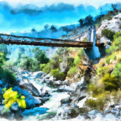
The segment mileage for this section of the river is approximately 10 miles, with notable rapids such as Toilet Bowl, Pinball, and Deadman's Curve. These rapids are known for their steep drops, tight turns, and challenging obstacles that require skilled maneuvering. It is important for kayakers and rafters to have prior experience and proper equipment when attempting this run.
Specific regulations for this area include a permit requirement for commercial operations, as well as restrictions on group sizes and camping. It is also important to note that the river is located within the San Bernardino National Forest and is subject to rules and regulations set by the forest service.
Overall, the Whitewater River Run from Ellicots Bridge to Big Grizzly Canyon is a challenging and exciting experience for experienced whitewater enthusiasts. It is important to check streamflow levels and adhere to regulations in order to have a safe and enjoyable trip on the river.
Plan your run down to the hour
Same weather feed Snoflo's iOS app uses -- updated continuously from NOAA / yr.no. Watch the precipitation column on the meteogram; rain ahead of a run typically lifts flows 12-48 hours later depending on the basin.
Next 5 days, hour by hour
Temperature line with weather symbols on top, snow + rain accumulation as columns, humidity as a dotted line.
5-day forecast table
Every 3 hours, broken out across temperature, snow, rain, humidity, and wind. Each cell is colour-coded relative to the column min/max.
| Time | Condition | Temp (°F) | Snow (in) | Rain (in) | Humidity (%) | Wind (mps) | Wind dir |
|---|---|---|---|---|---|---|---|
| Loading detailed forecast… | |||||||
15-day temperature & precipitation
Daily temperatures, snow, and rain projected over the next two weeks -- the upstream story that drives next week's flows.
Regional streamflow levels
USGS streamgauges around Ellicots Bridge To Big Grizzly Canyon -- useful for spotting upstream pulses and gauging which tributary is contributing what.
| Streamgauge | Discharge | View |
|---|---|---|
| Pilot C Ab Stumpy Meadows Res Ca | 3 cfs | → |
| Pilot C Bl Mutton Canyon Nr Georgetown Ca | 2 cfs | → |
| Blackwood C Nr Tahoe City Ca | 2 cfs | → |
| General C Nr Meeks Bay Ca | 1 cfs | → |
| Ward C At Hwy 89 Nr Tahoe Pines Ca | 1 cfs | → |
| Truckee R A Tahoe City Ca | 291 cfs | → |
Plan a longer trip
The closest boat launches, other paddle runs, and campgrounds so a day on the water can grow into a full weekend.
Boat launches
- Dry Lakes Trail El Dorado County
- Union Valley Rervoir - West Point
- Junction Boat Ramp Road El Dorado County
- Stumpy Meadows Reservoir
- Union Valley Reservoir - Peninsula
- Hell Hole Reservoir
Other river runs
- Big Grizzly Canyon To Oxbow Reservoir
- Interbay To Oxbow (End Of The World)
- Hell Hole Dam To Ellicotts Bridge
- Tunnel Run (Ralston Powerhouse To Greenwood)
- Generation And Giant Gaps (Tadpole To Colfax-Iowa Hill Road)
Campgrounds
Whitewater safety
- Check the flow before you run
- Use the linked-gauge card and Regional Flow panel above. Class ratings change with flow -- a Class III at low water can become Class IV+ at high water.
- Know your skill ceiling
- Pick runs comfortably below your ceiling. Cold-water and big-water runs raise the consequences of any mistake.
- Wear the right gear
- Helmet, PFD, drysuit / wetsuit when water is below 60°F. Throw bag, knife, and whistle on your person, not in the boat.
- Scout, set safety, and run with a team
- Scout new rapids on foot, set safety with throw bags above the consequence pool, and run with at least one other competent paddler.
- Respect the river
- Strainers, undercuts, low-head dams, and wood can kill at any class rating. When in doubt, portage.
Set push alerts in the Snoflo app
Save Ellicots Bridge To Big Grizzly Canyon as a favorite, set a discharge threshold (e.g. "alert me when flow hits 600 cfs"), and the iOS app pushes the moment the linked gauge crosses.
About Ellicots Bridge To Big Grizzly Canyon
What's the optimal flow for Ellicots Bridge To Big Grizzly Canyon?
The optimal flow depends on the section and the craft. Check the Run Details panel for the linked gauge and current status.
How fresh is the cfs reading on this page?
The linked USGS streamgauge reports continuously (every 15 minutes); Snoflo refreshes throughout the day. Hover the streamflow sparkline to read individual datapoints.
What's the whitewater class?
See the Run Details panel for the class rating Snoflo tracks for this run. Class ratings change with flow -- a Class III at low water can become Class IV in high water.
Where do I put in / take out?
Tap Directions in the hero above to open driving directions to the put-in. For shuttle planning, check the Nearby Boat Launches panel and the river run operator's site.
Can I get alerts when flows hit the optimal range?
Yes -- alerts are managed in the Snoflo iOS app. Favorite this run, set a discharge threshold, and you'll get a push the moment the gauge crosses.
Other runs near here
Snoflo-tracked paddle runs within driving distance of Ellicots Bridge To Big Grizzly Canyon.