Headwaters South Fork Little Sur To Confluence With Mainstem Little Sur River Run
Community Reviews
Been here? Share the conditions.
Reviews, ratings & photos are added in the free Snoflo iOS app — rate a spot, tag the conditions, and your visit is verified by location. Add or manage your reviews from the app.
Headwaters South Fork Little Sur To Confluence With Mainstem Little Sur
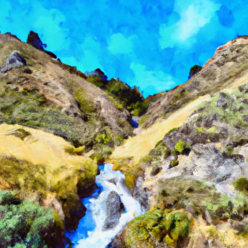
The Whitewater River Run Headwaters South Fork Little Sur To Confluence With Mainstem Little Sur in California is a popular destination for experienced white water rafters. The ideal streamflow range for this section of the river is between 300 and 1000 cfs, with optimal conditions found at around 500-700 cfs. The class rating for this run varies from Class II to Class IV, depending on the water level. The total segment mileage for this section of river is approximately 8 miles.
There are several notable rapids and obstacles on this run, including Broken Nose, Razorback, and Corkscrew. Broken Nose is a Class III rapid that requires precise maneuvering to avoid rocks and navigate through tight channels. Razorback is a Class IV rapid that features a steep drop and a large boulder in the center of the channel. Corkscrew is another Class IV rapid that requires expert paddling skills to successfully navigate through tight turns and turbulent water.
As with all rivers in California, there are specific regulations that must be followed when rafting on the Whitewater River. All boaters must wear personal flotation devices (PFDs) and helmets, and boats must be equipped with appropriate safety gear such as throw ropes and first aid kits. Additionally, all boaters must adhere to Leave No Trace principles and pack out all trash and waste.
Plan your run down to the hour
Same weather feed Snoflo's iOS app uses -- updated continuously from NOAA / yr.no. Watch the precipitation column on the meteogram; rain ahead of a run typically lifts flows 12-48 hours later depending on the basin.
Next 5 days, hour by hour
Temperature line with weather symbols on top, snow + rain accumulation as columns, humidity as a dotted line.
5-day forecast table
Every 3 hours, broken out across temperature, snow, rain, humidity, and wind. Each cell is colour-coded relative to the column min/max.
| Time | Condition | Temp (°F) | Snow (in) | Rain (in) | Humidity (%) | Wind (mps) | Wind dir |
|---|---|---|---|---|---|---|---|
| Loading detailed forecast… | |||||||
15-day temperature & precipitation
Daily temperatures, snow, and rain projected over the next two weeks -- the upstream story that drives next week's flows.
Regional streamflow levels
USGS streamgauges around Headwaters South Fork Little Sur To Confluence With Mainstem Little Sur -- useful for spotting upstream pulses and gauging which tributary is contributing what.
| Streamgauge | Discharge | View |
|---|---|---|
| Big Sur R Nr Big Sur Ca | 19 cfs | → |
| Carmel R A Robles Del Rio Ca | 8 cfs | → |
| Carmel R Nr Carmel Ca | 4 cfs | → |
| Salinas R Nr Spreckels Ca | 28 cfs | → |
| Salinas R Nr Chualar Ca | 68 cfs | → |
| Reclamation Ditch Nr Salinas Ca | 1 cfs | → |
Plan a longer trip
The closest boat launches, other paddle runs, and campgrounds so a day on the water can grow into a full weekend.
Other river runs
- Boy Scout Camp To Confluence With Mainstem Little Sur
- Headwaters North Fork Little Sur To Boy Scout Camp
- 0.25 Miles Downstream Of The Impoundment Of Sportsman's Lodge To Ventana Wilderness Boundary
- 0.25 Milesupstram Of The Impoundment At Sportsman's Lodge To 0.25 Miles Downstream Of The Impoundment At Sportsman's Lodge
- Headwaters To Sportsman's Club
Campgrounds
Whitewater safety
- Check the flow before you run
- Use the linked-gauge card and Regional Flow panel above. Class ratings change with flow -- a Class III at low water can become Class IV+ at high water.
- Know your skill ceiling
- Pick runs comfortably below your ceiling. Cold-water and big-water runs raise the consequences of any mistake.
- Wear the right gear
- Helmet, PFD, drysuit / wetsuit when water is below 60°F. Throw bag, knife, and whistle on your person, not in the boat.
- Scout, set safety, and run with a team
- Scout new rapids on foot, set safety with throw bags above the consequence pool, and run with at least one other competent paddler.
- Respect the river
- Strainers, undercuts, low-head dams, and wood can kill at any class rating. When in doubt, portage.
Set push alerts in the Snoflo app
Save Headwaters South Fork Little Sur To Confluence With Mainstem Little Sur as a favorite, set a discharge threshold (e.g. "alert me when flow hits 600 cfs"), and the iOS app pushes the moment the linked gauge crosses.
About Headwaters South Fork Little Sur To Confluence With Mainstem Little Sur
What's the optimal flow for Headwaters South Fork Little Sur To Confluence With Mainstem Little Sur?
The optimal flow depends on the section and the craft. Check the Run Details panel for the linked gauge and current status.
How fresh is the cfs reading on this page?
The linked USGS streamgauge reports continuously (every 15 minutes); Snoflo refreshes throughout the day. Hover the streamflow sparkline to read individual datapoints.
What's the whitewater class?
See the Run Details panel for the class rating Snoflo tracks for this run. Class ratings change with flow -- a Class III at low water can become Class IV in high water.
Where do I put in / take out?
Tap Directions in the hero above to open driving directions to the put-in. For shuttle planning, check the Nearby Boat Launches panel and the river run operator's site.
Can I get alerts when flows hit the optimal range?
Yes -- alerts are managed in the Snoflo iOS app. Favorite this run, set a discharge threshold, and you'll get a push the moment the gauge crosses.
Other runs near here
Snoflo-tracked paddle runs within driving distance of Headwaters South Fork Little Sur To Confluence With Mainstem Little Sur.