Relief Reservoir Outlet To Confluence With Clark Fork River Run
Community Reviews
Been here? Share the conditions.
Reviews, ratings & photos are added in the free Snoflo iOS app — rate a spot, tag the conditions, and your visit is verified by location. Add or manage your reviews from the app.
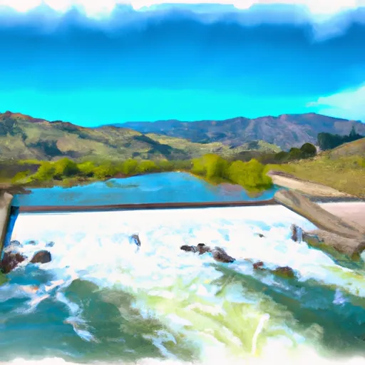
Relief Reservoir Outlet To Confluence With Clark Fork
The Gauntlet is a Class IV rapid with a steep drop and tight chute, leading into a powerful hydraulic. The Maze is a technical Class V rapid with several tight turns and large boulders. The Labyrinth is a Class IV rapid with a long, winding channel and several powerful hydraulics.
Due to the challenging nature of this run, the area is heavily regulated. All boaters must have a valid California boater card and must wear a properly fitting personal flotation device. Additionally, camping permits are required for overnight stays in the area.
Overall, the Whitewater River Run from Relief Reservoir Outlet to Confluence with Clark Fork is a thrilling and challenging experience for experienced whitewater enthusiasts. However, it is important to follow all regulations and safety guidelines to ensure a safe and enjoyable trip.
Plan your run down to the hour
Same weather feed Snoflo's iOS app uses -- updated continuously from NOAA / yr.no. Watch the precipitation column on the meteogram; rain ahead of a run typically lifts flows 12-48 hours later depending on the basin.
Next 5 days, hour by hour
Temperature line with weather symbols on top, snow + rain accumulation as columns, humidity as a dotted line.
5-day forecast table
Every 3 hours, broken out across temperature, snow, rain, humidity, and wind. Each cell is colour-coded relative to the column min/max.
| Time | Condition | Temp (°F) | Snow (in) | Rain (in) | Humidity (%) | Wind (mps) | Wind dir |
|---|---|---|---|---|---|---|---|
| Loading detailed forecast… | |||||||
15-day temperature & precipitation
Daily temperatures, snow, and rain projected over the next two weeks -- the upstream story that drives next week's flows.
Regional streamflow levels
USGS streamgauges around Relief Reservoir Outlet To Confluence With Clark Fork -- useful for spotting upstream pulses and gauging which tributary is contributing what.
| Streamgauge | Discharge | View |
|---|---|---|
| W Walker R Blw L Walker R Nr Coleville | 117 cfs | → |
| W Walker R Nr Coleville | 111 cfs | → |
| Buckeye C Nr Bridgeport | 32 cfs | → |
| Lk Eleanor Div To Cherry Lake Nr Hetch Hetchy Ca | 1 cfs | → |
| Eleanor C Nr Hetch Hetchy Ca | 23 cfs | → |
| Robinson C At Twin Lks Outlet Nr Bridgeport | 100 cfs | → |
Plan a longer trip
The closest boat launches, other paddle runs, and campgrounds so a day on the water can grow into a full weekend.
Boat launches
Other river runs
- Headwater Deadman Creek To Confluence With Middle Fork Stanislaus River
- Headwaters Kennedy Creek To Confluence With Middle Fork Stanislaus
- Headwaters To Wilderness Boundary
- Wilderness Boundary To Confluence With Middle Fork Stanislaus
- Hoover Wilderness Boundary To Leavitt Meadows Campground
Campgrounds
Fishing spots
Whitewater safety
- Check the flow before you run
- Use the linked-gauge card and Regional Flow panel above. Class ratings change with flow -- a Class III at low water can become Class IV+ at high water.
- Know your skill ceiling
- Pick runs comfortably below your ceiling. Cold-water and big-water runs raise the consequences of any mistake.
- Wear the right gear
- Helmet, PFD, drysuit / wetsuit when water is below 60°F. Throw bag, knife, and whistle on your person, not in the boat.
- Scout, set safety, and run with a team
- Scout new rapids on foot, set safety with throw bags above the consequence pool, and run with at least one other competent paddler.
- Respect the river
- Strainers, undercuts, low-head dams, and wood can kill at any class rating. When in doubt, portage.
Set push alerts in the Snoflo app
Save Relief Reservoir Outlet To Confluence With Clark Fork as a favorite, set a discharge threshold (e.g. "alert me when flow hits 600 cfs"), and the iOS app pushes the moment the linked gauge crosses.
About Relief Reservoir Outlet To Confluence With Clark Fork
What's the optimal flow for Relief Reservoir Outlet To Confluence With Clark Fork?
The optimal flow depends on the section and the craft. Check the Run Details panel for the linked gauge and current status.
How fresh is the cfs reading on this page?
The linked USGS streamgauge reports continuously (every 15 minutes); Snoflo refreshes throughout the day. Hover the streamflow sparkline to read individual datapoints.
What's the whitewater class?
See the Run Details panel for the class rating Snoflo tracks for this run. Class ratings change with flow -- a Class III at low water can become Class IV in high water.
Where do I put in / take out?
Tap Directions in the hero above to open driving directions to the put-in. For shuttle planning, check the Nearby Boat Launches panel and the river run operator's site.
Can I get alerts when flows hit the optimal range?
Yes -- alerts are managed in the Snoflo iOS app. Favorite this run, set a discharge threshold, and you'll get a push the moment the gauge crosses.
Other runs near here
Snoflo-tracked paddle runs within driving distance of Relief Reservoir Outlet To Confluence With Clark Fork.