Sec 17, T25n, R14e To Confluence With Last Chance Creek River Run
Community Reviews
Been here? Share the conditions.
Reviews, ratings & photos are added in the free Snoflo iOS app — rate a spot, tag the conditions, and your visit is verified by location. Add or manage your reviews from the app.
Sec 17, T25n, R14e To Confluence With Last Chance Creek
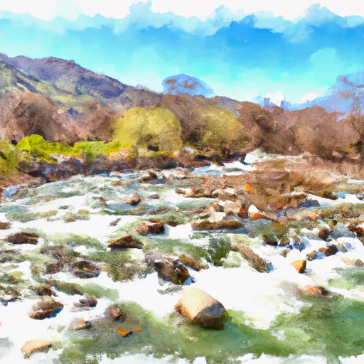
The segment mileage of this section of the Whitewater River Run is approximately 8 miles, with several notable obstacles and rapids along the way. Some of the most challenging rapids include "Chili Bar," "Troublemaker," and "Killer Fang Falls," which require technical skill and careful maneuvering to navigate safely.
It is important to note that the Whitewater River Run is subject to specific regulations in order to protect both the environment and the safety of visitors. For example, all boaters must wear a properly fitting personal flotation device (PFD) at all times, and motorized boats are not allowed on certain sections of the river. Additionally, there are specific rules governing camping and fires in the area, and visitors are encouraged to respect the natural beauty of the river and its surroundings.
Plan your run down to the hour
Same weather feed Snoflo's iOS app uses -- updated continuously from NOAA / yr.no. Watch the precipitation column on the meteogram; rain ahead of a run typically lifts flows 12-48 hours later depending on the basin.
Next 5 days, hour by hour
Temperature line with weather symbols on top, snow + rain accumulation as columns, humidity as a dotted line.
5-day forecast table
Every 3 hours, broken out across temperature, snow, rain, humidity, and wind. Each cell is colour-coded relative to the column min/max.
| Time | Condition | Temp (°F) | Snow (in) | Rain (in) | Humidity (%) | Wind (mps) | Wind dir |
|---|---|---|---|---|---|---|---|
| Loading detailed forecast… | |||||||
15-day temperature & precipitation
Daily temperatures, snow, and rain projected over the next two weeks -- the upstream story that drives next week's flows.
Regional streamflow levels
USGS streamgauges around Sec 17, T25n, R14e To Confluence With Last Chance Creek -- useful for spotting upstream pulses and gauging which tributary is contributing what.
| Streamgauge | Discharge | View |
|---|---|---|
| Spanish C Ab Blackhawk C At Keddie Ca | 24 cfs | → |
| Spanish C A Quincy Ca | 14 cfs | → |
| Little Truckee R Bl Div Dam Nr Sierraville Ca | 3 cfs | → |
| N Yuba R Bl Goodyears Bar Ca | 148 cfs | → |
| Independence C Nr Truckee Ca | 4 cfs | → |
| Sagehen C Nr Truckee Ca | 2 cfs | → |
Plan a longer trip
The closest boat launches, other paddle runs, and campgrounds so a day on the water can grow into a full weekend.
Boat launches
- Lost Cove Boat Ramp
- Lake Davis Recreation Area (Lightning Tree)
- Lake Davis Recreation Area (Mallard Cove)
- Lake Davis Recreation Area (Old Camp Five)
- Lake Davis Recreation Area (Honker Cove)
Other river runs
- Confluence With Squaw Queen Creek To Confluence With Red Clover Creek
- State Park To Confluence With Middle Fork Feather Wsr
- Confluence With East And West Branches Of Nelson Creek To Confluence With Middle Fork Feather Wsr
- Gold Lake Highway To Nf Boundary
- East Branch Nelson Creek Headwaters To Confluence With Nelson Creek
Campgrounds
- Long Point
- Long Point Group Campground
- Long Point Campground
- Antelope Lake Recreation Area
- Lightning Tree Campground
- Lightning Tree .
Whitewater safety
- Check the flow before you run
- Use the linked-gauge card and Regional Flow panel above. Class ratings change with flow -- a Class III at low water can become Class IV+ at high water.
- Know your skill ceiling
- Pick runs comfortably below your ceiling. Cold-water and big-water runs raise the consequences of any mistake.
- Wear the right gear
- Helmet, PFD, drysuit / wetsuit when water is below 60°F. Throw bag, knife, and whistle on your person, not in the boat.
- Scout, set safety, and run with a team
- Scout new rapids on foot, set safety with throw bags above the consequence pool, and run with at least one other competent paddler.
- Respect the river
- Strainers, undercuts, low-head dams, and wood can kill at any class rating. When in doubt, portage.
Set push alerts in the Snoflo app
Save Sec 17, T25n, R14e To Confluence With Last Chance Creek as a favorite, set a discharge threshold (e.g. "alert me when flow hits 600 cfs"), and the iOS app pushes the moment the linked gauge crosses.
About Sec 17, T25n, R14e To Confluence With Last Chance Creek
What's the optimal flow for Sec 17, T25n, R14e To Confluence With Last Chance Creek?
The optimal flow depends on the section and the craft. Check the Run Details panel for the linked gauge and current status.
How fresh is the cfs reading on this page?
The linked USGS streamgauge reports continuously (every 15 minutes); Snoflo refreshes throughout the day. Hover the streamflow sparkline to read individual datapoints.
What's the whitewater class?
See the Run Details panel for the class rating Snoflo tracks for this run. Class ratings change with flow -- a Class III at low water can become Class IV in high water.
Where do I put in / take out?
Tap Directions in the hero above to open driving directions to the put-in. For shuttle planning, check the Nearby Boat Launches panel and the river run operator's site.
Can I get alerts when flows hit the optimal range?
Yes -- alerts are managed in the Snoflo iOS app. Favorite this run, set a discharge threshold, and you'll get a push the moment the gauge crosses.
Other runs near here
Snoflo-tracked paddle runs within driving distance of Sec 17, T25n, R14e To Confluence With Last Chance Creek.