Henness Pass Road, Sierraville Boat Launch
Community Reviews
Been here? Share the conditions.
Reviews, ratings & photos are added in the free Snoflo iOS app — rate a spot, tag the conditions, and your visit is verified by location. Add or manage your reviews from the app.
Henness Pass Road, Sierraville
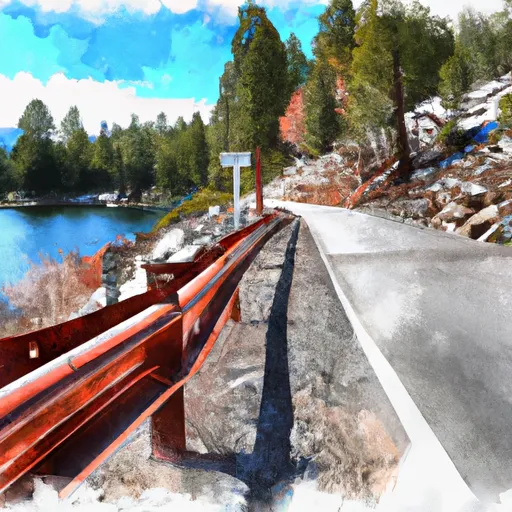
The body of water that the Henness Pass Road boat ramp services is the Yuba River. This river is known for its scenic beauty and offers excellent opportunities for fishing, kayaking, and rafting. The Yuba River is a popular destination for boaters in the Sierraville area.
According to the latest information available, the Henness Pass Road boat ramp permits motorized and non-motorized watercraft. This includes boats, canoes, kayaks, paddleboards, and other similar crafts. However, it is important to note that local regulations may apply, and boaters should check with the appropriate authorities before launching their craft.
In conclusion, the Henness Pass Road boat ramp in Sierraville, California is a concrete ramp that provides access to the Yuba River. It is approximately 16 feet wide and permits both motorized and non-motorized watercraft. It is a popular destination for boaters in the area and offers excellent opportunities for fishing, kayaking, and rafting.
Plan your launch down to the hour
Same weather feed Snoflo's iOS app uses -- updated continuously from NOAA / yr.no.
Next 5 days, hour by hour
Temperature line with weather symbols on top, snow + rain accumulation as columns, humidity as a dotted line.
5-day forecast table
Every 3 hours, broken out across temperature, snow, rain, humidity, and wind.
| Time | Condition | Temp (°F) | Snow (in) | Rain (in) | Humidity (%) | Wind (mps) | Wind dir |
|---|---|---|---|---|---|---|---|
| Loading detailed forecast… | |||||||
15-day temperature & precipitation
Daily temperatures, snow, and rain projected over the next two weeks.
Area streamflow levels
USGS streamgauges around Henness Pass Road, Sierraville -- the same readings that determine whether your launch is safe and your boat is the right craft.
| Streamgauge | Discharge | View |
|---|---|---|
| Little Truckee R Bl Div Dam Nr Sierraville Ca | 3 cfs | → |
| Independence C Nr Truckee Ca | 6 cfs | → |
| Sagehen C Nr Truckee Ca | 2 cfs | → |
| Donner C A Donner Lk Nr Truckee Ca | 4 cfs | → |
| N Yuba R Bl Goodyears Bar Ca | 162 cfs | → |
| Donner C At Hwy 89 Nr Truckee Ca | 7 cfs | → |
Plan a longer trip
The closest paddle runs, fishing spots, and other boat launches so you can extend a day on the water.
River runs
- Langs Crossing Bridge To One-Half Mile West Of Confluence With Fall Creek (Boundary Of Nf And Private Land)
- Gold Lake Dam To Falls
- Falls To Gold Lake Highway
- Gold Lake Highway To Nf Boundary
- Little Jamison Creek Headwaters To State Park
- One-Half Mile West Of Confluence With Fall Creek To Confluence With Jefferson Creek
Nearby fishing
Boating safety & etiquette
- Check the conditions before you launch
- Use the streamflow numbers, weather, and wind forecast on this page. High-cfs whitewater requires whitewater-specific craft and skill.
- Wear your life jacket
- Statistically the single biggest survival factor in a boating incident. State law often requires one per passenger.
- File a float plan
- Tell someone on shore your put-in, take-out, and expected return time. Especially for multi-day or remote trips.
- Yield at the ramp
- Prep gear in the parking lot, not on the ramp. Launch and clear quickly so others can use the lane.
- Clean, drain, dry
- Inspect, clean, drain and dry your boat between waters to prevent the spread of aquatic invasive species.
Set push alerts in the Snoflo app
Save Henness Pass Road, Sierraville as a favorite, set a discharge threshold or a wind/precipitation alert, and the iOS app will push the moment conditions cross.
About Henness Pass Road, Sierraville
Can I launch a motorboat here?
Most Snoflo-tracked launches support motorboats; check the operator for any horsepower restrictions, paddle-only zones, or seasonal closures.
How fresh is the streamflow data?
USGS streamgauges report continuously (every 15 minutes); the table on this page pulls the latest reading at page load.
Is there a fee?
Many federal and state boat launches charge a day-use fee. Check the operator's site before driving out.
What boat is right for these conditions?
Use the nearby streamflow numbers and river-run panel on this page to gauge current conditions. Wider, slower water is friendly for casual paddling and powerboats; high-cfs whitewater requires whitewater-specific craft and skill.
Can I get alerts when conditions change?
Yes -- alerts are managed in the Snoflo iOS app. Favorite this launch, set a threshold (discharge, wind), and you'll get a push the moment it crosses.
Other launches near here
Snoflo-tracked boat launches within driving distance of Henness Pass Road, Sierraville.