Headwaters In Sec 2, T9n, R18e To Confluence With Mokelumne River River Run
Community Reviews
Been here? Share the conditions.
Reviews, ratings & photos are added in the free Snoflo iOS app — rate a spot, tag the conditions, and your visit is verified by location. Add or manage your reviews from the app.
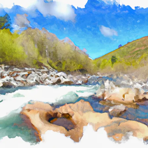
Headwaters In Sec 2, T9n, R18e To Confluence With Mokelumne River
This section is rated as class III-IV, making it suitable for intermediate to advanced rafters. The segment mileage of this section is about 17 miles, with several rapids and obstacles along the way. The most notable of these is "The Narrows," a tight, technical section of river that requires precise navigation.
In addition to the thrill of the rapids, visitors to this area must also abide by specific regulations. For example, all boats must have a Type III or V Coast Guard-approved personal flotation device (PFD) for each person on board. Additionally, visitors are encouraged to practice Leave No Trace principles to ensure the preservation of the natural environment.
Overall, the Whitewater River Run from Headwaters in Sec 2, T9N, R18E to Confluence with Mokelumne River offers a challenging and exciting whitewater rafting experience for those who are prepared. Visitors should always check the streamflow levels before visiting and ensure that they have the necessary equipment and skills to navigate this section safely.
Plan your run down to the hour
Same weather feed Snoflo's iOS app uses -- updated continuously from NOAA / yr.no. Watch the precipitation column on the meteogram; rain ahead of a run typically lifts flows 12-48 hours later depending on the basin.
Next 5 days, hour by hour
Temperature line with weather symbols on top, snow + rain accumulation as columns, humidity as a dotted line.
5-day forecast table
Every 3 hours, broken out across temperature, snow, rain, humidity, and wind. Each cell is colour-coded relative to the column min/max.
| Time | Condition | Temp (°F) | Snow (in) | Rain (in) | Humidity (%) | Wind (mps) | Wind dir |
|---|---|---|---|---|---|---|---|
| Loading detailed forecast… | |||||||
15-day temperature & precipitation
Daily temperatures, snow, and rain projected over the next two weeks -- the upstream story that drives next week's flows.
Regional streamflow levels
USGS streamgauges around Headwaters In Sec 2, T9n, R18e To Confluence With Mokelumne River -- useful for spotting upstream pulses and gauging which tributary is contributing what.
| Streamgauge | Discharge | View |
|---|---|---|
| Upper Truckee R At S Upper Truckee Rd Nr Meyers Ca | 4 cfs | → |
| West Fork Carson River At Woodfords | 16 cfs | → |
| E F Carson R Bl Markleeville C Nr Markleevilleca | 64 cfs | → |
| Upper Truckee R At Hwy 50 Above Meyers Ca | 12 cfs | → |
| Leviathan C Channel Underdrain Nr Markleeville Ca | 0 cfs | → |
| 4l C Nr Markleeville Ca | · | → |
Plan a longer trip
The closest boat launches, other paddle runs, and campgrounds so a day on the water can grow into a full weekend.
Boat launches
- Caples Lake Resort
- Kit Carson Resort
- Silver Lake
- Amador County
- Summit Lake Trail Alpine County
- Indian Creek Camp Ground Day Use Area
Other river runs
- Headwaters In Sec 15,T10n, R17e To Confluence With Silver Fork Of American River
- Highway 4 To Salt Springs Reservoir
- Headwaters To South Of Upper Truckee Road (Sec Line Between 17/20 Intercepts River And Unnamed Tributary)
- Centerville Flat To Hangman's Bridge
- Headwaters In Sec 7, T11n, R18e To Blair Bridge
Campgrounds
- Lost Campings
- Upper Blue Lake
- Upper Blue Lake Dam
- Middle Creek/Expansion
- Woods Lake Campground
- Lower Blue Lake
Fishing spots
Whitewater safety
- Check the flow before you run
- Use the linked-gauge card and Regional Flow panel above. Class ratings change with flow -- a Class III at low water can become Class IV+ at high water.
- Know your skill ceiling
- Pick runs comfortably below your ceiling. Cold-water and big-water runs raise the consequences of any mistake.
- Wear the right gear
- Helmet, PFD, drysuit / wetsuit when water is below 60°F. Throw bag, knife, and whistle on your person, not in the boat.
- Scout, set safety, and run with a team
- Scout new rapids on foot, set safety with throw bags above the consequence pool, and run with at least one other competent paddler.
- Respect the river
- Strainers, undercuts, low-head dams, and wood can kill at any class rating. When in doubt, portage.
Set push alerts in the Snoflo app
Save Headwaters In Sec 2, T9n, R18e To Confluence With Mokelumne River as a favorite, set a discharge threshold (e.g. "alert me when flow hits 600 cfs"), and the iOS app pushes the moment the linked gauge crosses.
About Headwaters In Sec 2, T9n, R18e To Confluence With Mokelumne River
What's the optimal flow for Headwaters In Sec 2, T9n, R18e To Confluence With Mokelumne River?
The optimal flow depends on the section and the craft. Check the Run Details panel for the linked gauge and current status.
How fresh is the cfs reading on this page?
The linked USGS streamgauge reports continuously (every 15 minutes); Snoflo refreshes throughout the day. Hover the streamflow sparkline to read individual datapoints.
What's the whitewater class?
See the Run Details panel for the class rating Snoflo tracks for this run. Class ratings change with flow -- a Class III at low water can become Class IV in high water.
Where do I put in / take out?
Tap Directions in the hero above to open driving directions to the put-in. For shuttle planning, check the Nearby Boat Launches panel and the river run operator's site.
Can I get alerts when flows hit the optimal range?
Yes -- alerts are managed in the Snoflo iOS app. Favorite this run, set a discharge threshold, and you'll get a push the moment the gauge crosses.
Other runs near here
Snoflo-tracked paddle runs within driving distance of Headwaters In Sec 2, T9n, R18e To Confluence With Mokelumne River.