Confluence With Daggett Creek To Confluence With Klamath River River Run
Community Reviews
Been here? Share the conditions.
Reviews, ratings & photos are added in the free Snoflo iOS app — rate a spot, tag the conditions, and your visit is verified by location. Add or manage your reviews from the app.
Confluence With Daggett Creek To Confluence With Klamath River
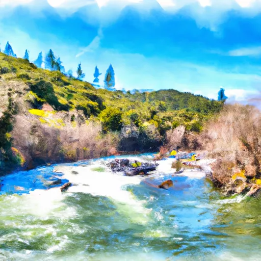
One of the most challenging sections of the run is the Hell's Corner rapid, which is a long and technical rapid with a steep gradient. Another notable rapid is the Stateline Falls, which has a steep drop and requires precise navigation.
To ensure safety and protect the natural environment, the Bureau of Land Management has established regulations for this area. Permits are required for overnight camping, and fires are only allowed in designated areas. It is also essential to practice Leave No Trace principles and pack out all trash.
Overall, the Whitewater River Run Confluence with Daggett Creek to Confluence with Klamath River is a thrilling adventure for experienced paddlers who are prepared for challenging rapids and rugged terrain. It is important to follow all regulations and safety guidelines to ensure a safe and enjoyable trip.
Plan your run down to the hour
Same weather feed Snoflo's iOS app uses -- updated continuously from NOAA / yr.no. Watch the precipitation column on the meteogram; rain ahead of a run typically lifts flows 12-48 hours later depending on the basin.
Next 5 days, hour by hour
Temperature line with weather symbols on top, snow + rain accumulation as columns, humidity as a dotted line.
5-day forecast table
Every 3 hours, broken out across temperature, snow, rain, humidity, and wind. Each cell is colour-coded relative to the column min/max.
| Time | Condition | Temp (°F) | Snow (in) | Rain (in) | Humidity (%) | Wind (mps) | Wind dir |
|---|---|---|---|---|---|---|---|
| Loading detailed forecast… | |||||||
15-day temperature & precipitation
Daily temperatures, snow, and rain projected over the next two weeks -- the upstream story that drives next week's flows.
Regional streamflow levels
USGS streamgauges around Confluence With Daggett Creek To Confluence With Klamath River -- useful for spotting upstream pulses and gauging which tributary is contributing what.
| Streamgauge | Discharge | View |
|---|---|---|
| Indian C Nr Happy Camp Ca | 44 cfs | → |
| Klamath R Nr Seiad Valley Ca | 1,100 cfs | → |
| Scott R Nr Fort Jones Ca | 27 cfs | → |
| Salmon R A Somes Bar Ca | 257 cfs | → |
| Klamath R A Orleans | 1,000 cfs | → |
| Applegate River Near Copper | 124 cfs | → |
Plan a longer trip
The closest boat launches, other paddle runs, and campgrounds so a day on the water can grow into a full weekend.
Boat launches
- P. Wingate Bar River Access
- Wingate Bar
- Q. Ferry Point River Access
- R. Independence Rest Area /River Access
- O. Chambers Flat River Access
- N. Indian Creek River Access
Other river runs
- Confluence With Ten Mile Creek To Confluence With Daggett Creek
- Bridge In Sec 19 To Bridge In Sec 25, T16n, R7e
- Ten Mile Creek Headwaters To Confluence With Clear Creek
- Headwaters In Siskiyou Wilderness To Confluence With Ten Mile Creek
- Bridge In Sec 25 To Confluence With Klamath River
Campgrounds
- Curly Jack Campground
- Curly Jack
- Sulphur Springs Campground
- Sulphur Springs
- Norcross - Horse
- Norcross Campground
Fishing spots
Whitewater safety
- Check the flow before you run
- Use the linked-gauge card and Regional Flow panel above. Class ratings change with flow -- a Class III at low water can become Class IV+ at high water.
- Know your skill ceiling
- Pick runs comfortably below your ceiling. Cold-water and big-water runs raise the consequences of any mistake.
- Wear the right gear
- Helmet, PFD, drysuit / wetsuit when water is below 60°F. Throw bag, knife, and whistle on your person, not in the boat.
- Scout, set safety, and run with a team
- Scout new rapids on foot, set safety with throw bags above the consequence pool, and run with at least one other competent paddler.
- Respect the river
- Strainers, undercuts, low-head dams, and wood can kill at any class rating. When in doubt, portage.
Set push alerts in the Snoflo app
Save Confluence With Daggett Creek To Confluence With Klamath River as a favorite, set a discharge threshold (e.g. "alert me when flow hits 600 cfs"), and the iOS app pushes the moment the linked gauge crosses.
About Confluence With Daggett Creek To Confluence With Klamath River
What's the optimal flow for Confluence With Daggett Creek To Confluence With Klamath River?
The optimal flow depends on the section and the craft. Check the Run Details panel for the linked gauge and current status.
How fresh is the cfs reading on this page?
The linked USGS streamgauge reports continuously (every 15 minutes); Snoflo refreshes throughout the day. Hover the streamflow sparkline to read individual datapoints.
What's the whitewater class?
See the Run Details panel for the class rating Snoflo tracks for this run. Class ratings change with flow -- a Class III at low water can become Class IV in high water.
Where do I put in / take out?
Tap Directions in the hero above to open driving directions to the put-in. For shuttle planning, check the Nearby Boat Launches panel and the river run operator's site.
Can I get alerts when flows hit the optimal range?
Yes -- alerts are managed in the Snoflo iOS app. Favorite this run, set a discharge threshold, and you'll get a push the moment the gauge crosses.
Other runs near here
Snoflo-tracked paddle runs within driving distance of Confluence With Daggett Creek To Confluence With Klamath River.