Butte Creek River Run
Community Reviews
Been here? Share the conditions.
Reviews, ratings & photos are added in the free Snoflo iOS app — rate a spot, tag the conditions, and your visit is verified by location. Add or manage your reviews from the app.
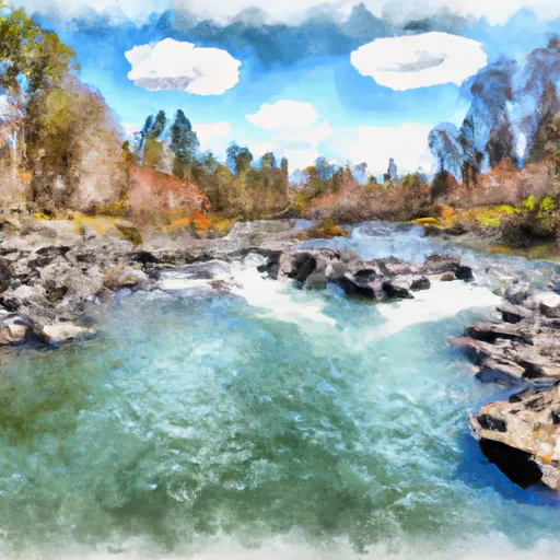
Butte Creek
The class rating of Butte Creek varies from Class III to Class V, depending on the segment. The upper segment is rated Class III, while the lower segment is rated Class V due to its challenging rapids and obstacles. The entire river run covers a distance of 18 miles, with the upper segment being 10 miles and the lower segment being 8 miles.
Some of the specific rapids and obstacles in Butte Creek include 'Meatgrinder,' 'Hell's Hole,' and 'Dead Man's Drop.' These rapids require experienced rafters and kayakers to navigate safely.
There are specific regulations for rafting in Butte Creek. Rafters are required to wear a personal flotation device (PFD) at all times while on the river. The river run is only open during the rafting season, which typically runs from April to June. Additionally, rafters are required to obtain a permit to access certain segments of the river.
In conclusion, Butte Creek is an exciting California river run that offers a thrilling white-water rafting experience. With its varying class ratings, specific rapids, and obstacles, it is a popular destination for experienced rafters and kayakers. However, it is important to follow the specific regulations to ensure a safe and enjoyable experience on the river.
Plan your run down to the hour
Same weather feed Snoflo's iOS app uses -- updated continuously from NOAA / yr.no. Watch the precipitation column on the meteogram; rain ahead of a run typically lifts flows 12-48 hours later depending on the basin.
Next 5 days, hour by hour
Temperature line with weather symbols on top, snow + rain accumulation as columns, humidity as a dotted line.
5-day forecast table
Every 3 hours, broken out across temperature, snow, rain, humidity, and wind. Each cell is colour-coded relative to the column min/max.
| Time | Condition | Temp (°F) | Snow (in) | Rain (in) | Humidity (%) | Wind (mps) | Wind dir |
|---|---|---|---|---|---|---|---|
| Loading detailed forecast… | |||||||
15-day temperature & precipitation
Daily temperatures, snow, and rain projected over the next two weeks -- the upstream story that drives next week's flows.
Regional streamflow levels
USGS streamgauges around Butte Creek -- useful for spotting upstream pulses and gauging which tributary is contributing what.
| Streamgauge | Discharge | View |
|---|---|---|
| Butte C Nr Chico Ca | 161 cfs | → |
| Deer C Nr Vina Ca | 101 cfs | → |
| Mill C Nr Los Molinos Ca | 140 cfs | → |
| Spanish C Ab Blackhawk C At Keddie Ca | 37 cfs | → |
| Spanish C A Quincy Ca | 16 cfs | → |
| Sacramento R Ab Bend Bridge Nr Red Bluff Ca | 13,300 cfs | → |
Plan a longer trip
The closest boat launches, other paddle runs, and campgrounds so a day on the water can grow into a full weekend.
Other river runs
- Big Chico Creek
- Just Below Confluence With Beaver Creek To Sec 35, T26n, R2e, Ishi Wilderness
- Poe Dam To Highway 70 Crossing
Campgrounds
- Forks Of Butte Creek
- West Branch
- Philbrook - Feather River
- Butte Meadows
- Butte Meadows Campground
- Cherry Hill Campground
Fishing spots
Parks
Whitewater safety
- Check the flow before you run
- Use the linked-gauge card and Regional Flow panel above. Class ratings change with flow -- a Class III at low water can become Class IV+ at high water.
- Know your skill ceiling
- Pick runs comfortably below your ceiling. Cold-water and big-water runs raise the consequences of any mistake.
- Wear the right gear
- Helmet, PFD, drysuit / wetsuit when water is below 60°F. Throw bag, knife, and whistle on your person, not in the boat.
- Scout, set safety, and run with a team
- Scout new rapids on foot, set safety with throw bags above the consequence pool, and run with at least one other competent paddler.
- Respect the river
- Strainers, undercuts, low-head dams, and wood can kill at any class rating. When in doubt, portage.
Set push alerts in the Snoflo app
Save Butte Creek as a favorite, set a discharge threshold (e.g. "alert me when flow hits 600 cfs"), and the iOS app pushes the moment the linked gauge crosses.
About Butte Creek
What's the optimal flow for Butte Creek?
The optimal flow depends on the section and the craft. Check the Run Details panel for the linked gauge and current status.
How fresh is the cfs reading on this page?
The linked USGS streamgauge reports continuously (every 15 minutes); Snoflo refreshes throughout the day. Hover the streamflow sparkline to read individual datapoints.
What's the whitewater class?
See the Run Details panel for the class rating Snoflo tracks for this run. Class ratings change with flow -- a Class III at low water can become Class IV in high water.
Where do I put in / take out?
Tap Directions in the hero above to open driving directions to the put-in. For shuttle planning, check the Nearby Boat Launches panel and the river run operator's site.
Can I get alerts when flows hit the optimal range?
Yes -- alerts are managed in the Snoflo iOS app. Favorite this run, set a discharge threshold, and you'll get a push the moment the gauge crosses.
Other runs near here
Snoflo-tracked paddle runs within driving distance of Butte Creek.