Little South Fork Elk Creek River Run
Community Reviews
Been here? Share the conditions.
Reviews, ratings & photos are added in the free Snoflo iOS app — rate a spot, tag the conditions, and your visit is verified by location. Add or manage your reviews from the app.
Little South Fork Elk Creek
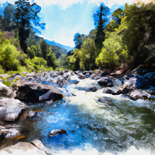
The segment mileage for the Little South Fork Elk Creek is approximately 6.4 miles, and the river has several challenging rapids and obstacles that paddlers must navigate. Some of the most notable rapids include Red Rock Falls, The Narrows, and The Maze. These rapids are known for their technical challenges and are only recommended for advanced paddlers.
To ensure safety and protect the local ecosystem, there are specific regulations in place for the Little South Fork Elk Creek. Paddlers are required to obtain a permit to access the river, and they must also adhere to strict camping regulations. Additionally, paddlers are prohibited from disturbing the local wildlife and vegetation, and they must adhere to Leave No Trace principles to prevent environmental damage.
In summary, the Little South Fork Elk Creek is a challenging and exciting white water river run that requires experience and skill to navigate. It has a narrow ideal streamflow range, a class IV-V rating, and several notable rapids and obstacles. Paddlers must adhere to specific regulations to ensure safety and protect the local ecosystem.
Plan your run down to the hour
Same weather feed Snoflo's iOS app uses -- updated continuously from NOAA / yr.no. Watch the precipitation column on the meteogram; rain ahead of a run typically lifts flows 12-48 hours later depending on the basin.
Next 5 days, hour by hour
Temperature line with weather symbols on top, snow + rain accumulation as columns, humidity as a dotted line.
5-day forecast table
Every 3 hours, broken out across temperature, snow, rain, humidity, and wind. Each cell is colour-coded relative to the column min/max.
| Time | Condition | Temp (°F) | Snow (in) | Rain (in) | Humidity (%) | Wind (mps) | Wind dir |
|---|---|---|---|---|---|---|---|
| Loading detailed forecast… | |||||||
15-day temperature & precipitation
Daily temperatures, snow, and rain projected over the next two weeks -- the upstream story that drives next week's flows.
Regional streamflow levels
USGS streamgauges around Little South Fork Elk Creek -- useful for spotting upstream pulses and gauging which tributary is contributing what.
| Streamgauge | Discharge | View |
|---|---|---|
| Eel R A Scotia Ca | 219 cfs | → |
| Van Duzen R Nr Bridgeville Ca | 13 cfs | → |
| Mad R Nr Arcata Ca | 50 cfs | → |
| Bull C Nr Weott Ca | 1 cfs | → |
| Redwood C Nr Blue Lake Ca | 7 cfs | → |
| Mattole R Nr Petrolia Ca | 34 cfs | → |
Plan a longer trip
The closest boat launches, other paddle runs, and campgrounds so a day on the water can grow into a full weekend.
Boat launches
- Hookton Slough Trailhead Access, Loleta
- Field's Landing County
- Pedrazzini Boat Ramp
- Samoa Boat County Park
- Waterfront Trail Eureka
- Highway 255 Bridge
Other river runs
- From The Confluence With The South Fork Elk River To To The Headwaters In Sec. 21, T3n, R1e, H.M.
- Starts In Sec. 8 T3n, R1e, H.M. To Ends In Sec. 15, T3n, R1e, H.M
- Salmon Creek Trib
- From The Reserve Boundary In Sec. 18, T3n, R1e, H.M. To To The Headwaters In Sec. 22 And 28, T3n, R1e, H.M.
Campgrounds
- Humboldt County Fairgrounds
- Redwood Acres Fairgrounds
- Stafford Rv Park
- Samoa Boat Ramp County Rv Park
- Hike And Bike Campsite
- Ancient Redwoods Rv Park
Whitewater safety
- Check the flow before you run
- Use the linked-gauge card and Regional Flow panel above. Class ratings change with flow -- a Class III at low water can become Class IV+ at high water.
- Know your skill ceiling
- Pick runs comfortably below your ceiling. Cold-water and big-water runs raise the consequences of any mistake.
- Wear the right gear
- Helmet, PFD, drysuit / wetsuit when water is below 60°F. Throw bag, knife, and whistle on your person, not in the boat.
- Scout, set safety, and run with a team
- Scout new rapids on foot, set safety with throw bags above the consequence pool, and run with at least one other competent paddler.
- Respect the river
- Strainers, undercuts, low-head dams, and wood can kill at any class rating. When in doubt, portage.
Set push alerts in the Snoflo app
Save Little South Fork Elk Creek as a favorite, set a discharge threshold (e.g. "alert me when flow hits 600 cfs"), and the iOS app pushes the moment the linked gauge crosses.
About Little South Fork Elk Creek
What's the optimal flow for Little South Fork Elk Creek?
The optimal flow depends on the section and the craft. Check the Run Details panel for the linked gauge and current status.
How fresh is the cfs reading on this page?
The linked USGS streamgauge reports continuously (every 15 minutes); Snoflo refreshes throughout the day. Hover the streamflow sparkline to read individual datapoints.
What's the whitewater class?
See the Run Details panel for the class rating Snoflo tracks for this run. Class ratings change with flow -- a Class III at low water can become Class IV in high water.
Where do I put in / take out?
Tap Directions in the hero above to open driving directions to the put-in. For shuttle planning, check the Nearby Boat Launches panel and the river run operator's site.
Can I get alerts when flows hit the optimal range?
Yes -- alerts are managed in the Snoflo iOS app. Favorite this run, set a discharge threshold, and you'll get a push the moment the gauge crosses.
Other runs near here
Snoflo-tracked paddle runs within driving distance of Little South Fork Elk Creek.