Trinidad Wharf, Trinidad Boat Launch
Community Reviews
Been here? Share the conditions.
Reviews, ratings & photos are added in the free Snoflo iOS app — rate a spot, tag the conditions, and your visit is verified by location. Add or manage your reviews from the app.
Trinidad Wharf, Trinidad
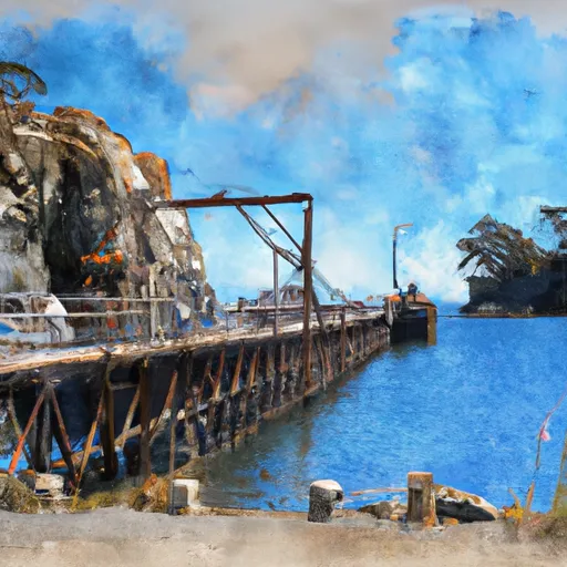
This boat ramp services Trinidad Harbor, which is a small natural harbor located on the Pacific Ocean. The harbor is protected by Trinidad Head, which provides a natural breakwater that helps to shelter boats from the sometimes rough waters of the Pacific. Trinidad Harbor is a popular destination for recreational boaters, fishermen, and kayakers.
The body of water that Trinidad Wharf boat ramp services is the Pacific Ocean, which is a large body of water that covers a significant portion of the Earth's surface. The waters off the coast of Trinidad are home to a wide variety of marine life, including whales, dolphins, sea lions, and a variety of fish species.
The Trinidad Wharf boat ramp is open to a variety of craft, including recreational boats, fishing boats, and kayaks. However, there may be restrictions on the types of boats that are allowed in certain areas of the harbor, so it is important to check with local authorities before launching a boat. Additionally, there may be rules and regulations regarding fishing and other activities in the harbor, so it is important to be aware of these rules before heading out on the water.
In conclusion, the Trinidad Wharf boat ramp is a valuable resource for boaters and fishermen in the Trinidad area. It provides easy access to the waters of Trinidad Harbor, which is a popular destination for recreational boaters and fishermen. The boat ramp is approximately 20 feet wide and is open to a variety of craft, including recreational boats, fishing boats, and kayaks.
Plan your launch down to the hour
Same weather feed Snoflo's iOS app uses -- updated continuously from NOAA / yr.no.
Next 5 days, hour by hour
Temperature line with weather symbols on top, snow + rain accumulation as columns, humidity as a dotted line.
5-day forecast table
Every 3 hours, broken out across temperature, snow, rain, humidity, and wind.
| Time | Condition | Temp (°F) | Snow (in) | Rain (in) | Humidity (%) | Wind (mps) | Wind dir |
|---|---|---|---|---|---|---|---|
| Loading detailed forecast… | |||||||
15-day temperature & precipitation
Daily temperatures, snow, and rain projected over the next two weeks.
Area streamflow levels
USGS streamgauges around Trinidad Wharf, Trinidad -- the same readings that determine whether your launch is safe and your boat is the right craft.
| Streamgauge | Discharge | View |
|---|---|---|
| Little R Nr Trinidad Ca | 6 cfs | → |
| Mad R Nr Arcata Ca | 50 cfs | → |
| Redwood C A Orick Ca | 46 cfs | → |
| Redwood C Nr Blue Lake Ca | 7 cfs | → |
| Trinity R A Hoopa Ca | 714 cfs | → |
Plan a longer trip
The closest paddle runs, fishing spots, and other boat launches so you can extend a day on the water.
River runs
- Sounthern Boundary Of Redwood National And State Parks To Northern Boundary Of Redwood National And State Parks
- Lacks Creek
- From The Reserve Boundary Just Downstream Of The Elk River Trailhead In Sec. 35 T4n, R1w, Humboldt Meridian (H.M.) To To The Old Town Site At Falk In Sec. 36, T4n, R1w, H.M.
- Starts In Sec. 8 T3n, R1e, H.M. To Ends In Sec. 15, T3n, R1e, H.M
- Little South Fork Elk Creek
- From The Confluence With The South Fork Elk River To To The Headwaters In Sec. 21, T3n, R1e, H.M.
Boating safety & etiquette
- Check the conditions before you launch
- Use the streamflow numbers, weather, and wind forecast on this page. High-cfs whitewater requires whitewater-specific craft and skill.
- Wear your life jacket
- Statistically the single biggest survival factor in a boating incident. State law often requires one per passenger.
- File a float plan
- Tell someone on shore your put-in, take-out, and expected return time. Especially for multi-day or remote trips.
- Yield at the ramp
- Prep gear in the parking lot, not on the ramp. Launch and clear quickly so others can use the lane.
- Clean, drain, dry
- Inspect, clean, drain and dry your boat between waters to prevent the spread of aquatic invasive species.
Set push alerts in the Snoflo app
Save Trinidad Wharf, Trinidad as a favorite, set a discharge threshold or a wind/precipitation alert, and the iOS app will push the moment conditions cross.
About Trinidad Wharf, Trinidad
Can I launch a motorboat here?
Most Snoflo-tracked launches support motorboats; check the operator for any horsepower restrictions, paddle-only zones, or seasonal closures.
How fresh is the streamflow data?
USGS streamgauges report continuously (every 15 minutes); the table on this page pulls the latest reading at page load.
Is there a fee?
Many federal and state boat launches charge a day-use fee. Check the operator's site before driving out.
What boat is right for these conditions?
Use the nearby streamflow numbers and river-run panel on this page to gauge current conditions. Wider, slower water is friendly for casual paddling and powerboats; high-cfs whitewater requires whitewater-specific craft and skill.
Can I get alerts when conditions change?
Yes -- alerts are managed in the Snoflo iOS app. Favorite this launch, set a threshold (discharge, wind), and you'll get a push the moment it crosses.
Other launches near here
Snoflo-tracked boat launches within driving distance of Trinidad Wharf, Trinidad.