SNOFLO
Login
Climate
►
Snow Report
Flow Report
Avalanche Data
Buoy Levels
Mountains
Reservoirs
River Levels
Watersheds
Recreation
►
Boat Launches
Camping
Fishing
Parks
Points of Interest
River Surfing
Ski & Snowboard
Surfing
Whitewater Paddling
Tools
►
Snoflo Map
Latest News
Weather by City
Fish Species Guide
Flood Monitor
Hurricane Monitor
Wildfire Monitor
Welcome to Snoflo
Continue with a
free
account
Already Have an Account?
By clicking the sign up button above you agree to the
terms of service
,
code of conduct
, and
privacy policy
Snoflo Premium
Your first week's
free
. Cancel anytime
Snoflo Premium
$6.99/Month
After 7 Day Free Trial
Secure Payment Information
Already Have an Account?
By clicking the sign up button above you agree to the
terms of service
,
code of conduct
, and
privacy policy
. After any free trial period is completed, you agree to a recurring monthly charge of
$6.99
until you cancel. Cancel anytime prior to renewal date to avoid future charges.
Login to Snoflo
Need an Account?
Reset Your Password
SNOFLO
®
Login
Climate
Snow Report
Flow Report
Avalanche Data
Buoy Levels
Mountains
Reservoirs
River Levels
Watersheds
Recreation
Boat Launches
Camping
Fishing
Parks
Points of Interest
River Surfing
Ski & Snowboard
Surfing
Whitewater Paddling
Tools
Snoflo Map
Latest News
Weather by City
Fish Species Guide
Flood Monitor
Hurricane Monitor
Wildfire Monitor
Terms
Privacy
Try Premium for Free
Sign In
Access 3D Map
River Runs
Colorado
EF/MIDDLE FORK AT WEMINUCHE WILDERNESS BOUNDARY TO FOREST DEVELOPMENT ROAD 631
RIVER RUNS
2025-03-27
62°F
7,061 ft
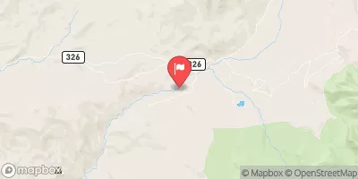
37.44, -107.18
62
°F
Today
31
°F
Tonight
3
mph
Windspeed
53
%
Humidity
Last Updated
2025-03-27
River Levels
1670 cfs (7.42 ft)
Percent of Normal
100%
Status
Class Level
None
Elevation
ft
Streamflow Discharge
cfs
Gauge Height
ft
Reporting Streamgage
USGS 09342500
River Runs
Colorado
Explore Interactive Map
EF/MIDDLE FORK AT WEMINUCHE WILDERNESS BOUNDARY TO FOREST DEVELOPMENT ROAD 631
River Runs
•
Kayaking
•
Whitewater
March 27, 2025
Last Updated
2025-03-27
River Levels
1670 cfs (7.42 ft)
Percent of Normal
100%
Status
Class Level
None
Elevation
ft
Streamflow Discharge
cfs
Gauge Height
ft
Reporting Streamgage
USGS 09342500
Realtime River Levels
USGS 09342500
Start Free Trial
Weather Forecast
Created with Highcharts 8.0.0
humidity
0.26"
0.26"
0.81"
0.81"
1.99"
1.99"
0.26"
0.26"
0.06"
0.06"
0.05"
0.05"
0.39"
0.39"
0.13"
0.13"
0.06"
0.06"
0.1"
0.1"
Fri
Mar 28
Sat
Mar 29
Sun
Mar 30
Mon
Mar 31
Tue
Apr 1
0°
32°
64°
96°
0%
60%
120%
180%
Time
Condition
Temp (F)
Snow (in)
Rain (in)
Humidity (%)
Windspeed (mps)
Wind Direction (°)
Time
Condition
Temp (F)
Snow (in)
Rain (in)
Humidity (%)
Windspeed (mps)
Wind Direction (°)
2025-03-27 11:00:00
overcast clouds
45.54
2025-03-27 14:00:00
overcast clouds
60.4
2025-03-27 17:00:00
overcast clouds
62.33
2025-03-27 20:00:00
overcast clouds
57.87
2025-03-27 23:00:00
broken clouds
47.8
2025-03-28 02:00:00
broken clouds
40.69
2025-03-28 05:00:00
few clouds
36.64
2025-03-28 08:00:00
broken clouds
34.41
2025-03-28 11:00:00
scattered clouds
43.7
2025-03-28 14:00:00
scattered clouds
52.86
2025-03-28 17:00:00
overcast clouds
54.9
2025-03-28 20:00:00
overcast clouds
50.32
2025-03-28 23:00:00
light snow
38.61
2025-03-29 02:00:00
snow
36.19
2025-03-29 05:00:00
snow
35.31
2025-03-29 08:00:00
light snow
34.03
2025-03-29 11:00:00
light snow
35.56
2025-03-29 14:00:00
light snow
40.42
2025-03-29 17:00:00
light rain
43.07
2025-03-29 20:00:00
light snow
36.54
2025-03-29 23:00:00
light snow
30.54
2025-03-30 02:00:00
broken clouds
26.62
2025-03-30 05:00:00
scattered clouds
25.56
2025-03-30 08:00:00
few clouds
23.92
2025-03-30 11:00:00
overcast clouds
35.28
2025-03-30 14:00:00
overcast clouds
41.68
2025-03-30 17:00:00
overcast clouds
44.13
2025-03-30 20:00:00
overcast clouds
39.67
2025-03-30 23:00:00
broken clouds
28.8
2025-03-31 02:00:00
light snow
30.63
2025-03-31 05:00:00
broken clouds
29.12
2025-03-31 08:00:00
broken clouds
26.8
2025-03-31 11:00:00
broken clouds
34.77
2025-03-31 14:00:00
broken clouds
46.02
2025-03-31 17:00:00
broken clouds
49.42
2025-03-31 20:00:00
broken clouds
46.08
2025-03-31 23:00:00
overcast clouds
34.92
2025-04-01 02:00:00
overcast clouds
36.63
2025-04-01 05:00:00
overcast clouds
36.39
2025-04-01 08:00:00
broken clouds
28.47
Nearby Streamflow Levels
ALAMOSA RIVER ABOVE WIGHTMAN FORK NEAR JASPER
-999cfs
WIGHTMAN FORK BEL CROPSY CREEK AT SUMMITVILLE
2cfs
PIEDRA RIVER NEAR ARBOLES
198cfs
WIGHTMAN FORK AT MOUTH NEAR JASPER
3cfs
NAVAJO R AT BANDED PEAK RANCH
81cfs
LOS PINOS RIVER NEAR IGNACIO
23cfs
SALT CREEK NEAR OXFORD
-888cfs
View more
Local Parks
Centennial Plaza
Wilderness Black Canyon of the Gunnison
Gunnison Gorge National Conservation Area
Curecanti National Recreation Area
Wilderness Fossil Ridge
View more
Nearby Fishing
Dark Canyon Fishing Site
Rio Chama Fishing
Bluffs Fishing Site
La Junta Fishing Site
Las Casitas Fishing Site
View more
Boat Launches
Rito Hondo Reservoir Boating Site
R 982 Archuleta County
CR 243 La Plata County
CR 11 Hinsdale County
CR 10 Hinsdale County
You Might Like
Boat Launches
River Runs & Boating
Ski Reports
River Levels
Reservoirs & Dams
LOGIN TO CONTINUE
Already a Member?
Login
- OR -
GET UNLIMITED ACCESS NOW
SNOFLO PREMIUM
$4.99/month
After 7 Day Free Trial
Exit to Colorado River Runs