Private Land To Confluence With Beaver Creek River Run
Community Reviews
Been here? Share the conditions.
Reviews, ratings & photos are added in the free Snoflo iOS app — rate a spot, tag the conditions, and your visit is verified by location. Add or manage your reviews from the app.
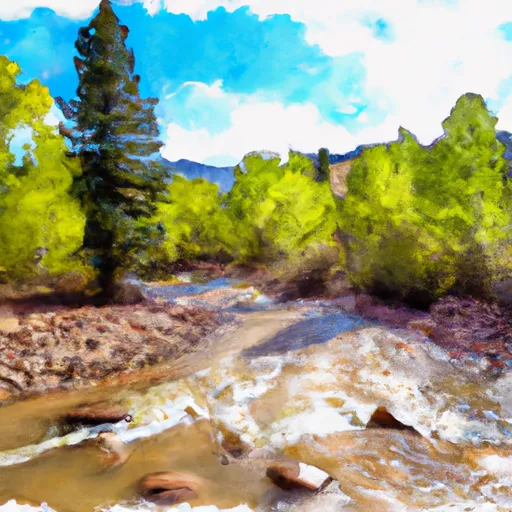
Private Land To Confluence With Beaver Creek
There are specific regulations to this area, including the requirement of a permit to access the river. The permits are available from the Bureau of Land Management, and there is a limit of 25 permits per day. Additionally, all boaters are required to wear a personal flotation device, and it is recommended that they have previous experience navigating rapids of this difficulty.
Sources indicate that the river is typically runnable from June through August, depending on snowmelt and rainfall. It is important for boaters to be aware of changing conditions and potential hazards, such as strainers (submerged branches or logs) and eddies.
Overall, the Private Land to Confluence with Beaver Creek section of the Whitewater River offers a challenging and exciting run for experienced kayakers and rafters. It is important for visitors to be aware of the regulations and potential hazards, and to take necessary precautions to ensure a safe and enjoyable experience.
Plan your run down to the hour
Same weather feed Snoflo's iOS app uses -- updated continuously from NOAA / yr.no. Watch the precipitation column on the meteogram; rain ahead of a run typically lifts flows 12-48 hours later depending on the basin.
Next 5 days, hour by hour
Temperature line with weather symbols on top, snow + rain accumulation as columns, humidity as a dotted line.
5-day forecast table
Every 3 hours, broken out across temperature, snow, rain, humidity, and wind. Each cell is colour-coded relative to the column min/max.
| Time | Condition | Temp (°F) | Snow (in) | Rain (in) | Humidity (%) | Wind (mps) | Wind dir |
|---|---|---|---|---|---|---|---|
| Loading detailed forecast… | |||||||
15-day temperature & precipitation
Daily temperatures, snow, and rain projected over the next two weeks -- the upstream story that drives next week's flows.
Regional streamflow levels
USGS streamgauges around Private Land To Confluence With Beaver Creek -- useful for spotting upstream pulses and gauging which tributary is contributing what.
| Streamgauge | Discharge | View |
|---|---|---|
| South Platte River Above Cheesman Lake | 102 cfs | → |
| South Platte River Near Lake George | 97 cfs | → |
| West Cr. Abv Shrewsbury Gulch Nr Westcreek Co | 1 cfs | → |
| South Platte River Below Cheesman Lake | 200 cfs | → |
| S Platte R Ab 11-Mile Canyon Re | 93 cfs | → |
| Trout Creek Blw Fern Cr Nr Westcreek | 1 cfs | → |
Plan a longer trip
The closest boat launches, other paddle runs, and campgrounds so a day on the water can grow into a full weekend.
Boat launches
- Eleven Mile State Park
- Forest Road 96.I Park County
- Thirtynine Mile Road Park County
- Spinney Mountain State Park
Other river runs
- Beaver Creek To Cheeseman Reservoir
- Eleven Mile Canyon Dam To Private Land In Vicinity Of Lake George
- Cheeseman Dam To Wigman Club
- Fourmile Creek
- Little High Creek
Campgrounds
- Happy Meadows
- Happy Meadows Campground
- Travel Port Campground
- Round Mountain
- Blue Mountain
- Blue Mountain Campground
Fishing spots
- Cheesman Reservoir
- Elevenmile Canyon Reservoir
- Eleven Mile Reservoir
- Manitou Lake
- Spinney Mountain Reservoir
- North Catamount Reservoir
Whitewater safety
- Check the flow before you run
- Use the linked-gauge card and Regional Flow panel above. Class ratings change with flow -- a Class III at low water can become Class IV+ at high water.
- Know your skill ceiling
- Pick runs comfortably below your ceiling. Cold-water and big-water runs raise the consequences of any mistake.
- Wear the right gear
- Helmet, PFD, drysuit / wetsuit when water is below 60°F. Throw bag, knife, and whistle on your person, not in the boat.
- Scout, set safety, and run with a team
- Scout new rapids on foot, set safety with throw bags above the consequence pool, and run with at least one other competent paddler.
- Respect the river
- Strainers, undercuts, low-head dams, and wood can kill at any class rating. When in doubt, portage.
Set push alerts in the Snoflo app
Save Private Land To Confluence With Beaver Creek as a favorite, set a discharge threshold (e.g. "alert me when flow hits 600 cfs"), and the iOS app pushes the moment the linked gauge crosses.
About Private Land To Confluence With Beaver Creek
What's the optimal flow for Private Land To Confluence With Beaver Creek?
The optimal flow depends on the section and the craft. Check the Run Details panel for the linked gauge and current status.
How fresh is the cfs reading on this page?
The linked USGS streamgauge reports continuously (every 15 minutes); Snoflo refreshes throughout the day. Hover the streamflow sparkline to read individual datapoints.
What's the whitewater class?
See the Run Details panel for the class rating Snoflo tracks for this run. Class ratings change with flow -- a Class III at low water can become Class IV in high water.
Where do I put in / take out?
Tap Directions in the hero above to open driving directions to the put-in. For shuttle planning, check the Nearby Boat Launches panel and the river run operator's site.
Can I get alerts when flows hit the optimal range?
Yes -- alerts are managed in the Snoflo iOS app. Favorite this run, set a discharge threshold, and you'll get a push the moment the gauge crosses.
Other runs near here
Snoflo-tracked paddle runs within driving distance of Private Land To Confluence With Beaver Creek.