Below Big Meadows Reservoir Dam To Sec 9 And 10, T39n, R3e River Run
Community Reviews
Been here? Share the conditions.
Reviews, ratings & photos are added in the free Snoflo iOS app — rate a spot, tag the conditions, and your visit is verified by location. Add or manage your reviews from the app.
Below Big Meadows Reservoir Dam To Sec 9 And 10, T39n, R3e
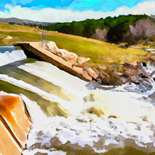
Rock Garden is a class III rapid that requires paddlers to navigate through a narrow chute with large boulders on either side. Pinball is a class IV rapid that features a series of large, unpredictable waves that can easily flip rafts. S-Turn is a class III rapid that requires precise maneuvering through a tight channel with two sharp turns.
As for regulations, this section of the Whitewater River is located on public land managed by the US Forest Service. A permit is not required for private boaters, but commercial outfitters must obtain a permit. Additionally, all boaters are required to wear personal flotation devices (PFDs) and follow Leave No Trace principles to minimize environmental impact.
Plan your run down to the hour
Same weather feed Snoflo's iOS app uses -- updated continuously from NOAA / yr.no. Watch the precipitation column on the meteogram; rain ahead of a run typically lifts flows 12-48 hours later depending on the basin.
Next 5 days, hour by hour
Temperature line with weather symbols on top, snow + rain accumulation as columns, humidity as a dotted line.
5-day forecast table
Every 3 hours, broken out across temperature, snow, rain, humidity, and wind. Each cell is colour-coded relative to the column min/max.
| Time | Condition | Temp (°F) | Snow (in) | Rain (in) | Humidity (%) | Wind (mps) | Wind dir |
|---|---|---|---|---|---|---|---|
| Loading detailed forecast… | |||||||
15-day temperature & precipitation
Daily temperatures, snow, and rain projected over the next two weeks -- the upstream story that drives next week's flows.
Regional streamflow levels
USGS streamgauges around Below Big Meadows Reservoir Dam To Sec 9 And 10, T39n, R3e -- useful for spotting upstream pulses and gauging which tributary is contributing what.
| Streamgauge | Discharge | View |
|---|---|---|
| South Fork Rio Grande At South Fork | 45 cfs | → |
| Rio Grande Near Del Norte | 215 cfs | → |
| Pinos Creek Near Del Norte | 4 cfs | → |
| Goose Creek At Wagonwheel Gap | 13 cfs | → |
| Rio Grande At Wagon Wheel Gap | 167 cfs | → |
| San Francisco C At Upper Sta | 1 cfs | → |
Plan a longer trip
The closest boat launches, other paddle runs, and campgrounds so a day on the water can grow into a full weekend.
Boat launches
- Deer Park Fishing Access
- Coller State Wildlife Area
- Beaver Creek Reservoir State Wildlife Area
- Rio Grande River State Wildlife Area (Del Norte Fishing Easements)
Other river runs
- Sec 30, T41n, R2e To Sec 11, T40n, R2e
- Headwaters (Sec 21, T38n, R1e) To 1/4 Mile Above Big Meadows Reservoir
- Sec 10, T42n, R1e To Sec 13, T41n, R1e
- El Rito Azul--Blue Lake (Sec 26, T35n, R3e) And Portion Of Conejos Above Platoro Reservoir To Upper Reach Of Platoro Reservoir--Sec 6, T35n, R4e
- East Fork--Unnamed Ponds Approx 1/4 Mile Below Continental Divide To Weminuche Wilderness Boundary
Campgrounds
- Alder Guard Station
- Highway Springs Campground
- Highway Springs
- Lower Beaver Creek
- Lower Beaver Creek Campground
- Upper Beaver Creek
Whitewater safety
- Check the flow before you run
- Use the linked-gauge card and Regional Flow panel above. Class ratings change with flow -- a Class III at low water can become Class IV+ at high water.
- Know your skill ceiling
- Pick runs comfortably below your ceiling. Cold-water and big-water runs raise the consequences of any mistake.
- Wear the right gear
- Helmet, PFD, drysuit / wetsuit when water is below 60°F. Throw bag, knife, and whistle on your person, not in the boat.
- Scout, set safety, and run with a team
- Scout new rapids on foot, set safety with throw bags above the consequence pool, and run with at least one other competent paddler.
- Respect the river
- Strainers, undercuts, low-head dams, and wood can kill at any class rating. When in doubt, portage.
Set push alerts in the Snoflo app
Save Below Big Meadows Reservoir Dam To Sec 9 And 10, T39n, R3e as a favorite, set a discharge threshold (e.g. "alert me when flow hits 600 cfs"), and the iOS app pushes the moment the linked gauge crosses.
About Below Big Meadows Reservoir Dam To Sec 9 And 10, T39n, R3e
What's the optimal flow for Below Big Meadows Reservoir Dam To Sec 9 And 10, T39n, R3e?
The optimal flow depends on the section and the craft. Check the Run Details panel for the linked gauge and current status.
How fresh is the cfs reading on this page?
The linked USGS streamgauge reports continuously (every 15 minutes); Snoflo refreshes throughout the day. Hover the streamflow sparkline to read individual datapoints.
What's the whitewater class?
See the Run Details panel for the class rating Snoflo tracks for this run. Class ratings change with flow -- a Class III at low water can become Class IV in high water.
Where do I put in / take out?
Tap Directions in the hero above to open driving directions to the put-in. For shuttle planning, check the Nearby Boat Launches panel and the river run operator's site.
Can I get alerts when flows hit the optimal range?
Yes -- alerts are managed in the Snoflo iOS app. Favorite this run, set a discharge threshold, and you'll get a push the moment the gauge crosses.
Other runs near here
Snoflo-tracked paddle runs within driving distance of Below Big Meadows Reservoir Dam To Sec 9 And 10, T39n, R3e.