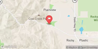
Lower Boulder Canyon
As a Boulder local, I have a love hate relationship with Boulder creek. It's Boulder's main artery and so much fun at elusive high flows, but so rocky and poor quality at low flows. Why people insist on dropping everything to run this stretch of "almost" whitewater at 200 cfs is beyond me, especially since there are almost always better options with just a little extra driving. Maybe it's the hords of slightly intoxicated college girls in bikinis tubing through the sticky whitewater park in town. For me, the run gets good when the tubing ban goes into effect for the creek (about 500 cfs).
Suggested river levels for paddling this section of the Boulder Creek are between a bare minimum of 250cfs and a high of 1,300cfs.
River conditions sourced from USGS 06730500, the Boulder Creek At Mouth
Remember only watercraft are permitted
at Lower Boulder Canyon.
Run Stats
Status | Too Low |
Class Level | IV- to V- |
Elevation | 4,860 ft |
Streamflow Discharge | 10.7 cfs |
Gage Height | 9.1 ft |
Air Temperature | 89° |
River | Boulder Creek |
Reporting Streamgage |
Boulder Creek At Mouth
USGS 06730500 |
Gauge | Streamflow | Stage |
---|---|---|
Clear Creek At Golden
USGS 06719505 |
300 cfs | 4.9 ft |
Fraser River At Winter Park
USGS 09024000 |
27 cfs | 1.1 ft |
Middle Boulder Creek At Nederland
USGS 06725500 |
143 cfs | 1.9 ft |
Monument Creek At Palmer Lake
USGS 07103747 |
1 cfs | ft |
Harvard Gulch At Harvard Park
USGS 06711575 |
0 cfs | 10.2 ft |
South Platte R At 64Th Ave. Commerce City
USGS 06714215 |
314 cfs | 3.0 ft |
Ranch Creek Blw Meadow Cr Nr Tabernash Co
USGS 09033100 |
41 cfs | 7.3 ft |
Left Hand Creek At Hover Road Near Longmont
USGS 06724970 |
7 cfs | 5.8 ft |
S Clear Cr Abv Lwr Cabin Cr Res Spilwy Nr Georgtwn
USGS 06714500 |
30 cfs | 1.4 ft |
Little Dry Creek At Westminster
USGS 06719840 |
0 cfs | 7.4 ft |
Snotel Site | Snowpack | 24hr Change |
---|
Campground | Campsites | Reservations | Toilets | Showers | Elevation |
---|---|---|---|---|---|
Pinewood Reservoir | 22 | 6,604 ft | |||
Flatiron Reservoir | None | 5,483 ft | |||
Carter Lake - South Side Campgrounds | None | 5,711 ft | |||
Meadow Park | None | 5,349 ft | |||
Clear Creek RV Park | 36 | 5,684 ft | |||
Bear Creek Lake Park | 52 | 5,693 ft | |||
South Bay - Horsetooth Reservoir | None | 5,435 ft | |||
Aspen Meadow - Golden Gate Canyon State Park | 35 | 9,000 ft | |||
Inlet Bay - Horsetooth Reservoir | None | 5,437 ft | |||
Carter Lake - North Side Campgrounds | None | 5,792 ft |
Ski Area | Snowpack | Air Temperature | 5 Day Forecast |
---|---|---|---|
Eldora Mountain Resort | 24" | 70° | 0" |
Echo Mountain Park | 18" | 66° | 0" |
River Run | Streamflow | Length | Class |
---|---|---|---|
Filter Plant | 3.92cfs | None Mi | II to III+ |
Steven's Gulch to Bridges Take Out | 182.0cfs | 12.0 Mi | III- to IV+ |
Filter Plant | 3.92cfs | None Mi | II to III+ |
Upper Clear Creek | 60.7cfs | 2.5 Mi | IV- to IV+ |
Idledale to Morrison | 11.2cfs | 3.0 Mi | IV+ to V |
NSV | 37.8cfs | 13.0 Mi | V+ |
SSV - Confluence to Picnic Grounds | 37.8cfs | 5.0 Mi | V to V+ |
Main Section | 55.3cfs | 3.0 Mi | IV+ to V |
Upper South Boulder Creek | 5.0cfs | None Mi | V+ |
October Hole | 37.8cfs | None Mi | II |
Upper South Boulder Creek | 5.0cfs | None Mi | V+ |
Lower Boulder Canyon | 42.0cfs | None Mi | IV- to V- |
Golden Whitewater Park | 3.92cfs | 0.75 Mi | II+ |
Gnar Section | 405.0cfs | 1.0 Mi | V+ |
Lower North Fork | 182.0cfs | 11.0 Mi | III |
Tunnel 1 to Golden Whitewater Park | 60.7cfs | None Mi | III- to III+ |
Lower Narrows | 182.0cfs | 0.5 Mi | V- to V+ |
Middle Narrows | 182.0cfs | 1.0 Mi | IV to V- |
Upper Narrows | 182.0cfs | 0.5 Mi | V- to V+ |