Smith Creek To Confluence With Main Salmon River Run
Community Reviews
Been here? Share the conditions.
Reviews, ratings & photos are added in the free Snoflo iOS app — rate a spot, tag the conditions, and your visit is verified by location. Add or manage your reviews from the app.
Smith Creek To Confluence With Main Salmon
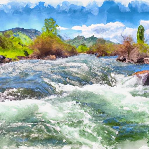
The segment mileage for Smith Creek to Confluence with Main Salmon is approximately 50 miles, and it takes about 3-5 days to complete the entire run. Along the way, adventurers will encounter stunning views of the Salmon River Canyon, wildlife, and unique geologic formations.
There are specific regulations to the area that all visitors should be aware of. The river is managed by the Bureau of Land Management, and permits are required for all overnight trips. Additionally, all visitors must follow Leave No Trace principles and pack out all trash and waste. Camping is only allowed in designated areas, and fires are only permitted in fire rings.
In summary, the Smith Creek to Confluence with Main Salmon Whitewater River Run in Idaho is an exciting adventure for intermediate to advanced rafters. The ideal streamflow range is between 1,000-4,000 cfs, and the run is classified as Class III-IV. The segment mileage is approximately 50 miles, and visitors can expect to encounter unique rapids, stunning views, and wildlife. Specific regulations to the area include a required permit, Leave No Trace principles, designated camping areas, and fire ring restrictions.
Plan your run down to the hour
Same weather feed Snoflo's iOS app uses -- updated continuously from NOAA / yr.no. Watch the precipitation column on the meteogram; rain ahead of a run typically lifts flows 12-48 hours later depending on the basin.
Next 5 days, hour by hour
Temperature line with weather symbols on top, snow + rain accumulation as columns, humidity as a dotted line.
5-day forecast table
Every 3 hours, broken out across temperature, snow, rain, humidity, and wind. Each cell is colour-coded relative to the column min/max.
| Time | Condition | Temp (°F) | Snow (in) | Rain (in) | Humidity (%) | Wind (mps) | Wind dir |
|---|---|---|---|---|---|---|---|
| Loading detailed forecast… | |||||||
15-day temperature & precipitation
Daily temperatures, snow, and rain projected over the next two weeks -- the upstream story that drives next week's flows.
Regional streamflow levels
USGS streamgauges around Smith Creek To Confluence With Main Salmon -- useful for spotting upstream pulses and gauging which tributary is contributing what.
| Streamgauge | Discharge | View |
|---|---|---|
| Johnson Creek At Yellow Pine Id | 102 cfs | → |
| Sf Salmon River Nr Krassel Ranger Station Id | 154 cfs | → |
| Sugar Creek Nr Stibnite | 37 cfs | → |
| Efsf Salmon R Abv Sugar Crk Nr Stibnite | 82 cfs | → |
| Sf Clearwater River Nr Elk City Id | 42 cfs | → |
| Ef Of Sf Salmon River At Stibnite Id | 46 cfs | → |
Plan a longer trip
The closest boat launches, other paddle runs, and campgrounds so a day on the water can grow into a full weekend.
Other river runs
- Headwaters (Boise Nf) To Confluence With Smith Creek (Smith Creek Landing Strip) (Payette Nf)
- Crooked Creek, Sec. 10, T25n, R7e To Gospel-Hump Wilderness Boundary
- Payette Nf Boundary On Lake Creek (Just West Marshall Lake) To To And Including Chinook Campground
- Lake Creek
- Salmon River
Whitewater safety
- Check the flow before you run
- Use the linked-gauge card and Regional Flow panel above. Class ratings change with flow -- a Class III at low water can become Class IV+ at high water.
- Know your skill ceiling
- Pick runs comfortably below your ceiling. Cold-water and big-water runs raise the consequences of any mistake.
- Wear the right gear
- Helmet, PFD, drysuit / wetsuit when water is below 60°F. Throw bag, knife, and whistle on your person, not in the boat.
- Scout, set safety, and run with a team
- Scout new rapids on foot, set safety with throw bags above the consequence pool, and run with at least one other competent paddler.
- Respect the river
- Strainers, undercuts, low-head dams, and wood can kill at any class rating. When in doubt, portage.
Set push alerts in the Snoflo app
Save Smith Creek To Confluence With Main Salmon as a favorite, set a discharge threshold (e.g. "alert me when flow hits 600 cfs"), and the iOS app pushes the moment the linked gauge crosses.
About Smith Creek To Confluence With Main Salmon
What's the optimal flow for Smith Creek To Confluence With Main Salmon?
The optimal flow depends on the section and the craft. Check the Run Details panel for the linked gauge and current status.
How fresh is the cfs reading on this page?
The linked USGS streamgauge reports continuously (every 15 minutes); Snoflo refreshes throughout the day. Hover the streamflow sparkline to read individual datapoints.
What's the whitewater class?
See the Run Details panel for the class rating Snoflo tracks for this run. Class ratings change with flow -- a Class III at low water can become Class IV in high water.
Where do I put in / take out?
Tap Directions in the hero above to open driving directions to the put-in. For shuttle planning, check the Nearby Boat Launches panel and the river run operator's site.
Can I get alerts when flows hit the optimal range?
Yes -- alerts are managed in the Snoflo iOS app. Favorite this run, set a discharge threshold, and you'll get a push the moment the gauge crosses.
Other runs near here
Snoflo-tracked paddle runs within driving distance of Smith Creek To Confluence With Main Salmon.