Coeur D"Alene River, Sec. 8, T49n, R2e To Honey Mountain, Sec. 32, T53n, R1w River Run
Community Reviews
Been here? Share the conditions.
Reviews, ratings & photos are added in the free Snoflo iOS app — rate a spot, tag the conditions, and your visit is verified by location. Add or manage your reviews from the app.
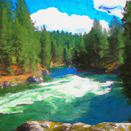
Coeur D"Alene River, Sec. 8, T49n, R2e To Honey Mountain, Sec. 32, T53n, R1w
The class rating for this section of the river is class III-IV, which means that it is suitable for intermediate and advanced paddlers. Some of the specific river rapids and obstacles on this run include the Steamboat Rock, the Twin Bridges, and the Devil's Toenail. It is important to note that water levels can rise quickly due to snowmelt or rain, so it is essential to check the current streamflow levels before embarking on a trip down this river.
In terms of regulations, it is mandatory to wear a life jacket at all times while on the river, and children under 14 years old are required to wear helmets as well. It is also important to note that the river flows through private property in some areas, so paddlers should be mindful of their surroundings and respect the property rights of others. The Coeur D'Alene River is a thrilling whitewater river run that offers an exciting adventure for those seeking a challenging and scenic outdoor experience.
Plan your run down to the hour
Same weather feed Snoflo's iOS app uses -- updated continuously from NOAA / yr.no. Watch the precipitation column on the meteogram; rain ahead of a run typically lifts flows 12-48 hours later depending on the basin.
Next 5 days, hour by hour
Temperature line with weather symbols on top, snow + rain accumulation as columns, humidity as a dotted line.
5-day forecast table
Every 3 hours, broken out across temperature, snow, rain, humidity, and wind. Each cell is colour-coded relative to the column min/max.
| Time | Condition | Temp (°F) | Snow (in) | Rain (in) | Humidity (%) | Wind (mps) | Wind dir |
|---|---|---|---|---|---|---|---|
| Loading detailed forecast… | |||||||
15-day temperature & precipitation
Daily temperatures, snow, and rain projected over the next two weeks -- the upstream story that drives next week's flows.
Regional streamflow levels
USGS streamgauges around Coeur D"Alene River, Sec. 8, T49n, R2e To Honey Mountain, Sec. 32, T53n, R1w -- useful for spotting upstream pulses and gauging which tributary is contributing what.
| Streamgauge | Discharge | View |
|---|---|---|
| Nf Coeur D Alene River At Enaville Id | 238 cfs | → |
| Sf Coeur D Alene River Nr Pinehurst Id | 127 cfs | → |
| Sf Coeur D Alene River Abv Pine Cr Nr Pinehurst Id | 131 cfs | → |
| Coeur D Alene River Nr Cataldo Id | 368 cfs | → |
| Pine Creek Blw Amy Gulch Nr Pinehurst Id | 10 cfs | → |
| Sf Coeur D Alene At Elizabeth Park Nr Kellogg Id | 89 cfs | → |
Plan a longer trip
The closest boat launches, other paddle runs, and campgrounds so a day on the water can grow into a full weekend.
Boat launches
- Coeur D'Alene River Road Shoshone County
- Old River Road Shoshone County
- South Mission Road Kootenai County
- Kootenai County
- East Of Rose Lake
- Kilarney Lake
Other river runs
- Confluence North Fork Coeur D'Alene River To Cataldo Mission
- Cataldo Mission To Coeur D'Alene Lake
- Boundary Proposed Addition Cabinet Mtns Wilderness, Sec. To Cabinet Gorge Reservoir
- Willow Creek, Sec. 32, T24n, R29w To Noxon Reservoir, Sec. 14, T24n, R31w
- Little North Fork Clearwater River
Campgrounds
Whitewater safety
- Check the flow before you run
- Use the linked-gauge card and Regional Flow panel above. Class ratings change with flow -- a Class III at low water can become Class IV+ at high water.
- Know your skill ceiling
- Pick runs comfortably below your ceiling. Cold-water and big-water runs raise the consequences of any mistake.
- Wear the right gear
- Helmet, PFD, drysuit / wetsuit when water is below 60°F. Throw bag, knife, and whistle on your person, not in the boat.
- Scout, set safety, and run with a team
- Scout new rapids on foot, set safety with throw bags above the consequence pool, and run with at least one other competent paddler.
- Respect the river
- Strainers, undercuts, low-head dams, and wood can kill at any class rating. When in doubt, portage.
Set push alerts in the Snoflo app
Save Coeur D"Alene River, Sec. 8, T49n, R2e To Honey Mountain, Sec. 32, T53n, R1w as a favorite, set a discharge threshold (e.g. "alert me when flow hits 600 cfs"), and the iOS app pushes the moment the linked gauge crosses.
About Coeur D"Alene River, Sec. 8, T49n, R2e To Honey Mountain, Sec. 32, T53n, R1w
What's the optimal flow for Coeur D"Alene River, Sec. 8, T49n, R2e To Honey Mountain, Sec. 32, T53n, R1w?
The optimal flow depends on the section and the craft. Check the Run Details panel for the linked gauge and current status.
How fresh is the cfs reading on this page?
The linked USGS streamgauge reports continuously (every 15 minutes); Snoflo refreshes throughout the day. Hover the streamflow sparkline to read individual datapoints.
What's the whitewater class?
See the Run Details panel for the class rating Snoflo tracks for this run. Class ratings change with flow -- a Class III at low water can become Class IV in high water.
Where do I put in / take out?
Tap Directions in the hero above to open driving directions to the put-in. For shuttle planning, check the Nearby Boat Launches panel and the river run operator's site.
Can I get alerts when flows hit the optimal range?
Yes -- alerts are managed in the Snoflo iOS app. Favorite this run, set a discharge threshold, and you'll get a push the moment the gauge crosses.
Other runs near here
Snoflo-tracked paddle runs within driving distance of Coeur D"Alene River, Sec. 8, T49n, R2e To Honey Mountain, Sec. 32, T53n, R1w.